Channahon, Illinois facts for kids
Quick facts for kids
Channahon
|
|
|---|---|

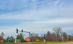
Channahon, near a community center
|
|

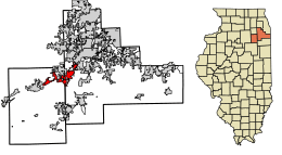
Location of Channahon in Grundy and Will Counties, Illinois.
|
|

Location of Illinois in the United States
|
|
| Country | United States |
| State | Illinois |
| County | Grundy, Will |
| Townships | Channahon, Troy, Aux Sable, Goose Lake, Saratoga |
| Incorporated | December 11, 1961 |
| Area | |
| • Total | 17.01 sq mi (44.06 km2) |
| • Land | 15.74 sq mi (40.76 km2) |
| • Water | 1.28 sq mi (3.30 km2) |
| Elevation | 531 ft (162 m) |
| Population
(2020)
|
|
| • Total | 13,383 |
| • Density | 850.47/sq mi (328.36/km2) |
| Time zone | UTC-6 (CST) |
| • Summer (DST) | UTC-5 (CDT) |
| ZIP Code(s) |
60410
|
| Area code(s) | 815 |
| FIPS code | 17-12476 |
Channahon ( shan-Ə-hon) is a village in Grundy and Will counties in the U.S. state of Illinois. The population was 12,560 at the 2010 census. Located in a rural area southwest of Joliet, Illinois, most of the village is within Channahon Township in Will County. The current village president is Missey Moorman Schumacher.
History
Its name meaning "Meeting of the Waters" in the language of the area's original Potawatomi inhabitants, Channahon is located at the confluence of the Des Plaines and Kankakee rivers, where they form the Illinois River. The Illinois and Michigan Canal (including several locks) runs through most of the village, where it is fed by the water of the DuPage River. The local Channahon State Park celebrates the region's unique geographical history.
Later in the 19th century, a railroad line that eventually came under the control of the Santa Fe Railroad was laid through the eastern portions of the township, but no railroad actually passed through the village itself. In the late 1920s, U.S. Highway 6 came through Channahon; Interstates 80 and 55 followed in the 1960s (although I-80 runs approximately two miles to the north of the village limits).
History of the Village of Channahon
The Village of Channahon grew along the I & M Canal at the intersection of three rivers (i.e., DuPage, Des Plaines, and Kankakee Rivers.) An early archaeological excavation in the 1900s unearthed mound remnants that pointed to three to four thousand years of history. The Potawatomie Indians named this area and called it Channahon, which means "meeting of the waters". The Potawatomie Indians solely inhabited this area until white settlers began to settle here in 1832.
In 1836, construction began on the I & M Canal and Channahon became the site for one of the locks that were needed along the waterway. The village itself was laid out by Myrvin Benjamin, and for a while it was called DuPage, after the river that cut through the area. In the 1840s, the name of the area became Swifton, after the I & M Canal board president. This area continued to thrive until the railroad replaced inland boat travel, which caused business to decline. In the early 1900s, the automobile began to emerge as a new form of transportation. In June 1908, the owner of an automobile planned to sue the village after their automobile plummeted into the Du Page River due to a bridge failure. According to legend, that incident was one of the factors in the decision of the village fathers to discard an earlier established corporate charter.
In 1962, the area was once again incorporated as the village of Channahon. Serious development finally began in the 1970s, as the village's proximity to two trunk line interstates resulted in both industrial growth (a Mobil oil refinery, two petrochemicals plants, a gigantic soybean oil production facility, and numerous support businesses for the freight hauling industry) and residential development. The village also saw an influx of population from eastern Kentucky in the wake of the closure of many of that area's coal mines.
A major natural gas pipeline to the Chicago area from Canada had its southern terminus built in Channahon in 2000.
Park District
Formed in 1971, the Channahon Park District maintains numerous parks, facilities and plans a variety of programs and activities for all ages throughout the year.
The Park District is governed by an elected Board of Commissioners, and employs over 200 staff.
The boundaries of the Channahon Park District include all of the Village of Channahon; unincorporated areas in Channahon Township; and the portions of the Village of Minooka in Will County serving more than 20,000 residents.
The Channahon Park District operates Heritage Bluffs Public Golf Club. Heritage Crossing Field House features two gymnasiums, a three lane, eight lap to the mile indoor track, and Dimensions Fitness Center. Arrowhead Community Center houses Park District offices and indoor program space, including a dance/aerobics studio, two racquetball courts, and the popular Fun-N-Learn Preschool Program.
The Park District has over 210 acres (0.85 km2) of public parks. Major facilities include 122-acre (0.49 km2) Community Park, and 41-acre (170,000 m2) Central Park. These locations include lighted sports fields, winding trails, playgrounds and beautiful picnic space. Community Park includes a Disc Golf course and a scenic trail system. Central Park is the home of SK8 Zone skate park and serves as the location for the community’s annual Three Rivers Festival. Neighborhood parks are currently located in 16 areas, with five new locations planned.
Geography
Channahon is located at 41°26′17″N 88°12′59″W / 41.438156°N 88.216520°W.
According to the 2010 census, Channahon has a total area of 16.417 square miles (42.52 km2), of which 14.99 square miles (38.82 km2) (or 91.31%) is land and 1.427 square miles (3.70 km2) (or 8.69%) is water.
Demographics
| Historical population | |||
|---|---|---|---|
| Census | Pop. | %± | |
| 1900 | 261 | — | |
| 1910 | 208 | −20.3% | |
| 1970 | 1,505 | — | |
| 1980 | 3,788 | 151.7% | |
| 1990 | 4,266 | 12.6% | |
| 2000 | 7,344 | 72.2% | |
| 2010 | 12,560 | 71.0% | |
| 2020 | 13,383 | 6.6% | |
| U.S. Decennial Census | |||
As of the census of 2000, there were 7,344 people, 2,279 households, and 1,989 families residing in the village. The population density was 1,019.0 people per square mile (393.3/km2). There were 2,346 housing units at an average density of 325.5 per square mile (125.6/km2). The racial makeup of the village was 97.22% White, 0.42% African American, 0.11% Native American, 0.27% Asian, none Pacific Islander, 0.95% from other races, and 1.02% from two or more races. 3.64% of the population were Hispanic or Latino of any race.
There were 2,279 households, out of which 50.8% had children under the age of 18 living with them, 78.6% were married couples living together, 5.4% had a female householder with no husband present, and 12.7% were non-families. 10.0% of all households were made up of individuals, and 2.8% had someone living alone who was 65 years of age or older. The average household size was 3.22 and the average family size was 3.47.
In the village, the population was spread out, with 32.8% under the age of 18, 7.2% from 18 to 24, 33.8% from 25 to 44, 20.9% from 45 to 64, and 5.3% who were 65 years of age or older. The median age was 34 years. For every 100 females, there were 105.7 males. For every 100 females age 18 and over, there were 102.7 males.
The median income for a household in the village was $71,991, and the median income for a family was $74,481. Males had a median income of $52,479 versus $31,692 for females. The per capita income for the village was $22,867. About 1.8% of families and 1.7% of the population were below the poverty line, including 1.7% of those under age 18 and 3.8% of those age 65 or over.
See also
 In Spanish: Channahon (Illinois) para niños

