
Charlestown, Maryland facts for kids
Quick facts for kids
Charlestown, Maryland
|
||
|---|---|---|

Town hall and post office
|
||
|
||

Location of Charlestown, Maryland
|
||
| Country | ||
| State | ||
| County | ||
| Incorporated | 1742 | |
| Area | ||
| • Total | 1.17 sq mi (3.03 km2) | |
| • Land | 1.17 sq mi (3.03 km2) | |
| • Water | 0.00 sq mi (0.01 km2) | |
| Elevation | 36 ft (11 m) | |
| Population
(2020)
|
||
| • Total | 1,496 | |
| • Density | 1,279.73/sq mi (494.22/km2) | |
| Time zone | UTC-5 (Eastern (EST)) | |
| • Summer (DST) | UTC-4 (EDT) | |
| ZIP code |
21914
|
|
| Area code(s) | 410 | |
| FIPS code | 24-15400 | |
| GNIS feature ID | 0589939 | |
| Website | http://www.charlestownmd.org/ | |

Charlestown is a town in Cecil County, Maryland, United States. The population was 1,183 at the 2010 census.
Contents
History
It is the location of Charlestown Historic District and Indian Queen Tavern and Black's Store, both listed on the National Register of Historic Places in 1975.
Geography
Charlestown is located at 39°34′36″N 75°58′40″W / 39.57667°N 75.97778°W (39.576617, -75.977888).
According to the United States Census Bureau, the town has a total area of 1.51 square miles (3.91 km2), of which, 1.19 square miles (3.08 km2) is land and 0.32 square miles (0.83 km2) is water.
Demographics
| Historical population | |||
|---|---|---|---|
| Census | Pop. | %± | |
| 1870 | 223 | — | |
| 1880 | 211 | −5.4% | |
| 1890 | 228 | 8.1% | |
| 1900 | 244 | 7.0% | |
| 1910 | 274 | 12.3% | |
| 1920 | 177 | −35.4% | |
| 1930 | 286 | 61.6% | |
| 1940 | 307 | 7.3% | |
| 1950 | 551 | 79.5% | |
| 1960 | 711 | 29.0% | |
| 1970 | 721 | 1.4% | |
| 1980 | 720 | −0.1% | |
| 1990 | 578 | −19.7% | |
| 2000 | 1,019 | 76.3% | |
| 2010 | 1,183 | 16.1% | |
| 2020 | 1,496 | 26.5% | |
| U.S. Decennial Census | |||
2010 census
As of the census of 2010, there were 1,183 people, 454 households, and 324 families living in the town. The population density was 994.1 inhabitants per square mile (383.8/km2). There were 550 housing units at an average density of 462.2 per square mile (178.5/km2). The racial makeup of the town was 94.8% White, 3.7% African American, 0.2% Native American, 0.1% Asian, 0.2% from other races, and 1.1% from two or more races. Hispanic or Latino of any race were 2.5% of the population.
There were 454 households, of which 31.9% had children under the age of 18 living with them, 54.8% were married couples living together, 9.0% had a female householder with no husband present, 7.5% had a male householder with no wife present, and 28.6% were non-families. 23.3% of all households were made up of individuals, and 7.9% had someone living alone who was 65 years of age or older. The average household size was 2.60 and the average family size was 3.05.
The median age in the town was 41.4 years. 22.5% of residents were under the age of 18; 7.5% were between the ages of 18 and 24; 26.1% were from 25 to 44; 32.9% were from 45 to 64; and 11% were 65 years of age or older. The gender makeup of the town was 50.3% male and 49.7% female.
Education

Charlestown is within Cecil County Public Schools. Zoned public schools include Charlestown Elementary School, Perryville Middle School, and Perryville High School.
Transportation
_between_Maryland_State_Route_267_(Bladen_Street)_and_Louisa_Lane_Extended_in_Charlestown,_Cecil_County,_Maryland.jpg)
The main method of transportation to and from Charlestown is by road. Maryland Route 7 is the most prominent highway serving Charlestown, following Old Philadelphia Road along the north edge of town. MD 7 heads east and west, linking with U.S. Route 40 and passing through the nearby town of North East. MD 7 also connects with Maryland Route 272, which provides access to the nearest Interstate highway, Interstate 95. Maryland Route 267 also serves Charlestown, passing through the center of town on an old alignment of MD 7.
Images for kids
-
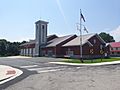
Fire station
-
Athletic complex


See also
 In Spanish: Charlestown (Maryland) para niños
