
Cher (river) facts for kids
Quick facts for kids Cher |
|
| River | |
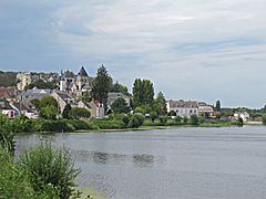
 The Cher river at Saint-Georges-sur-Cher
|
|
| Country | France |
|---|---|
| Regions | Nouvelle-Aquitaine, Auvergne-Rhône-Alpes, Centre-Val de Loire |
| Departments | Creuse, Puy-de-Dôme, Allier, Cher, Loir-et-Cher, Indre, Indre-et-Loire |
| Tributaries | |
| - left | Tardes, Arnon, Fouzon |
| - right | Aumance, Yèvre, Sauldre |
| Cities | Montluçon, Tours |
| Source | |
| - location | Mérinchal, Massif Central, France |
| - elevation | 715 m (2,346 ft) |
| - coordinates | 45°55′17″N 2°28′25″E / 45.92139°N 2.47361°E |
| Mouth | Loire |
| - location | Villandry, Indre-et-Loire, France |
| - elevation | 38 m (125 ft) |
| - coordinates | 47°20′33″N 0°28′50″E / 47.34250°N 0.48056°E |
| Length | 367.8 km (229 mi) |
| Basin | 13,920 km² (5,375 sq mi) |
| Discharge | for Tours |
| - average | 92.60 m³/s (3,270 cu ft/s) |
The Cher is a river in central France. It is a left tributary of the Loire River. It flows through several regions of France.
The Cher and Loir-et-Cher departments are named after this river.
Geography
The Cher is 367.8 kilometres (228.5 miles) long. Its drainage basin covers 13,920 square kilometres (5,375 square miles).
Its average yearly discharge (volume of water which passes through a section of the river per unit of time) is 92.60 m3/s (3,270 cu ft/s) at Tours, Indre-et-Loire (1966 - 2017), near its mouth.
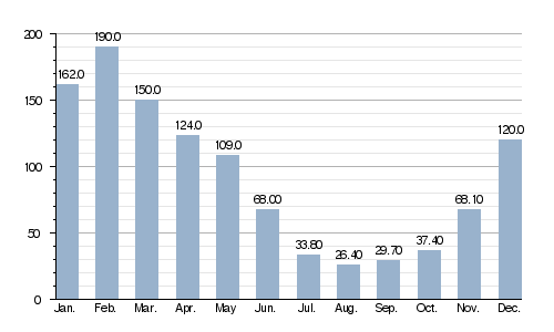
Average monthly discharge (m3/s) at Tours
Course
The Cher starts in the Massif Central, in the Mérinchal municipality, Creuse department, Nouvelle-Aquitaine region. It starts at an altitude of about 715 metres (2,346 feet).
The Cher flows, in general, to the northwest. It goes through the following regions, departments and communes:
- Nouvelle-Aquitaine region
- Creuse: Auzances.
- Auvergne-Rhône-Alpes region
- Puy-de-Dôme: Château-sur-Cher.
- Allier: Montluçon, Vallon-en-Sully, Meaulne.
- Centre-Val de Loire region
- Cher: Ainay-le-Vieil, Bouzais, Saint-Amand-Montrond, Châteauneuf-sur-Cher, Colombiers, Corquoy, Crézançay-sur-Cher, Drevant, Épineuil-le-Fleuriel, Farges-Allichamps, Foëcy, La Groutte, Lapan, Lunery, Méry-sur-Cher, Nozières, Orval, La Perche, Quincy, Saint-Florent-sur-Cher, Saint-Caprais, Saint-Georges-de-Poisieux, Saint-Georges-sur-la-Prée, Saint-Loup-des-Chaumes, Thénioux, Vallenay, Venesmes, Vierzon
- Loir-et-Cher : Angé, Bourré, La Chapelle-Montmartin, Châtillon-sur-Cher, Châtres-sur-Cher, Châteauvieux, Couddes, Faverolles-sur-Cher, Gièvres, Mareuil-sur-Cher, Mennetou-sur-Cher, Monthou-sur-Cher, Montrichard, Pouillé,Selles-sur-Cher, Saint-Aignan, Saint-Georges-sur-Cher, Saint-Julien-sur-Cher, Seigy, Thésée, Villefranche-sur-Cher.
- Indre : Chabris
- Indre-et-Loire : Athée-sur-Cher, Azay-sur-Cher, Bléré, Chenonceaux, Chisseaux, Civray-de-Touraine, La Croix-en-Touraine, Dierre, Larçay, La Riche, Saint-Avertin, Saint-Genouph, Savonnières, Tours, Véretz, Villandry.
At its end, the Cher flows into the Loire River at the bec du Cher ("beak of the Cher") in the Regional nature park Loire-Anjou-Touraine (Parc naturel régional Loire-Anjou-Touraine) in Villandry. That is about 20 kilometres (12 miles) west of the city of Tours, in the Indre-et-Loire department, at 38 metres (125 feet) of altitude.
Main tributaries
The main tributaries, with a length greater than 50 km, of the Cher are:
|
Left tributaries:
|
Right tributaries:
|
Gallery
-
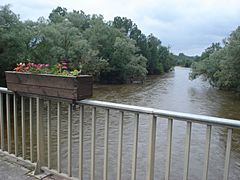
The Cher at Villeneuve-sur-Cher.
-
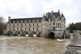
Château de Chenonceau over the Cher river.
-
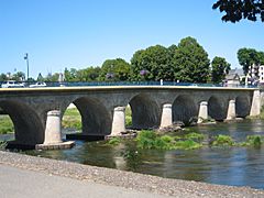
Bridge over the Cher in Saint-Florent-sur-Cher.
-
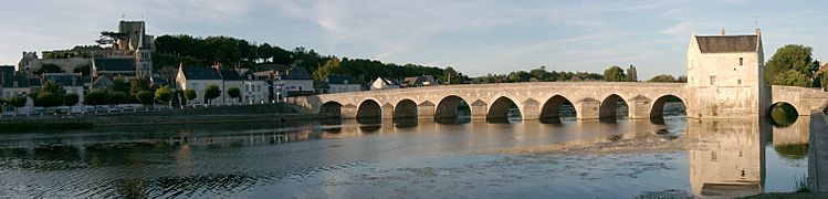
The Cher river at Saint-Aignan.
-
The Cher river at Montrichard.
,_le_Cher.JPG)


.jpg)

Related pages
See also
 In Spanish: Río Cher para niños
