
Chermside, Queensland facts for kids
Quick facts for kids ChermsideBrisbane, Queensland |
|||||||||||||||
|---|---|---|---|---|---|---|---|---|---|---|---|---|---|---|---|

Kedron-Wavell Community Hall, Kittyhawk Drive, 2011
|
|||||||||||||||

Chermside
Location in Queensland
|
|||||||||||||||
| Population | 9,315 (2016 census) | ||||||||||||||
| • Density | 2,329/km2 (6,030/sq mi) | ||||||||||||||
| Postcode(s) | 4032 | ||||||||||||||
| Area | 4.0 km2 (1.5 sq mi) | ||||||||||||||
| Time zone | AEST (UTC+10:00) | ||||||||||||||
| Location | 9.8 km (6 mi) N of Brisbane GPO | ||||||||||||||
| LGA(s) | City of Brisbane (Marchant Ward; Northgate Ward) |
||||||||||||||
| State electorate(s) |
|
||||||||||||||
| Federal Division(s) | Lilley | ||||||||||||||
|
|||||||||||||||
Chermside is a suburb in the City of Brisbane, Queensland, Australia. In the 2016 census Chermside had a population of 9,315 people. The suburb is situated 9.8 kilometres (6.1 mi) by road north of the Brisbane CBD. It is home to a large Westfield shopping centre.
Demographics
In the 2011 census, Chermside recorded a population of 8,170 people, 53.2% female and 46.8% male.
The median age of the Chermside population was 35 years of age, 2 years below the Australian median.
59.5% of people living in Chermside were born in Australia, compared to the national average of 69.8%; the next most common countries of birth were India 4%, New Zealand 3.8%, Philippines 2.7%, England 2.6%, China 1.5%.
67.9% of people spoke only English at home; the next most popular languages were 1.7% Malayalam,1.5% Tagalog, 1.3% Italian, 1.3% Mandarin, 0.9% Korean.
History
The Chermside area was first settled by Europeans in the late 19th century. The first plot of land was sold on 23 May 1866, and the population has progressively increased since with a significant increase with the post-war residential development.
In November 1868 Cobb & Co. stagecoaches began to travel through Chermside on the way to the goldfields at Gympie.

Brisbane's tramway network finally reached the suburb on 29 March 1947, and Chermside remained the northernmost point on the system until the line to Chermside was closed on 2 December 1968. The tram line along Gympie Road was separated from other traffic (this is commonly called "reserved track"), which resulted in fast travel times along this portion of the route. Another feature of the Chermside tram line were the rose gardens which bordered the reserved track portion of the line. A picture of the Chermside tram line can be viewed at [1].
Originally named Downfall Creek, the suburb's name was changed to Chermside in 1903 after the Governor of Queensland, Sir Herbert Chermside.
Chermside State School (then called Downfall Creek State School) was opened on 9 July 1900 and closed on 13 December 1996 [2]. Craigslea State School opened 24 January 1972 and a neighbouring High School in January 1975.
The Dawn theatre first opened in 1928 (showing The Man Who Laughs), and closed on 2 August 2005 (with Mr. & Mrs. Smith). It was the last single screen cinema in Brisbane.

Westfield Chermside first opened in May 1957 as The Chermside Drive-in Shopping Centre with an Allan & Stark's department store and a small arcade of a dozen shops, before becoming a Myer department store. It was the first drive-in shopping centre in Australia. It is now the largest single level shopping centre in Australia, with a 3 storey Myer, as well as a 16 screen Birch, Carrol and Coyle megaplex. It is also home to Brisbane's first Apple Store.
The early 1970s saw the opening of Queensland's first Kmart store in Chermside, which was situated next to a Coles supermarket. Both of these stores closed in the mid-1990s and have been replaced with a Woolworths supermarket and specialty stores. Both Kmart and Coles have been relocated in Westfield Chermside.
Chermside has many outdoor recreational facilities, including two large parks, 7th Brigade Park, and Marchant Park - on land donated 9 September 1921 by soft drink manufacturer George Marchant. Before and during World War I this land had been variously the home of artillery and light horse units. During World War II a diverse range of volunteers, soldiers, and camps were at Chermside, such as U.S. Army units, including a number of African American soldiers. A Kitty Hawk airplane on a training flight crashed there in 1943, killing the pilot and instructor.
Chermside has had a library since 1909 - it now forms a branch of the Brisbane City Council Library service, and is situated next to the Kedron Wavell RSL and some sports facilities, including a moderate water park. The Prince Charles Hospital (Public) was opened in 1959 and Holy Spirit Northside Private Hospital in 2001.
A history of Chermside was published by a local teacher and part-time historian Mr David R Teague in 1973 [3].
The Hamilton family
One of the earliest settlers in Chermside was Andrew Hamilton who purchased acreage there in 1875. Recently returned from the Gympie gold rush, Hamilton tried his hand at farming in Chermside. After failing as a farmer, Hamilton opened a successful blacksmith shop on Gympie Road which also served as the local post office. Hamilton's only son Thomas Andrew Hamilton became a councillor for Kedron Shire and was also a notable diarist. T.A. Hamilton kept detailed daily diaries from 1890 until his death in 1951 at the age of 91. Most of the diaries survive and are being digitised and transcribed by the Chermside and District Historical Society. Hamilton Road in Chermside is named after Andrew Hamilton.
Education
There are no schools in Chermside. The nearest government primary schools are Wavell Heights State School in neighbouring Wavell Heights to the east, Craigslea State School in neighbouring Chermside West to the west, Geebung State School in neighbouring Geebung to the north-east, and Somerset Hills State School in neighbouring Stafford Heights to the south-west. The nearest government secondary schools are Wavell Heights State High School in neighbouring Wavell Heights to the south-east and Craigslea State High School in neighbouring Chermside West to the west.
Transport
The Northern Busway between the Royal Children's Hospital and Windsor was completed in August 2009, and an extra 3 km of busway between Windsor and Kedron opened in June 2012 with Airport Link and 2 new busway stations at Lutwyche and Kedron. Planning for the ultimate Northern Busway between Kedron and Bracken Ridge (including Chermside) is being revised with stages subject to funding and government priority.
Images for kids
-
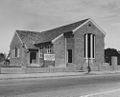
Chermside Methodist Church, 1950
-
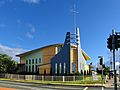
Chermside Kedron Community Church, 2007
-
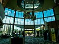
Kedron Wavell RSL entrance, 2105
.jpg)


