
Chesapeake City, Maryland facts for kids
Quick facts for kids
Chesapeake City, Maryland
|
||
|---|---|---|

Chesapeake City along the Chesapeake and Delaware Canal
|
||
|
||

Location of Chesapeake City, Maryland
|
||
| Country | ||
| State | ||
| County | ||
| Incorporated | 1850 | |
| Area | ||
| • Total | 0.72 sq mi (1.88 km2) | |
| • Land | 0.53 sq mi (1.37 km2) | |
| • Water | 0.19 sq mi (0.50 km2) | |
| Elevation | 26 ft (8 m) | |
| Population
(2020)
|
||
| • Total | 736 | |
| • Density | 1,388.68/sq mi (535.84/km2) | |
| Time zone | UTC-5 (Eastern (EST)) | |
| • Summer (DST) | UTC-4 (EDT) | |
| ZIP code |
21915
|
|
| Area code(s) | 410 | |
| FIPS code | 24-15950 | |
| GNIS feature ID | 0589952 | |
| Website | www.chesapeakecity-md.gov | |

Chesapeake City is a town in Cecil County, Maryland, United States. The population was 673 at the 2010 census.
The town was originally named by Bohemian colonist Augustine Herman the Village of Bohemia — or Bohemia Manor — but the name was changed in 1839 after the Chesapeake and Delaware Canal (C&D Canal) was built in 1829. Today, the town contains numerous old homes from that era that have been converted into bed and breakfasts, restaurants and the local historical museum.
Contents
History
The town was separated into north and south sections when the C&D Canal was built through the middle of the town. The two were connected by a drawbridge until 1942, when that was destroyed by a freighter that struck it. The current bridge opened in 1949.
The new bridge had to be tall enough to allow supertankers to pass beneath it, resulting in a structure so high and long that cars no longer went into the city to cross the canal. Business declined for decades thereafter.
Chesapeake City is the location of the Old Lock Pump House of the C&D Canal, listed on the National Register of Historic Places in 1966. The South Chesapeake City Historic District was listed in 1974.
In the late 20th century, Chesapeake City was the home of one of the world's most important stud farms, Windfields Farm.
Geography
Chesapeake City is located at 39°31′40″N 75°48′44″W / 39.52778°N 75.81222°W (39.527826, -75.812270).
According to the United States Census Bureau, the town has a total area of 0.69 square miles (1.79 km2), of which, 0.50 square miles (1.29 km2) is land and 0.19 square miles (0.49 km2) is water.
Demographics
| Historical population | |||
|---|---|---|---|
| Census | Pop. | %± | |
| 1850 | 423 | — | |
| 1870 | 1,008 | — | |
| 1880 | 1,402 | 39.1% | |
| 1890 | 1,155 | −17.6% | |
| 1900 | 1,172 | 1.5% | |
| 1910 | 1,016 | −13.3% | |
| 1920 | 958 | −5.7% | |
| 1930 | 1,016 | 6.1% | |
| 1940 | 1,094 | 7.7% | |
| 1950 | 1,154 | 5.5% | |
| 1960 | 1,104 | −4.3% | |
| 1970 | 1,031 | −6.6% | |
| 1980 | 899 | −12.8% | |
| 1990 | 735 | −18.2% | |
| 2000 | 787 | 7.1% | |
| 2010 | 673 | −14.5% | |
| 2020 | 736 | 9.4% | |
| U.S. Decennial Census | |||
2010 census
As of the census of 2010, there were 673 people, 335 households, and 177 families living in the town. The population density was 1,346.0 inhabitants per square mile (519.7/km2). There were 390 housing units at an average density of 780.0 per square mile (301.2/km2). The racial makeup of the town was 96.6% White, 2.4% African American, 0.1% Native American, 0.4% Asian, 0.1% from other races, and 0.3% from two or more races. Hispanic or Latino of any race were 2.8% of the population.
There were 335 households, of which 20.6% had children under the age of 18 living with them, 40.0% were married couples living together, 9.6% had a female householder with no husband present, 3.3% had a male householder with no wife present, and 47.2% were non-families. 39.7% of all households were made up of individuals, and 15.5% had someone living alone who was 65 years of age or older. The average household size was 2.01 and the average family size was 2.67.
The median age in the town was 47.9 years. 15% of residents were under the age of 18; 7.5% were between the ages of 18 and 24; 22% were from 25 to 44; 35.5% were from 45 to 64, and 20.1% were 65 years of age or older. The gender makeup of the town was 44.9% male and 55.1% female.
Education
Chesapeake City is a part of the Cecil County Public Schools System. There are three schools in the town:
- Chesapeake City Elementary School
- The previous facility, about 42,000 square feet (3,900 m2) in size, is in the southern part of Chesapeake City, along the Chesapeake & Delaware Canal. In 2019 a groundbreaking for the new school facility, along Augustine Herman Highway at the midpoint between the Bohemia Manor secondary schools and the Cheseapeake City fire department facility, was imminent. The facility, with about 62,000 square feet (5,800 m2) in area, is designed to look like the area bridge. The building's model is Gilpin Manor Elementary School.
- Bohemia Manor Middle School
- Bohemia Manor High School
Chesapeake City is served by the Chesapeake City Branch of the Cecil County Public Library located on Maryland Route 213. The library offers books, music, movies, computers with Internet access, free wifi, and programs for adults, teens, and children.
Transportation
_just_north_of_Maryland_State_Route_537_(George_Street)_in_Chesapeake_City,_Cecil_County,_Maryland.jpg)
The main method of transportation to and from the town is by road. Maryland Route 213 is the main highway serving Chesapeake City, connecting the two halves of the town via the Chesapeake City Bridge. MD 213 extends northward towards Elkton and southwards to Cecilton. Other state highways serving the town include Maryland Route 284, Maryland Route 285, Maryland Route 286, Maryland Route 342 and Maryland Route 537.
Notable person
- John Mabry, former major league baseball player and current hitting coach for the Kansas City Royals
Images for kids
-
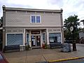
Town Hall
-

Former town hall


See also
 In Spanish: Chesapeake City (Maryland) para niños
