
Chippewa County, Michigan facts for kids
Quick facts for kids
Chippewa County
|
||
|---|---|---|

Chippewa County Courthouse, Sault Ste. Marie
|
||
|
||

Location within the U.S. state of Michigan
|
||
 Michigan's location within the U.S. |
||
| Country | ||
| State | ||
| Founded | December 22, 1826 | |
| Named for | Chippewa people | |
| Seat | Sault Ste. Marie | |
| Largest city | Sault Ste. Marie | |
| Area | ||
| • Total | 2,698 sq mi (6,990 km2) | |
| • Land | 1,558 sq mi (4,040 km2) | |
| • Water | 1,140 sq mi (3,000 km2) 42%% | |
| Population
(2020)
|
||
| • Total | 36,785 | |
| • Density | 25/sq mi (10/km2) | |
| Time zone | UTC−5 (Eastern) | |
| • Summer (DST) | UTC−4 (EDT) | |
| Congressional district | 1st | |

Chippewa County is a county in the Upper Peninsula of the U.S. state of Michigan. As of the 2020 Census, the population was 36,785. The county seat is Sault Ste. Marie. The county is named for the Ojibwe (Chippewa) people, and was set off and organized in 1826.
Chippewa County comprises the Sault Ste. Marie, MI micropolitan statistical area.
Contents
Geography
According to the U.S. Census Bureau, the county has a total area of 2,698 square miles (6,990 km2), of which 1,558 square miles (4,040 km2) is land and 1,140 square miles (3,000 km2) (42%) is water. It is the second-largest county in Michigan by land area and fifth-largest by total area.
The Michigan Meridian runs through the eastern portion of the county. South of Nine Mile Road, M-129 (Meridian Road) overlays the meridian. In Sault Ste. Marie, Meridian Street north of 12th Avenue overlays the meridian.
Adjacent counties
- Algoma District, Ontario, Canada (northeast)
- Manitoulin District, Ontario, Canada (east)
- Presque Isle County (southeast)
- Mackinac County (south)
- Luce County (west)
National protected areas
- Harbor Island National Wildlife Refuge
- Hiawatha National Forest (part)
- Whitefish Point Unit of the Seney National Wildlife Refuge
Game areas
The Munuscong Bay is open for recreation uses, such as hunting, boating and bird watching. The area is known for its duck hunting, including mallards, divers and green-winged teal ducks. The Bay is most known for its icefishing and duck hunting. During opening weekend of duck season (late September), hundreds of hunters come from all over the state to begin their season on the Bay. This area has many types of waterfowl pass through it each year on their southern and northern migrations.
Transportation
Major highways
All Interstate and US Highways in Michigan are all state-maintained highways and part of the Michigan State Trunkline Highway System.
 I-75 is Michigan's longest state highway overall; it ends on the Sault Ste. Marie International Bridge at the Canada border.
 BS I-75 travels from I-75 into downtown Sault Ste. Marie, and ends at the ferry to Sugar Island.
 M-28 is Michigan's longest state highway; it ends at M-129 eight miles (13 km) south of Sault Ste. Marie.
 M-48 is a highway that goes through Pickford and Rudyard, and ends at exit 373 on I-75.
 M-80 is a highway that begins at exit 378 on I-75, goes through the former base in Kincheloe, and terminates at M-129.
 M-123 is a highway that is the main connector from Tahquamenon Falls to M-28.
- M-129 (also known as Meridian Road) runs through the eastern part of the county, and ends at BS I-75 just south of Sault Ste. Marie.
- M-134 is a highway that goes to and terminates on Drummond Island.
 M-221 is the shortest highway in Chippewa County, just going through Brimley and ending at M-28.
County-designated highways
The following highways are maintained by the Chippewa County Road Commission as part of the county road system. They are assigned numbers by the Michigan Department of Transportation as part of the County-Designated Highway System.
 H-40
H-40 H-63 runs via Mackinac Trail, the former route of US 2 before it was replaced by I-75 in 1962.
 FFH 42(Whitefish Bay National Forest Scenic Byway), is a National Forest Scenic Byway with the US Forest Service the Chippewa County Road Commission jointly maintains.
Airports
- Chippewa County International Airport (CIU) serves Chippewa county and the surrounding communities, providing commercial connection to hub airports.
- Drummond Island Airport (DRM) is a public-owned, public-use general-aviation airport with 2 runways (1 hard-surfaced).
The Michigan Aerospace Manufacturers Association announced that Chippewa County will house its new command and control center. In last year, this is the third major announcement from the organization — guiding Michigan's aerospace and defense manufacturing community within the global industry. Previously, MAMA announced plans for a Oscoda, Michigan Wurtsmith Airport horizontal launch site at and a Marquette, Michigan vertical launch site.
Demographics
| Historical population | |||
|---|---|---|---|
| Census | Pop. | %± | |
| 1830 | 626 | — | |
| 1840 | 534 | −14.7% | |
| 1850 | 898 | 68.2% | |
| 1860 | 1,603 | 78.5% | |
| 1870 | 1,689 | 5.4% | |
| 1880 | 5,248 | 210.7% | |
| 1890 | 12,019 | 129.0% | |
| 1900 | 21,338 | 77.5% | |
| 1910 | 24,472 | 14.7% | |
| 1920 | 24,818 | 1.4% | |
| 1930 | 25,047 | 0.9% | |
| 1940 | 27,807 | 11.0% | |
| 1950 | 29,206 | 5.0% | |
| 1960 | 32,655 | 11.8% | |
| 1970 | 32,412 | −0.7% | |
| 1980 | 29,029 | −10.4% | |
| 1990 | 34,604 | 19.2% | |
| 2000 | 38,543 | 11.4% | |
| 2010 | 38,520 | −0.1% | |
| 2020 | 36,785 | −4.5% | |
| US Decennial Census 1790-1960 1900-1990 1990-2000 2010-2018 |
|||
The 2010 United States Census indicates Chippewa County had a population of 38,520. This decrease of 23 people from the 2000 United States Census represents a -0.1% change in population. In 2010 there were 14,329 households and 9,106 families in the county. The population density was 24.7 per square mile (9.5 square kilometers). There were 21,253 housing units at an average density of 13.6 per square mile (5.3 square kilometers). 72.3% of the population were White, 15.8% Native American, 6.5% Black or African American, 0.6% Asian, 0.1% Pacific Islander, 0.2% of some other race and 4.6% of two or more races. 1.2% were Hispanic or Latino (of any race). 17.0% were of German, 11.8% English, 12.2% Irish, 8.8% French, 6.4% Polish ancestry.
There were 14,329 households, out of which 28.2% had children under the age of 18 living with them, 47.5% were husband and wife families, 10.9% had a female householder with no husband present, 36.5% were non-families, and 29.5% were made up of individuals. The average household size was 2.34 and the average family size was 2.88.
The county population contained 20.1% under age of 18, 11.0% from 18 to 24, 26.5% from 25 to 44, 27.7% from 45 to 64, and 14.6% who were 65 years of age or older. The median age was 40 years. The population was 55.1% male and 44.9% female.
The 2010 American Community Survey 3-year estimate indicates the median income for a household in the county was $39,351 and the median income for a family was $54,625. Males had a median income of $25,760 versus $16,782 for females. The per capita income for the county was $19,334. About 2.3% of families and 18.6% of the population were below the poverty line, including 26.0% of those under the age 18 and 10.0% of those age 65 or over.
Communities
City
- Sault Ste. Marie (county seat)
Village
Unincorporated communities
Townships
- Bay Mills Township
- Bruce Township
- Chippewa Township
- Dafter Township
- Detour Township
- Drummond Township
- Hulbert Township
- Kinross Charter Township
- Pickford Township
- Raber Township
- Rudyard Township
- Soo Township
- Sugar Island Township
- Superior Township
- Trout Lake Township
- Whitefish Township
Images for kids
-
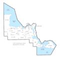
U.S. Census data map showing local municipal boundaries within Chippewa County. Shaded areas represent incorporated cities.

See also
 In Spanish: Condado de Chippewa (Míchigan) para niños
