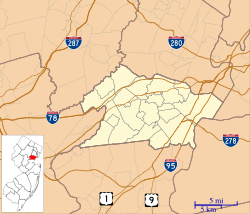
Clark, New Jersey facts for kids
Quick facts for kids
Clark, New Jersey
|
|
|---|---|
|
Township
|
|
| Township of Clark | |
| Motto(s):
Growth, Industry, History
|
|
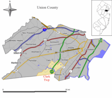
Map of Clark Township in Union County. Inset: Location of Union County in New Jersey.
|
|
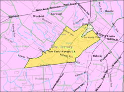
Census Bureau map of Clark, New Jersey
|
|
| Country | |
| State | |
| County | |
| Incorporated | March 23, 1864 |
| Named for | Abraham Clark |
| Government | |
| • Type | Faulkner Act Mayor-Council |
| • Body | Township Council |
| Area | |
| • Total | 4.45 sq mi (11.53 km2) |
| • Land | 4.27 sq mi (11.07 km2) |
| • Water | 0.18 sq mi (0.47 km2) 4.04% |
| Area rank | 283rd of 565 in state 11th of 21 in county |
| Elevation | 39 ft (12 m) |
| Population | |
| • Total | 15,544 |
| • Rank | 170th of 566 in state 13th of 21 in county |
| • Density | 3,640.3/sq mi (1,405.5/km2) |
| • Density rank | 188th of 566 in state 16th of 21 in county |
| Time zone | UTC−05:00 (Eastern (EST)) |
| • Summer (DST) | UTC−04:00 (Eastern (EDT)) |
| ZIP Code |
07066
|
| Area code(s) | 732/848 |
| FIPS code | 3403913150 |
| GNIS feature ID | 0882216 |
Clark is a township in southern Union County, New Jersey, United States. As of the 2020 United States Census, the township's population was 15,544 reflecting an increase of 788 (+5.07%) from the 14,756 counted in the 2010 United States Census, which had in turn increased by 159 (+1.1%) from the 14,597 counted in the 2000 Census.
Contents
History
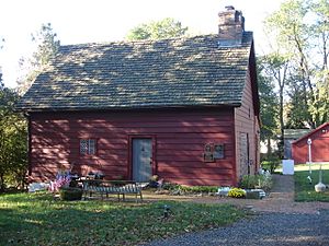
The territory that would become Clark was originally a part of several of the early villages, the Robinson Plantation House and The Squire Hartshorne House, buildings from the late 17th century are remnants of the era. The Homestead Farm at Oak Ridge was the site of a skirmish preceding the Battle of Short Hills. In 1858, after the City of Rahway was incorporated the area of present-day Clark was designated as the 5th Ward of Rahway. Clark was incorporated as a township by an act of the New Jersey Legislature on March 23, 1864, from portions of Rahway. The township was named for Abraham Clark, a signer of the Declaration of Independence. Portions of the township were taken to form Cranford Township (March 14, 1871) and Winfield Township (August 6, 1941).
New Jersey Monthly magazine ranked Clark as its 33rd best place to live in its 2008 rankings of the "Best Places To Live" in New Jersey. In 2013, New Jersey Monthly magazine ranked Clark as 174th in its rankings of "Best Places To Live" in New Jersey.
Geography
According to the United States Census Bureau, the township had a total area of 4.494 square miles (11.640 km2), including 4.301 square miles (11.141 km2) of land and 0.193 square miles (0.499 km2) of water (4.29%).
Unincorporated communities, localities and place names located partially or completely within the township include Ashbrook, Florence Mills, Lenox, Madison Hill and Picton.
Demographics
| Historical population | |||
|---|---|---|---|
| Census | Pop. | %± | |
| 1870 | 331 | — | |
| 1880 | 353 | 6.6% | |
| 1890 | 367 | 4.0% | |
| 1900 | 374 | 1.9% | |
| 1910 | 469 | 25.4% | |
| 1920 | 794 | 69.3% | |
| 1930 | 1,474 | 85.6% | |
| 1940 | 2,083 | 41.3% | |
| 1950 | 4,352 | 108.9% | |
| 1960 | 12,195 | 180.2% | |
| 1970 | 18,829 | 54.4% | |
| 1980 | 16,699 | −11.3% | |
| 1990 | 14,629 | −12.4% | |
| 2000 | 14,597 | −0.2% | |
| 2010 | 14,756 | 1.1% | |
| 2020 | 15,544 | 5.3% | |
| Population sources: 1870-1920 1870 1880-1890 1890-1910 1910-1930 1930-1990 2000 2010 2020 |
|||
Census 2010
As of the census of 2010, there were 14,756 people, 5,562 households, and 4,038 families residing in the township. The population density was 3,430.5 per square mile (1,324.5/km2). There were 5,751 housing units at an average density of 1,337.0 per square mile (516.2/km2)*. The racial makeup of the township was 93.29% (13,766) White, 0.84% (124) Black or African American, 0.10% (15) Native American, 3.71% (547) Asian, 0.03% (5) Pacific Islander, 1.15% (169) from other races, and 0.88% (130) from two or more races. [[Hispanic (U.S. Census)|Hispanic or Latino of any race were 7.50% (1,107) of the population.
There were 5,562 households out of which 30.2% had children under the age of 18 living with them, 60.4% were married couples living together, 9.0% had a female householder with no husband present, and 27.4% were non-families. 24.0% of all households were made up of individuals, and 12.0% had someone living alone who was 65 years of age or older. The average household size was 2.63 and the average family size was 3.15.
In the township, the population was spread out with 21.2% under the age of 18, 7.1% from 18 to 24, 23.6% from 25 to 44, 29.6% from 45 to 64, and 18.5% who were 65 years of age or older. The median age was 43.8 years. For every 100 females there were 92.6 males. For every 100 females ages 18 and old there were 88.8 males.
The Census Bureau's 2006-2010 American Community Survey showed that (in 2010 inflation-adjusted dollars) median household income was $80,959 (with a margin of error of +/- $7,674) and the median family income was $99,839 (+/- $7,789). Males had a median income of $65,399 (+/- $3,444) versus $49,649 (+/- $3,780) for females. The per capita income for the township was $37,288 (+/- $2,811). About 2.3% of families and 3.3% of the population were below the poverty line, including 3.3% of those under age 18 and 6.4% of those age 65 or over.
According to the 2009-2013 American Community Survey, the largest ancestry groups were:
Transportation
Roads and highways
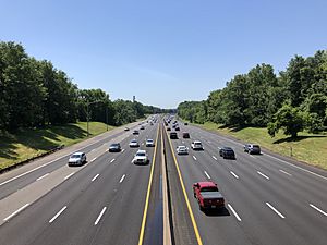
As of May 2010[update], the township had a total of 58.95 miles (94.87 km) of roadways, of which 48.34 miles (77.80 km) were maintained by the municipality, 8.03 miles (12.92 km) by Union County, and 2.58 miles (4.15 km) by the New Jersey Turnpike Authority.
The Clark Circle connects Central Avenue, Brant Avenue, Valley Road, and the Garden State Parkway via Exit 135. The New Jersey Turnpike Authority redesigned the circle as part of a project that ran from 2007 to 2009 under which the movements at the circle are now controlled by traffic lights. Interchange 135 on the Parkway is signed for Clark / Westfield.
Public transportation
The Lehigh Valley Railroad served the town with a passenger station in the Picton section. The rail line remains active under Conrail's auspices. The closest NJ Transit rail station is in Rahway, located approximately 2 miles (3.2 km) from the center of Clark.
NJ Transit also provides bus service to New York City and points in-between. The 112 route provides service to the Port Authority Bus Terminal in Midtown Manhattan, as well as stops throughout downtown Elizabeth.
Newark Liberty International Airport is approximately 11 miles (18 km) from Clark.
Education
The Clark Public School District serves students in pre-kindergarten through twelfth grade. As of the 2019–20 school year, the district, comprised of five schools, had an enrollment of 2,299 students and 184.7 classroom teachers (on an FTE basis), for a student–teacher ratio of 12.4:1. Schools in the district (with 2019–20 enrollment data from the National Center for Education Statistics) are Clark Preschool with 20 students in PreK, Frank K. Hehnly Elementary School with 551 students in grades K-5, Valley Road Elementary School with 435 students in grades K-5, Carl H. Kumpf Middle School with 518 students in grades 6-8 and Arthur L. Johnson High School with 708 students in grades 9-12. Students from Garwood attend the district's high school as part of a sending/receiving relationship with the Garwood Public Schools.
Students who excel in middle school have the opportunity to attend the Union County Magnet High School and the other programs of the Union County Vocational Technical Schools, which accept students from across the county on the basis of admissions examinations and applications.
Mother Seton Regional High School is an all-girls, private, Roman Catholic high school, operated under the auspices of the Roman Catholic Archdiocese of Newark. St. John the Apostle School School is a co-ed K-12 school, also operated under the auspices of the same archdiocese. It was dedicated as a National Blue Ribbon school in 2011.
The Clark Scholarship Fund is a not-for-profit organization that has provided need-based scholarships to college-bound Clark residents since 1955, funded entirely by contributions from individuals and businesses.
Notable people
People who were born in, residents of, or otherwise closely associated with Clark include:
- Todd Burger (born 1970), former offensive guard who played for the New York Jets.
- Halsey (born 1994), singer.
- Kenneth Ham (born 1964), NASA astronaut
- Jeffrey Lichtman (born 1965), defense attorney who represented Joaquin “El Chapo” Guzman and John Gotti Jr.
- William J. Maguire (1916–1997), politician who served as Mayor of Clark and in the New Jersey General Assembly from 1976 to 1982
- Ed Pinkham (born 1953), college football coach who is an assistant coach for the Arkansas State Red Wolves.
- Matt Poskay (born 1984), professional lacrosse player for the Boston Cannons.
- Erik Rosenmeier (born 1965), former NFL center who played for the Buffalo Bills in 1987.
- Robert Sparks (born 1947), former handball player who competed in the 1972 Summer Olympics and in the 1976 Summer Olympics.
- Frank Spaziani (born 1947), former head football coach for Boston College Eagles football.
- Kurt Sutter (born 1964), creator of the television show Sons of Anarchy who plays the character Otto Delaney in the show.
- Dave Toma (born 1933), whose life in law enforcement was the basis of the television shows Toma and Baretta.
Images for kids
See also
 In Spanish: Clark (Nueva Jersey) para niños


