
Clark County, Washington facts for kids
Quick facts for kids
Clark County
|
|
|---|---|
.jpg)
Clark County Courthouse
|
|

Location within the U.S. state of Washington
|
|
 Washington's location within the U.S. |
|
| Country | |
| State | |
| Founded | August 20, 1845 |
| Named for | William Clark |
| Seat | Vancouver |
| Largest city | Vancouver |
| Area | |
| • Total | 656 sq mi (1,700 km2) |
| • Land | 629 sq mi (1,630 km2) |
| • Water | 27 sq mi (70 km2) 4.1%% |
| Population
(2020)
|
|
| • Total | 503,311 |
| • Estimate
(2021)
|
511,404 |
| • Density | 717/sq mi (277/km2) |
| Time zone | UTC−8 (Pacific) |
| • Summer (DST) | UTC−7 (PDT) |
| Congressional district | 3rd |
Clark County is the southernmost county in the U.S. state of Washington. As of the 2020 census, the population was 503,311, making it Washington's fifth-most populous county. Its county seat and largest city is Vancouver. It was the first county in Washington, named after William Clark of the Lewis and Clark Expedition. It was created by the provisional government of Oregon Territory on August 20, 1845, and at that time covered the entire present-day state.
Clark County is the third-most-populous county in the Portland-Vancouver-Hillsboro, OR-WA Metropolitan Statistical Area, and is across the Columbia River from Portland.
Contents
History
Clark County began as the District of Vancouver on July 27, 1844. It included all the land north of the Columbia River, west of the Rocky Mountains, and south of Alaska. In 1845 the provisional government changed its name to Vancouver County. At that time it stretched from the Columbia River to 54 degrees 40 minutes North Latitude in what is now British Columbia. On June 15, 1846 the United States Senate approved the present boundary between the U.S. and Canada at the 49th Parallel.
On August 13, 1848, President James K. Polk signed an act creating the entire region as the Oregon Territory. On September 3, 1849, the Oregon Territorial Legislature modified the borders again and changed its name to Clarke County in honor of explorer William Clark. At this time it included all of present-day Washington and continued to be divided and subdivided until reaching its present area in 1880. It was not until 1925 that the spelling was corrected to its present form.
In September 1902 the Yacolt Burn, the largest fire in state history, began in neighboring Skamania County and swept west along a 12-mile front to Yacolt, nearly engulfing the town. Salvaging the remaining timber was a lucrative industry for a time.
Geography and climate
According to the U.S. Census Bureau, the county has a total area of 656 square miles (1,700 km2), of which 629 square miles (1,630 km2) is land and 27 square miles (70 km2) (4.1%) is water. It is the fifth-smallest county in Washington by land area.
Clark County is surrounded on two sides by the Columbia River and on the north by the North Fork of the Lewis River. The East Fork of the Lewis River and the Washougal River cut across the county. The largest stream arising solely within the county is Salmon Creek, which terminates at Vancouver Lake before eventually flowing into the Columbia River.
Like most of Oregon and Washington south of Puget Sound into the Willamette Valley the landscape and climate of Clark County are determined by its placement between the volcanic Pacific Coast and Cascade Ranges, where glaciation helped form a U-shaped valley which meets the river valley of the Columbia River as it leaves the Columbia River Gorge. Volcanic andisol soils are common, with fertile mollisols in the lower areas. The central and southwest areas of the county are generally flat floodplains, sculpted by torrents of prehistoric Lake Missoula. A series of dramatic floods known as the Missoula Floods took place 15,000 - 13,000 years ago, as several ice dams melted, forming a series of low steps such as the "Heights", "Mill Plain", "Fourth Plain" and "Fifth Plain". Clark County's Köppen climate classification is "Csb."
Many lakes border the river in the lowlands near Ridgefield, including Vancouver Lake. Eastern and northern Clark County contain forested foothills of the Cascade Mountains, rising to an elevation of 4,000 feet (1,200 m) on the border with Skamania County. Larch Mountain is the county's highest free-standing peak.
Flora and fauna of the region include the normal ecological succession from lowland big leaf maple and western red cedar through Garry oak on up through fire-dependent species such as lodgepole pine and Douglas fir, as well as grand fir, silver fir and other species common to Gifford Pinchot National Forest. In addition to a wide variety of birds including great blue heron, raptors such as barred owl, osprey, red-tailed hawk and bald eagle, corvids (raven, crow, California scrub and Steller's jay) and others, the native streams are home to various species of salmon and the Vancouver Trout Hatchery. Larger mammals include black-tailed deer, coyote, raccoon, skunk and invasive opossum; with sightings of lynx, bobcat, black bear, cougar and elk not uncommon, especially in the northern parts of the county. Common foods used by the indigenous people such as the Klickitat tribe and Chinook included salmon, huckleberry and Camassia quamash (after which the city of Camas, Washington is named).
Mount Hood, Mount Saint Helens and Mount Adams are all visible from Clark County, and cold winter winds through the Columbia River Gorge often bring freezing rain and a coating of glaze ice or clear ice known locally as a "silver thaw," especially in southeastern areas of the county closest to the gorge. The counterpart to this are warm winds from the southwest known locally as the "Pineapple Express".
Spring thaws can often swell county waterways, with two of the more destructive floods being those of the Columbia River in June 1894 and May, 1948. The 1948 Memorial Day flood almost topped the Interstate Bridge's support piers and completely destroyed nearby Vanport, Oregon. Construction of The Dalles Dam and destruction of Celilo Falls are credited with a decrease in such floods.
Significant windstorms in Clark County include the Columbus Day windstorm of October 12, 1962, and an April 6, 1972 tornado which rated F3 on the Fujita scale, striking a local school. A "Friday the 13th" storm in November 1981 brought winds up to 70 miles per hour (110 km/h), with other storms including the inauguration day storm of January 20, 1993, the Guadalupe Day storm of December 12, 1995 (with winds up to 95 miles per hour (153 km/h) at Washougal, Washington) and small tornado on January 10, 2008, which destroyed a boathouse at Vancouver Lake and caused damage to buildings in Hazel Dell before dissolving near Hockinson.
Geographic features
|
Major highways
 Interstate 5
 Interstate 205
 State Route 14
 State Route 500
 State Route 501
 State Route 502
 State Route 503
Former major highway
 State Route 140
Adjacent counties
- Cowlitz County - north
- Skamania County - east
- Multnomah County, Oregon - south
- Columbia County, Oregon - southwest
National protected areas
- Fort Vancouver National Historic Site (part)
- Gifford Pinchot National Forest (part)
- Ridgefield National Wildlife Refuge
- Steigerwald Lake National Wildlife Refuge
Demographics
| Historical population | |||
|---|---|---|---|
| Census | Pop. | %± | |
| 1850 | 643 | — | |
| 1860 | 2,384 | 270.8% | |
| 1870 | 3,081 | 29.2% | |
| 1880 | 5,490 | 78.2% | |
| 1890 | 11,709 | 113.3% | |
| 1900 | 13,419 | 14.6% | |
| 1910 | 26,115 | 94.6% | |
| 1920 | 32,805 | 25.6% | |
| 1930 | 40,316 | 22.9% | |
| 1940 | 49,852 | 23.7% | |
| 1950 | 85,307 | 71.1% | |
| 1960 | 93,809 | 10.0% | |
| 1970 | 128,454 | 36.9% | |
| 1980 | 192,227 | 49.6% | |
| 1990 | 238,053 | 23.8% | |
| 2000 | 345,238 | 45.0% | |
| 2010 | 425,363 | 23.2% | |
| 2020 | 503,311 | 18.3% | |
| 2021 (est.) | 511,404 | 20.2% | |
| U.S. Decennial Census 1790–1960 1900–1990 1990–2000 2010–2020 |
|||
2010 census
As of the 2010 census, there were 425,363 people, 158,099 households, and 110,672 families residing in the county. The population density was 676.2 inhabitants per square mile (261.1/km2). There were 167,413 housing units at an average density of 266.2 per square mile (102.8/km2). The racial makeup of the county was 85.4% white, 4.1% Asian, 2.0% black or African American, 0.9% American Indian, 0.6% Pacific islander, 2.9% from other races, and 4.0% from two or more races. Those of Hispanic or Latino origin made up 7.6% of the population. In terms of ancestry, 24.4% were German, 13.1% were Irish, 13.1% were English, 5.7% were Norwegian, and 4.3% were American.
Of the 158,099 households, 36.3% had children under the age of 18 living with them, 53.6% were married couples living together, 11.3% had a female householder with no husband present, 30.0% were non-families, and 23.1% of all households were made up of individuals. The average household size was 2.67 and the average family size was 3.15. The median age was 36.7 years.
The median income for a household in the county was $58,262 and the median income for a family was $67,352. Males had a median income of $52,160 versus $38,167 for females. The per capita income for the county was $27,828. About 7.8% of families and 10.9% of the population were below the poverty line, including 14.9% of those under age 18 and 7.2% of those age 65 or over.
Religion
Clark County is religiously diverse, with no single group comprising 10% of the population. The four groups that exceed 1% are nondenominational Christian with 30,026 members, the Catholic Church with 26,886 members, The Church of Jesus Christ of Latter-day Saints with 20,793 members, and the Evangelical Lutheran Church of America with 4,827. The area is also home to the nation's largest population of the Old Apostolic Lutheran Church with between 5,000 and 6,000 members living in the county. This is estimated because the Church doesn't keep membership rolls.
Clark County Youth Commission
The Clark County Youth Commission (CCYC) is a citizen advisory board to the Clark County Board of Commissioners (BOCC) in Clark County, Washington. The Youth Commission consists of approximately thirty 11- to 19-year-old youth from around the county, each school district in the county having two representatives. Since its establishment in 1998, the CCYC has given input to the BOCC and other county departments and organizations on various issues important to youth. In the past, the group worked on a fireworks policy and an economic development plan for the county.
In addition to helping shape county policy, the Youth Commission takes on a youth-driven project each year to promote or combat an issue. Past youth-driven projects include a Civil Rights Open House at the Youth House, a benefit concert for Invisible Children, and Freedom's Answer. Each year, the Youth Commission also hosts a Clark County Youth Achievement Celebration at Skyview High School to honor youth around the county.
Communities
Cities
- Battle Ground
- Camas
- La Center
- Ridgefield
- Vancouver (county seat)
- Washougal
- Woodland (partly in Cowlitz County)
Towns
Census-designated places
Other unincorporated communities
- Chelatchie
- Heisson
- Mill Plain
Images for kids
-
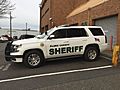
A patrol car of the Clark County Sheriff's Department.

See also
 In Spanish: Condado de Clark (Washington) para niños
