
Clayfield, Queensland facts for kids
Quick facts for kids ClayfieldBrisbane, Queensland |
|||||||||||||||
|---|---|---|---|---|---|---|---|---|---|---|---|---|---|---|---|

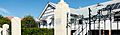
Aerial view of houses in the suburb in 1930
|
|||||||||||||||

Clayfield
Location in Queensland
|
|||||||||||||||
| Population | 10,555 (2016 census) | ||||||||||||||
| • Density | 3,770/km2 (9,800/sq mi) | ||||||||||||||
| Postcode(s) | 4011 | ||||||||||||||
| Area | 2.8 km2 (1.1 sq mi) | ||||||||||||||
| Time zone | AEST (UTC+10:00) | ||||||||||||||
| Location | 7.4 km (5 mi) NE of Brisbane GPO | ||||||||||||||
| LGA(s) | City of Brisbane (Hamilton Ward) |
||||||||||||||
| State electorate(s) | Clayfield | ||||||||||||||
| Federal Division(s) | Brisbane | ||||||||||||||
|
|||||||||||||||
Clayfield is a suburb in the City of Brisbane, Queensland, Australia. In the 2016 census Clayfield had a population of 10,555 people.
Contents
Demographics
In the 2011 census, Clayfield recorded a population of 10,006 people, 52.6% female and 47.4% male.
The median age of the Clayfield population was 34 years of age, 3 years below the Australian median.
70.3% of people living in Clayfield were born in Australia, compared to the national average of 69.8%; the next most common countries of birth were New Zealand 3.7%, England 3.6%, India 2.5%, Philippines 0.8%, and China 0.8%.
81.9% of people spoke only English at home; the next most popular languages were 1% Italian, 1% Mandarin, 0.7% Punjabi, 0.7% Korean, and 0.7% Hindi.
Heritage listings
Clayfield has a number of heritage-listed sites, including:
- 3 London Road: Lyndhurst
- 8 London Road: Turrawan
- 18 Tarranalma Avenue: Tarranalma
- 25 Enderley Road: Stanley Hall
- 40 Enderley Road: Ralahyne
Facilities
Transport
Clayfield was served by an electric tram line which ran along Sandgate Road until its closure on 13 April 1969. It is now served by bus and train services from the nearby Clayfield railway station and Eagle Junction railway station. Along the capital road (Alexandra Road), a canopy of poinciana and oak trees produce a 'New England' canopy effect.
Education
Schools located within Clayfield include:
- Aviation High
- Clayfield College
- Eagle Junction State Primary School
- St Rita's College
Other schools that serve the Clayfield area include:
- Kedron State High School
- St Margaret's Anglican Girls' School, Ascot
Places of worship
Churches that are located in Clayfield include:
- Clayfield Baptist Church
- Clayfield Gospel Hall
- Clayfield Uniting Church
- Scots Presbyterian Church
- St Agatha's Catholic Church
- St Mark's Anglican Church
Notable residents
- Mary Hyacinthe Petronel White (1900-1984) Women's right campaigner and local government councillor.
- James Campbell (1830-1904) Politician and businessman
- Timothy Joseph O’Leary (1925-1987), Flying doctor
Education
Eagle Junction State School is a government primary (Prep-6) school for boys and girls at 49 Roseby Avenue (27°25′04″S 153°03′01″E / 27.4177°S 153.0504°E). In 2018, the school had an enrolment of 877 students with 66 teachers (52 full-time equivalent) and 30 non-teaching staff (17 full-time equivalent). It includes a special education program.
St Agatha's Primary School is a Catholic primary (Prep-6) school for boys and girls at 6 Hunter Lane (27°25′34″S 153°03′17″E / 27.4260°S 153.0547°E). In 2018, the school had an enrolment of 338 students with 24 teachers (21 full-time equivalent) and 17 non-teaching staff (11 full-time equivalent).
St Rita's College is a Catholic secondary (7-12) school for girls at 41 Enderley Road (27°25′30″S 153°03′22″E / 27.4249°S 153.0561°E). In 2018, the school had an enrolment of 1005 students with 74 teachers (71 full-time equivalent) and 44 non-teaching staff (39 full-time equivalent).
Clayfield College is a private primary and secondary (Prep-12) school for boys and girls at 23 Gregory Street (27°25′13″S 153°03′07″E / 27.4202°S 153.0519°E). In 2018, the school had an enrolment of 565 students with 69 teachers (64 full-time equivalent) and 40 non-teaching staff (34 full-time equivalent).
Notable residents
- Charles Evans CMG, Commissioner of Railways
- Timothy Joseph O'Leary (1925–1987), flying doctor
- Richard Frank Tunley, developer of educational resources for blind children
- Mary Hyacinthe Petronel White (1900–1984), women's rights campaigner and local government councillor
Images for kids
-
Eagle Junction State School, 2020
