
Courtland, Kansas facts for kids
Quick facts for kids
Courtland, Kansas
|
|
|---|---|

Courtland Mural (2014)
|
|

Location within Republic County and Kansas
|
|

|
|
| Country | United States |
| State | Kansas |
| County | Republic |
| Founded | 1885 |
| Incorporated | 1892 |
| Named for | Cortland, New York |
| Area | |
| • Total | 0.27 sq mi (0.70 km2) |
| • Land | 0.27 sq mi (0.70 km2) |
| • Water | 0.00 sq mi (0.00 km2) |
| Elevation | 1,499 ft (457 m) |
| Population
(2020)
|
|
| • Total | 294 |
| • Density | 1,089/sq mi (420/km2) |
| Time zone | UTC-6 (CST) |
| • Summer (DST) | UTC-5 (CDT) |
| ZIP code |
66939
|
| Area code | 785 |
| FIPS code | 20-16025 |
| GNIS ID | 472819 |
Courtland is a city in Republic County, Kansas, United States. As of the 2020 census, the population of the city was 294.
History

The first settlement was made at Courtland in 1885. A post office was opened in Prospect (an extinct town) in 1878, but it was moved to Courtland in 1888. The community was named after Cortland, New York.
In 1887, Atchison, Topeka and Santa Fe Railway built a branch line from Neva (3 miles west of Strong City) through Courtland to Superior, Nebraska. In 1996, the Atchison, Topeka and Santa Fe Railway merged with Burlington Northern Railroad and renamed to the current BNSF Railway. Most locals still refer to this railroad as the "Santa Fe".
Courland was incorporated as a city in 1892.
Geography
Courtland is located at 39°46′58″N 97°53′49″W / 39.78278°N 97.89694°W (39.782803, -97.897054). According to the United States Census Bureau, the city has a total area of 0.27 square miles (0.70 km2), all of it land.
Demographics
| Historical population | |||
|---|---|---|---|
| Census | Pop. | %± | |
| 1890 | 267 | — | |
| 1900 | 286 | 7.1% | |
| 1910 | 454 | 58.7% | |
| 1920 | 411 | −9.5% | |
| 1930 | 430 | 4.6% | |
| 1940 | 383 | −10.9% | |
| 1950 | 367 | −4.2% | |
| 1960 | 384 | 4.6% | |
| 1970 | 403 | 4.9% | |
| 1980 | 377 | −6.5% | |
| 1990 | 343 | −9.0% | |
| 2000 | 334 | −2.6% | |
| 2010 | 285 | −14.7% | |
| 2020 | 294 | 3.2% | |
| U.S. Decennial Census | |||
2010 census
As of the census of 2010, there were 285 people, 137 households, and 82 families living in the city. The population density was 1,055.6 inhabitants per square mile (407.6/km2). There were 161 housing units at an average density of 596.3 per square mile (230.2/km2). The racial makeup of the city was 98.9% White, 0.7% African American, and 0.4% Asian. Hispanic or Latino of any race were 0.4% of the population.
There were 137 households, of which 26.3% had children under the age of 18 living with them, 46.0% were married couples living together, 7.3% had a female householder with no husband present, 6.6% had a male householder with no wife present, and 40.1% were non-families. 34.3% of all households were made up of individuals, and 14.6% had someone living alone who was 65 years of age or older. The average household size was 2.08 and the average family size was 2.66.
The median age in the city was 46.1 years. 22.1% of residents were under the age of 18; 6% were between the ages of 18 and 24; 19.7% were from 25 to 44; 29.8% were from 45 to 64; and 22.5% were 65 years of age or older. The gender makeup of the city was 52.6% male and 47.4% female.
Education
The community is served by Pike Valley USD 426 public school district. School unification consolidated Courtland and Scandia schools forming the district. The Pike Valley High School mascot is Panthers.
Prior to school unification, the Courtland High School mascot was Courtland Tigers. The Courtland Tigers won the Kansas State High School boys class B Indoor Track & Field championship in 1961.
Images for kids
-
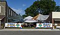
Courtland Fun Day (2014)
_(1).jpg)
See also
 In Spanish: Courtland (Kansas) para niños
