North Myrtle Beach, South Carolina facts for kids
Quick facts for kids
North Myrtle Beach, South Carolina
|
||
|---|---|---|

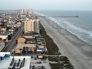
Cherry Grove Beach in North Myrtle Beach
|
||
|
||
| Nickname(s):
Myrtle town
|
||

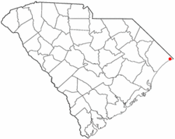
Location in South Carolina
|
||
| Country | United States | |
| State | South Carolina | |
| County | Horry | |
| First settled | 1735 | |
| Incorporated | 1968 | |
| Area | ||
| • Total | 21.71 sq mi (56.24 km2) | |
| • Land | 21.16 sq mi (54.81 km2) | |
| • Water | 0.55 sq mi (1.43 km2) | |
| Elevation | 7 ft (2 m) | |
| Population
(2010)
|
||
| • Total | 13,752 | |
| • Estimate
(2019)
|
16,819 | |
| • Density | 794.77/sq mi (306.86/km2) | |
| Time zone | UTC−5 (EST) | |
| • Summer (DST) | UTC−4 (EDT) | |
| ZIP codes |
29582, 29597, 29598
|
|
| Area code(s) | 843, 854 | |
| FIPS code | 45-51280 | |
| GNIS feature ID | 1251574 | |
North Myrtle Beach is a city in Horry County, South Carolina, United States. It was created in 1968 from four existing municipalities, and is located about 15 miles (24 km) northeast of Myrtle Beach. It serves as one of the primary tourist destinations along the Grand Strand. As of the 2010 census, the population was 13,752, and in 2019 the estimated population was 16,819. It is part of the Myrtle Beach–Conway–North Myrtle Beach Metropolitan Area, which had a combined population of 449,295 as of 2016.
Contents
Geography
North Myrtle Beach is located at 33°49′20″N 78°40′52″W / 33.82222°N 78.68111°W (33.822216, -78.680974). According to the United States Census Bureau, the city has a total area of 13.5 square miles (35.0 km²), of which, 13.0 square miles (33.8 km²) of it is land and 0.5 square miles (1.2 km²) of it (3.48%) is water.
The area is divided into four separate areas based on its former municipalities. These are Windy Hill, Crescent Beach, Ocean Drive, and Cherry Grove, a spit bordering North Carolina. Atlantic Beach, which lies inside of North Myrtle Beach, chose to remain its own town during the merger.
The current city government has pursued a policy of growth through annexation and in October 2008 annexed 2.1 square miles (5.4 km2) that resulted in the city extending from the North Carolina state line to the city limits of Myrtle Beach.
Demographics
| Historical population | |||
|---|---|---|---|
| Census | Pop. | %± | |
| 1970 | 1,957 | — | |
| 1980 | 3,960 | 102.4% | |
| 1990 | 8,636 | 118.1% | |
| 2000 | 10,974 | 27.1% | |
| 2010 | 13,752 | 25.3% | |
| 2019 (est.) | 16,819 | 22.3% | |
| U.S. Decennial Census | |||
2020 census
| Race | Num. | Perc. |
|---|---|---|
| White (non-Hispanic) | 16,808 | 89.45% |
| Black or African American (non-Hispanic) | 414 | 2.2% |
| Native American | 68 | 0.36% |
| Asian | 147 | 0.78% |
| Pacific Islander | 11 | 0.06% |
| Other/Mixed | 543 | 2.89% |
| Hispanic or Latino | 799 | 4.25% |
As of the 2020 United States census, there were 18,790 people, 7,558 households, and 4,583 families residing in the city.
Neighborhoods
- Barefoot
- Cherry Grove
- Crescent Beach
- Ocean Drive Beach
- Windy Hill Beach
Infrastructure
Transportation
Road
Air
North Myrtle Beach is home to a single terminal, the Grand Strand Airport, serving primarily banner planes and small aircraft. The airfield is located in the heart of the city. The airport generates over $10.1 million in local economic output.
Bus
North Myrtle Beach is served by the Coast RTA, formerly Waccamaw RTA or Lymo.
Adjacent towns and communities
(In order of location)
- Atlantic Beach
- Briarcliffe Acres
- Little River
 |
Wampee S.C. Highway 22 to SC 90 |
Longs S.C. Highway 9 |
Little River U.S. Route 17 |
 |
| Intracoastal Waterway | Cherry Grove Beach Ocean Drive (North Myrtle Beach) |
|||
| Atlantic Beach U.S. Route 17 |
Atlantic Ocean | Atlantic Ocean |
Education
- Ocean Drive Elementary School
- Riverside Elementary School
- Waterway Elementary School
- North Myrtle Beach Middle School
- North Myrtle Beach High School (in nearby Little River)
Notable people
- Ryan Quigley - football punter who has played for the Minnesota Vikings, Jacksonville Jaguars, Chicago Bears, New York Jets, and Philadelphia Eagles.
- Lou Saban, former football coach; lived here until his death
- Kelly Tilghman, Golf Channel broadcaster and PGA Tour's first female lead golf announcer
- Vanna White, television personality known for co-hosting Wheel of Fortune
See also
 In Spanish: North Myrtle Beach para niños


