
Darby, Montana facts for kids
Quick facts for kids
Darby, Montana
|
|
|---|---|

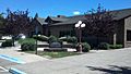
Discovery nature trail (East side towards river)
|
|

Location of Darby, Montana
|
|
| Country | United States |
| State | Montana |
| County | Ravalli |
| Area | |
| • Total | 0.63 sq mi (1.63 km2) |
| • Land | 0.61 sq mi (1.58 km2) |
| • Water | 0.02 sq mi (0.05 km2) |
| Elevation | 3,885 ft (1,184 m) |
| Population
(2020)
|
|
| • Total | 783 |
| • Density | 1,283.61/sq mi (495.57/km2) |
| Time zone | UTC-7 (Mountain (MST)) |
| • Summer (DST) | UTC-6 (MDT) |
| ZIP code |
59829
|
| Area code(s) | 406 Exchange: 821 |
| FIPS code | 30-19300 |
| GNIS feature ID | 0782081 |
| Website | http://www.darbymt.net/ |
Darby (Salish: snk̓ʷɫxʷexʷem̓i, "Place Where They Would Lift Something") is a town in Ravalli County, Montana, United States. The population was 783 at the 2020 census. Darby is located near the southwestern border of Montana and Idaho, along the Continental Divide.
Officially established in 1889, the town was named after James W. Darby who signed the post office application.
Contents
Geography
Darby is located at 46°1′19″N 114°10′47″W / 46.02194°N 114.17972°W (46.022030, -114.179603).
According to the United States Census Bureau, the town has a total area of 0.58 square miles (1.50 km2), all of it land.
The area south of Darby is called nɫpapʔá in Salish.
Climate
This climatic region is typified by large seasonal temperature differences, with warm to hot (and often humid) summers and cold (sometimes severely cold) winters. According to the Köppen Climate Classification system, Darby has a humid continental climate, abbreviated "Dfb" on climate maps.
Visitors to Darby may wish to seek shelter during thunderstorms. In July 2012, "A cowboy and two spectators were taken by ambulance to a Hamilton hospital ... after lightning hit a power pole at the Elite Bull Connection, sending an electric shock through the grandstands, rodeo chutes and bull pens." On July 14, 2014, 45 cattle on a ranch near Darby were killed in a single lightning strike.
Demographics
| Historical population | |||
|---|---|---|---|
| Census | Pop. | %± | |
| 1920 | 325 | — | |
| 1930 | 285 | −12.3% | |
| 1940 | 481 | 68.8% | |
| 1950 | 415 | −13.7% | |
| 1960 | 398 | −4.1% | |
| 1970 | 538 | 35.2% | |
| 1980 | 581 | 8.0% | |
| 1990 | 625 | 7.6% | |
| 2000 | 710 | 13.6% | |
| 2010 | 720 | 1.4% | |
| 2020 | 783 | 8.8% | |
| U.S. Decennial Census | |||
2010 census
As of the census of 2010, there were 720 people, 303 households, and 179 families residing in the town. The population density was 1,241.4 inhabitants per square mile (479.3/km2). There were 360 housing units at an average density of 620.7 per square mile (239.7/km2). The racial makeup of the town was 91.3% White, 0.1% African American, 4.2% Native American, 0.8% Asian, and 3.6% from two or more races. Hispanic or Latino of any race were 2.2% of the population.
There were 303 households, of which 28.1% had children under the age of 18 living with them, 39.6% were married couples living together, 14.5% had a female householder with no husband present, 5.0% had a male householder with no wife present, and 40.9% were non-families. 33.3% of all households were made up of individuals, and 12.9% had someone living alone who was 65 years of age or older. The average household size was 2.36 and the average family size was 2.94.
The median age in the town was 40.8 years. 24% of residents were under the age of 18; 8.2% were between the ages of 18 and 24; 23.1% were from 25 to 44; 29.6% were from 45 to 64; and 15% were 65 years of age or older. The gender makeup of the town was 49.9% male and 50.1% female.
City Council
The Darby Town Council has two wards and an at-large position.
Ward 1
- Scott Ralston
Ward 2
- Shane Starkey
At-large
Scenic Community Gallery
-
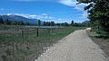
Fishing north of Darby (Lost Horse)
-
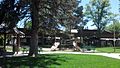
Main street park
-
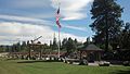
Veterans Memorial at Loggers Day field
-
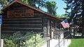
Pioneer Memorial Museum
-
District Library
-
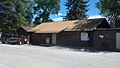
Community clubhouse
-
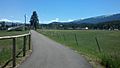
Discovery nature trail (West side near Rodeo grounds)
-
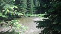
Discovery nature trail (East side towards river)
-
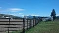
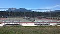
Richard Cromwell Memorial Rodeo Grounds
-
Tennis courts next to school
-
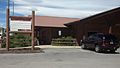
Town Hall (Tanner Ave and Hwy 93)


Education
Darby School District educates students from kindergarten through 12th grade. Darby High School's team name is the Tigers.
Darby Community Public Library serves the town.
See also
 In Spanish: Darby (Montana) para niños
