
Daufuskie Island facts for kids
Quick facts for kids |
|
|
Daufuskie Island Historic District
|
|

Haig Point Rear Range Light
|
|

Location in South Carolina

Location in the United States
|
|
| Nearest city | Hilton Head, South Carolina |
|---|---|
| Built | 1728 |
| Architectural style | Greek Revival |
| NRHP reference No. | 82003831 |
| Added to NRHP | June 2, 1982 |
Daufuskie Island, located between Hilton Head Island and Savannah, is the southernmost inhabited sea island in South Carolina. It is 5 miles (8 km) long by almost 2.5 miles (4.0 km) wide – approximate surface area of 8 square miles (21 km2) (5,000 acres). With over 3 miles (5 km) of beachfront, Daufuskie is surrounded by the waters of Calibogue Sound, the Intracoastal Waterway and the Atlantic Ocean. It was listed as a census-designated place (Daufuskie Island CDP) in the 2020 census with a population of 557.
Accessible only by ferry or barge, and with a full-time population of just over 400, Daufuskie Island encompasses a rich cultural experience, with environmental preserves, private communities, resorts, Gullah houses, diverse art galleries and history. The island was named a historic district on the National Register of Historic Places due to its Gullah and Civil War history. The island is also the setting of Pat Conroy's memoir The Water Is Wide recounting Conroy's experiences teaching on Daufuskie in the 1960s.
Contents
History
For thousands of years early humans called Daufuskie Island home as evidenced by ancient piles of discarded oyster shells exhibiting pottery shards from all phases of the hunter gathering period. Prior to European arrival numerous Indian tribes inhabited the Lowcountry and islands. Culturally and linguistically these tribes were of Muskogean stock. Daufuskie comes from the Muscogee language and means ‘’sharp feather’’ for the island’s distinctive shape.
As early as 1523, Spanish explorers were sailing the southeastern coast of North America in search of potential settlements. By 1565, the Spanish had settled in St Augustine, Florida and were pushing up the coast establishing and maintaining additional colonies. Concurrent with these 16th century ambitions for settlement, the French also made attempts at colonization in South Carolina Lowcountry areas. By the mid-1600’s the English began to explore the southern coast. Prosperous Caribbean planters sponsored several expeditions to South Carolina. Captain William Hilton and Robert Sandford both made voyages to Port Royal Sound and vicinity. In July 1666 Sanford entered Calibogue Sound between Hilton Head and Daufuskie.
It was during this period of early exploration that Spanish settlers introduced their distinctive Iberian horses to the Southeastern coast. Today the descendants of these horses are known as ′Carolina Marsh Tacky′. These sturdy, intelligent horses are particularly well adapted to the swampy and marshy lowcountry region. Examples of this rare breed can still be found on Daufuskie.
In 1684, Spanish soldiers enlisted the help of native warriors to fight Scottish settlers in Port Royal, and thus began the uneasy and difficult history of native entanglement in European settlement history. The inevitable clash of cultures culminated with a so-called Yamasee uprising that consisted of three brutal battles on the southwestern shore of Daufuskie Island between 1715-1717 that gave this piece of land the name it still bears today, Bloody Point.
The quest for religious freedom ultimately brought two European families to Daufuskie Island—the great grandson of French Huguenot David Mongin, and the daughter of Italian Prince Filippo de Martinangelo who escaped the Inquisition. The story of these two founding families is intertwined throughout their long history, and both rose to become powerful island plantation owners.
The American Revolution brought divided loyalties to the lowcountry. Daufuskie received the nickname “little Bermuda” during the Revolution due to the resident’s loyalist sentiments. After the Revolution, Daufuskie thrived with the introduction of world famous sea island cotton, a variety prized by European mills. High quality, sea island cotton exceeded all other long-staple cottons in fiber length, as well as fineness and strength. It was during this period of strong economic growth that several large plantation mansions were constructed.

The building of American wooden tall ships triggered the demand for timber from Live Oak trees abundant on Daufuskie. This hardwood species, unique to the southeastern coast, was prized by shipbuilders for its strength and resistance to rot, as well as its naturally curved limbs. Daufuskie was in the center of the ‘live oaking’ trade crucial to the development of US maritime power. Shipwrights traveled to Daufuskie and the lowcountry to fell the oaks, hew them, and lug the pieces by oxen to coastal landings. USS Constitution ‘Old Ironsides’ was constructed with live oak.
Prior to the Civil War, there were eleven plantations on Daufuskie. Large homes were constructed on several of these tracts – Oakley Hall at Bloody Point, Melrose, and Haig Point. The mansion at Haig Point was unique as it was built of tabby and was the largest tabby domestic building erected in coastal South Carolina.
Introduced in the southeast by early Spanish settlers, tabby is a type of concrete made by burning oyster shells to create lime, then mixing it with water, sand, ash and broken oyster shells. Three of the best preserved, tabby-walled single slave dwellings still standing in Beaufort County can be found today at Haig Point.

Early in the Civil War Union forces occupied the Beaufort-area islands. Union troops on Daufuskie supported the siege and reduction of Fort Pulaski protecting the Savannah river entrance. This Union presence caused white plantation owners to flee, leaving property and slaves behind. After the war, Daufuskie's remoteness allowed Gullah culture to survive and flourish through the generations.
The Gullah language is a legacy of the original slaves and later laborers who remained once the plantations folded. The lowcountry was remote until the mid-20th century, but the isolation of Daufuskie created the perfect climate for the language and manners of the Gullah people to remain remarkably well preserved. The language is a colorful and rhythmic blend of West African and rural English dialect that is becoming increasingly rare to hear. Daufuskie is in the center of the Gullah/Geechee Cultural Heritage Corridor.
Following the Civil War the farming, mining, and timber industries were re-established in Beaufort County and the lowcountry. This activity meant the waterways around Daufuskie, with its critical position between Port Royal and Savannah, became very busy. Navigation aids became necessary to support the increased volume of shipping. In 1873 the Haig Point Range Lights were constructed on the island's northern end. This was followed by the Bloody Point range lights in 1883 built to assist ships approaching the Savannah River entrance.
From the 1880’s the oyster industry flourished on Daufuskie. By the turn of the century the island had a population of 2,000-3,000, most of whom worked in this lucrative shellfish trade. The flat coastline, salt marsh estuary, and natural oyster reefs, combined with a lengthy spawning season, make waters surrounding Daufuskie the perfect habitat for growing abundant clusters of meaty, briny oysters. Daufuskie oysters were known as far away as Bar Harbor and New York. It’s reported that the Tsar of Russia preferred Daufuskie oysters.
Eventually, in the 1950s, pollution closed the oyster beds and the island’s economy declined. Electricity came to the island in 1953 and telephones in 1972; however, with few opportunities for work, the population shrank to less than a hundred people, leaving a legacy of rich Gullah history. In the 1980s developers started making plans to make Daufuskie Island a residential development destination and the planned developments of Bloody Point, Melrose, Haig Point, and Oakridge were born. Despite this progress and development, the island’s historic district has remained untouched to preserve the Gullah culture and today the entire island is on the National Register of Historic Places.
Locations
The island is now split into five parts.
To the northeast is the Haig Point Club[1], a private, member owned residential club with around 150 year-round residents and over 225 homes.
South of Haig Point is the Daufuskie Resort, Melrose on the Beach. Formerly a private vacation club with an emphasis on golf and tennis, and offering a private residential component, this is now a publicly accessible resort. Farther south on the eastern side of the island is Oak Ridge, a small undeveloped oceanfront community, followed by Bloody Point, a semi-private residential and golf club community.
The western part of the island is unincorporated land. Several dozen residents live in a variety of accommodations, from trailers to beautiful waterfront homes with private docks. This section of the island received federal designation as a Historical District in the early 1980s. According to a study conducted by the Savannah College of Art and Design, the island has excellent examples of Gullah homes which have not been altered. There are descendants of the Gullah people living in this area on land which they have owned since just after the Civil War.
A census in 2007 by the local Daufuskie Island Fire and Rescue Department counted a total of just 429 residents living full-time on the entire island. Rock musician John Mellencamp built a house on the island and uses it as a retreat.
.jpg)
Culture and Governance
The island is also home to the First Union African Baptist Church, which is Daufuskie's oldest building, and is still in use today as a place of worship.
There are two historic lighthouses on Daufuskie Island. The Bloody Point Lighthouse, built in 1883, and the Haig Point Lighthouse, built ten years earlier.
The island is part of Beaufort County, SC and has an elected council composed of representatives from the Island’s existing groups including the Historic District, Island Conservancy, and Property Owner’s Associations. The Daufuskie Island Council serves as the official voice between Daufuskie and the County.
Transportation
There are no bridges that connect Daufuskie with mainland South Carolina; therefore all island access must come by boat. A public ferry makes several daily transits between Buckingham Landing in the Bluffton area and Melrose Landing on Daufuskie.
Beaufort County provides a subsidized ferry that transports residents. The Haig Point Club has its own private ferry service. There are also several private companies that provide 25-30 minute water taxi services to the island. Residents of the clubs, as well as some of the other residents on the island, use golf carts and bicycles to travel around the island, although there are also some regular vehicles.
Flora and fauna

The Daufuskie Island Conservancy is one of several local organizations charged with preserving the ecosystem, flora and fauna, and quality of life on Daufuskie Island. Details of these groups and their meetings can be found at the island's only news source The Daufuskie Front Porch. In addition there is a web portal for the island with local interests and local business listings at Daufuskie Tides
Daufuskie Island boasts a wide variety of nature and animal life. One of the notable animals that inhabits the island is the fox squirrel. The bald eagle is also one of the magnificent creatures found on the island. During the day, you can see eagles soaring high in the air and occasionally swooping into the water for a catch.
Climate
Daufuskie Island has a humid subtropical climate.
| Climate data for Daufuskie Island, South Carolina | |||||||||||||
|---|---|---|---|---|---|---|---|---|---|---|---|---|---|
| Month | Jan | Feb | Mar | Apr | May | Jun | Jul | Aug | Sep | Oct | Nov | Dec | Year |
| Average high °F (°C) | 60 (16) |
63 (17) |
69 (21) |
76 (24) |
82 (28) |
87 (31) |
89 (32) |
88 (31) |
84 (29) |
77 (25) |
69 (21) |
62 (17) |
76 (24) |
| Average low °F (°C) | 39 (4) |
41 (5) |
47 (8) |
54 (12) |
62 (17) |
69 (21) |
72 (22) |
72 (22) |
68 (20) |
57 (14) |
48 (9) |
41 (5) |
56 (13) |
| Average precipitation inches (mm) | 3.8 (97) |
3.5 (89) |
3.9 (99) |
3.0 (76) |
3.8 (97) |
5.1 (130) |
6.3 (160) |
7.8 (200) |
5.9 (150) |
3.5 (89) |
2.5 (64) |
2.9 (74) |
52.1 (1,320) |
| Source: Weatherbase | |||||||||||||
Resort amenities
The island has four golf courses, the Bloody Point Course, designed by Tom Weiskopf and Jay Morrish, the Melrose Golf Course designed by Jack Nicklaus, and the 20 hole Haig Point Signature Course plus the 9-hole Haig Point Osprey Course designed by Rees Jones.
The 20-hole Haig Point Golf Course is designed to be played as two separate 18-hole courses, one easier, one more difficult. The course has two extra "easy" par threes and many holes have two sets of tees. It is a unique and ingenious design that allows every level of player to enjoy the Signature Course and its natural beauty. Ten of the twenty holes have spectacular marsh, sound and ocean views.
Notable natives
In Popular Culture
The Jimmy Buffett song, "Prince Of Tides" (from his 1988 album, Hot Water) laments the development of Daufuskie and loss of the Gullah culture.
Pat Conroy's 1972 book The Water is Wide is set on Daufuskie, fictionalized as Yamacraw Island. The book recounts Conroy's experiences teaching on the island in 1969. The book won Conroy a humanitarian award from the National Education Association and an Anisfield-Wolf Book Award.
The Water is Wide, Pat Conroy’s novel describing his teaching experience on Daufuskie, was made into a feature film, “Conrack”, starring Jon Voight in 1974. The novel was also produced as “The Water Is Wide” (2006 film), a Hallmark Hall of Fame TV movie starring Jeff Hephner.
In the novel Reefer Moon (2009), by Roger Pinckney, the principle action takes place on Daufuskie, as well as other Lowcountry locations.
The adventure novel Daufuskie Island (2016), by John Lueder, is centered on Daufuskie.
One episode of the National Geographic Channel television series “Diggers” (S2, E10; 2013) featured professional treasure hunters Tim Saylor and George ‘KG’ Wyant visiting Daufuskie seeking pirate’s gold.
The March 2014 issue of Architectural Digest magazine featured the Daufuskie part-time home of singer John Mellencamp.
The romance novel A Ferry to Catch: Daufuskie Island (2016), by Carol Bellhouse, features life on Daufuskie.
Travel + Leisure magazine designated restaurant Marshside Mama’s, at the County Landing on Daufuskie, as one of the “Ten Best Beach Bars in America.
Travel TV Channel show “Bizarre Foods America” featured a segment with Daufuskie native Sallie Ann Robinson on a show (S1, E8; 2012) dedicated to Lowcountry and Gullah food and culture.
Education
Daufuskie Island School is a Beaufort County public school built in 1997. It is a modern facility with two classrooms, lunchroom and library. The students are in multigrade classrooms: pre-K through 2nd grade and 3rd grade through 5th grade. Generally there are around 15-18 students each year, and the school has significant community support and many volunteers on the island.
Students in grades 6–12 are transported to Hilton Head Middle School and Hilton Head High School by a ferry. On Daufuskie, these students take a small school bus to the ferry. Once the students reach Hilton Head, they are picked up by a county school bus and taken to their appropriate school campus. The entire trip is about an hour and ten minutes each morning and afternoon. The students often do their homework or simply nap during the boat ride.
Images for kids
-
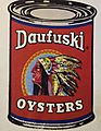
The waters around Daufuskie provided oysters for world-wide shipment.

See also
 In Spanish: Daufuskie Island para niños
