
Devils Lake, North Dakota facts for kids
Quick facts for kids
Devils Lake, North Dakota
|
|
|---|---|

Downtown Devils Lake
|
|

Location of Devils Lake, North Dakota
|
|
| Country | United States |
| State | North Dakota |
| County | Ramsey |
| Founded | 1882 |
| Incorporated (village) | 1884 |
| Incorporated (city) | 1887 |
| Area | |
| • Total | 6.93 sq mi (17.94 km2) |
| • Land | 6.92 sq mi (17.93 km2) |
| • Water | 0.01 sq mi (0.01 km2) |
| Elevation | 1,447 ft (441 m) |
| Population
(2010)
|
|
| • Total | 7,141 |
| • Estimate
(2020)
|
7,229 |
| • Density | 1,057.50/sq mi (408.32/km2) |
| Time zone | UTC-6 (Central (CST)) |
| • Summer (DST) | UTC-5 (CDT) |
| ZIP code |
58301
|
| Area code(s) | 701 |
| FIPS code | 38-19420 |
| GNIS feature ID | 1028672 |
| Highways | US 2, ND 19, ND 20 |
Devils Lake is a city in Ramsey County, North Dakota, United States. It is the county seat of Ramsey County. The population was 7,141 at the 2010 census. It is named after the nearby body of water called Devils Lake. The first house in Devils Lake was built in 1882. It was surveyed in 1883 and named Creelsburg and later Creel City, after the surveyor, Heber M. Creel. In 1884 it was renamed Devils Lake.
The local paper is the Devils Lake Journal. Devils Lake Municipal Airport serves the city. Devils Lake is home to Lake Region State College and the North Dakota School for the Deaf.
Contents
History
The present site of Devils Lake was historically territory of the Sioux or Lakota. The Sioux were relocated to the Spirit Lake Reservation. The name "Devils Lake" is a calque of the Sioux phrase mni wak’áŋ (literally: spirit water), which is also reflected in the names of the Spirit Lake Tribe and the nearby town of Minnewaukan.
The Sioux called the lake mni wak’áŋ chante, which separately translate as mni (water), wak’áŋ (spirit), and chante (bad). Early European-American settlers thought this meant "Bad Spirit Lake", or "Devils Lake." The "bad" referred to the high salinity of the lake, making it unfit to drink, and "spirit" meant the mirages often seen across the water. The Christian concept of the devil was not present in the Sioux religion.
The Hidatsa name is mirixubaash ("sacred water").
The first post office was founded here November 15, 1882, and originally named Creelsburg. It was founded by Lieutenant Heber M. Creel, a West Point graduate and topgraphical engineer stationed at nearby Fort Totten. After resigning from the U.S. Army, he surveyed and established the townsite.
The surrounding Creel Township is named for him. Its name was later changed to Creel City and expanded by the Great Northern Railway. When the village was incorporated in 1884, the name was changed to City of Devils Lake and then shortened to Devils Lake.
A period of increased rainfall, beginning in the 1990s and unprecedented in the history of the state, caused the nearby lake, which has no natural outlet, to rise. The surface area has quadrupled, and the higher water has resulted in the moving or destruction of over 400 houses.
Geography and climate
According to the United States Census Bureau, the city has a total area of 6.51 square miles (16.86 km2), of which, 6.50 square miles (16.83 km2) is land and 0.01 square miles (0.03 km2) is water.
Like all of North Dakota, Devils Lake has a humid continental climate (Köppen Dfb) with very cold winters with frequent light snowfall, and warm to very warm, wetter summers with most rain from convective thunderstorms. During the 1936 North American cold wave, the town was one of the coldest places south of the Canada–US border, averaging −21 °F or −29.4 °C for the five weeks ending February 21, 1936 (though at a different site from that now in use). On average 53.4 nights fall to or below 0 °F or −17.8 °C, 104.1 days fail to top freezing, and 184.5 nights fall below 32 °F or 0 °C. In the winter, only 17.5 days on average top freezing, and in severe winters months can pass without even a minor thaw. Extreme heat is rare in summer, with only one day in three years topping 100 °F or 37.8 °C, and only 9.3 topping 90 °F or 32.2 °C.
| Climate data for Devils Lake, North Dakota (1971-2000, extremes 1948-2001) | |||||||||||||
|---|---|---|---|---|---|---|---|---|---|---|---|---|---|
| Month | Jan | Feb | Mar | Apr | May | Jun | Jul | Aug | Sep | Oct | Nov | Dec | Year |
| Record high °F (°C) | 53 (12) |
60 (16) |
72 (22) |
97 (36) |
96 (36) |
103 (39) |
103 (39) |
103 (39) |
100 (38) |
94 (34) |
77 (25) |
59 (15) |
103 (39) |
| Average high °F (°C) | 14.7 (−9.6) |
22.3 (−5.4) |
33.6 (0.9) |
52.1 (11.2) |
67.5 (19.7) |
75.3 (24.1) |
80.1 (26.7) |
79.1 (26.2) |
67.7 (19.8) |
53.9 (12.2) |
33.1 (0.6) |
19.4 (−7.0) |
49.9 (9.9) |
| Average low °F (°C) | −2.5 (−19.2) |
5.2 (−14.9) |
17.3 (−8.2) |
32.2 (0.1) |
44.9 (7.2) |
54.3 (12.4) |
58.6 (14.8) |
56.2 (13.4) |
46.5 (8.1) |
34.6 (1.4) |
18.4 (−7.6) |
3.6 (−15.8) |
30.8 (−0.7) |
| Record low °F (°C) | −36 (−38) |
−37 (−38) |
−28 (−33) |
−12 (−24) |
1 (−17) |
29 (−2) |
39 (4) |
33 (1) |
20 (−7) |
−2 (−19) |
−25 (−32) |
−37 (−38) |
−37 (−38) |
| Average precipitation inches (mm) | 0.58 (15) |
0.51 (13) |
0.80 (20) |
0.90 (23) |
2.14 (54) |
3.83 (97) |
3.29 (84) |
2.21 (56) |
1.80 (46) |
1.47 (37) |
0.83 (21) |
0.57 (14) |
18.93 (480) |
| Average snowfall inches (cm) | 6.3 (16) |
4.7 (12) |
6.3 (16) |
2.2 (5.6) |
0.3 (0.76) |
0.0 (0.0) |
0.0 (0.0) |
0.0 (0.0) |
0.0 (0.0) |
1.9 (4.8) |
5.4 (14) |
7.2 (18) |
34.3 (87.16) |
| Average precipitation days (≥ 0.01 inch) | 8.4 | 6.7 | 7.2 | 7.1 | 9.5 | 12.1 | 10.1 | 8.9 | 8.4 | 7.3 | 6.8 | 7.4 | 99.9 |
| Average snowy days (≥ 0.1 inch) | 6.2 | 3.7 | 3.8 | 1.1 | 0.1 | 0.0 | 0.0 | 0.0 | 0.1 | 0.7 | 3.1 | 4.8 | 23.6 |
| Source: NOAA | |||||||||||||
Demographics
| Historical population | |||
|---|---|---|---|
| Census | Pop. | %± | |
| 1890 | 846 | — | |
| 1900 | 1,729 | 104.4% | |
| 1910 | 5,157 | 198.3% | |
| 1920 | 5,140 | −0.3% | |
| 1930 | 5,451 | 6.1% | |
| 1940 | 6,204 | 13.8% | |
| 1950 | 6,427 | 3.6% | |
| 1960 | 6,299 | −2.0% | |
| 1970 | 7,078 | 12.4% | |
| 1980 | 7,442 | 5.1% | |
| 1990 | 7,782 | 4.6% | |
| 2000 | 7,222 | −7.2% | |
| 2010 | 7,141 | −1.1% | |
| 2020 (est.) | 7,229 | 1.2% | |
| U.S. Decennial Census 2020 Estimate |
|||
2010 census
As of the census of 2010, there were 7,141 people, 3,229 households, and 1,712 families living in the city. The population density was 1,098.6 inhabitants per square mile (424.2/km2). There were 3,481 housing units at an average density of 535.5 per square mile (206.8/km2). The racial makeup of the city was 82.9% White, 0.5% African American, 12.5% Native American, 0.4% Asian, 0.3% from other races, and 3.4% from two or more races. Hispanic or Latino of any race were 1.3% of the population.
There were 3,229 households, of which 26.0% had children under the age of 18 living with them, 36.0% were married couples living together, 12.7% had a female householder with no husband present, 4.3% had a male householder with no wife present, and 47.0% were non-families. 41.8% of all households were made up of individuals, and 17.3% had someone living alone who was 65 years of age or older. The average household size was 2.07 and the average family size was 2.80.
The median age in the city was 40.4 years. 21.6% of residents were under the age of 18; 10.9% were between the ages of 18 and 24; 22.3% were from 25 to 44; 26.1% were from 45 to 64; and 19.2% were 65 years of age or older. The gender makeup of the city was 48.1% male and 51.9% female.
Transportation
Amtrak, the U.S. national passenger rail system, serves Devils Lake, operating its Empire Builder daily in both directions between Chicago and Seattle and Portland, Oregon. SkyWest Air Lines also operates two flights daily to the Devils Lake Municipal Airport from Denver International Airport.
Sites of interest
- Devils Lake Town and Country Club
- Devils Lake Basin Joint Water Resource Board http://www.dlbasin.com
In popular culture
- Devils Lake was a featured location in a fourth-season episode of the popular Syfy series Warehouse 13 titled "Personal Effects," though its establishing shot had little in common with town's actual topography and more closely resembled the North Dakota badlands.
- Devils Lake is the site of a youth camp for Evangelical Christians in the 2006 documentary Jesus Camp.
Sports
- Devils Lake Storm of North Dakota American Legion Baseball
- Devils Lake Firebirds
- Lake Region State College Royals - NJCAA
Education

K-12
The city of Devils Lake is served by Devils Lake Public Schools. This system operates Sweetwater Elementary School, Prairie View Elementary School, Minnie H Elementary School, Central Middle School, and Devils Lake High School.
A private school, St. Joseph's Catholic School (of the Roman Catholic Diocese of Fargo), is also located in Devils Lake.
Higher education
- Lake Region State College
Notable people
- Phyllis Frelich, Tony Award-winning deaf actress
- William L. Guy, Governor of North Dakota
- Rick Helling, Pitcher with several Major League Baseball teams
- Ralph Maxwell, North Dakota state court judge and athlete
- Mary Wakefield, Administrator of Health Resources and Services Administration
Images for kids
-
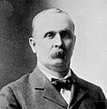
Portrait of Heber M. Creel, circa 1898
-
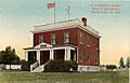
Weather Bureau building c. 1900
-
Hydrograph Illustrating rising waters over the 1900-2015 time period.


See also
 In Spanish: Devils Lake (Dakota del Norte) para niños
