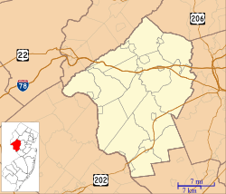
Delaware Township, Hunterdon County, New Jersey facts for kids
Quick facts for kids
Delaware Township, New Jersey
|
|
|---|---|
|
Township
|
|
| Township of Delaware | |
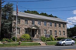
Township municipal building in Sergeantsville
|
|
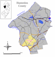
Map of Delaware Township in Hunterdon County. Inset: Location of Hunterdon County highlighted in the State of New Jersey.
|
|
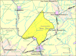
Census Bureau map of Delaware Township, Hunterdon County, New Jersey
|
|
| Country | |
| State | |
| County | |
| Incorporated | April 2, 1838 |
| Named for | Delaware River |
| Government | |
| • Type | Township |
| • Body | Township Committee |
| Area | |
| • Total | 37.05 sq mi (95.95 km2) |
| • Land | 36.66 sq mi (94.94 km2) |
| • Water | 0.39 sq mi (1.01 km2) 1.06% |
| Area rank | 65th of 565 in state 3rd of 26 in county |
| Elevation | 371 ft (113 m) |
| Population | |
| • Total | 4,563 |
| • Estimate
(2019)
|
4,425 |
| • Rank | 394th of 566 in state 10th of 26 in county |
| • Density | 124.5/sq mi (48.1/km2) |
| • Density rank | 532nd of 566 in state 25th of 26 in county |
| Time zone | UTC−05:00 (Eastern (EST)) |
| • Summer (DST) | UTC−04:00 (Eastern (EDT)) |
| ZIP Codes | |
| Area code(s) | 609, 908 |
| FIPS code | 3401917170 |
| GNIS feature ID | 0882182 |
| Website | |
Delaware Township is a township in Hunterdon County, New Jersey, United States. Part of the township is on the Hunterdon Plateau, while the southern portions are in the Amwell Valley. As of the 2010 United States Census, the township's population was 4,563, reflecting an increase of 85 (+1.9%) from the 4,478 counted in the 2000 Census, which had in turn declined by 34 (-0.8%) from the 4,512 counted in the 1990 Census.
The historic community of Sergeantsville is located within Delaware Township, as well as the unincorporated community of Raven Rock.
Contents
History
The township was first settled in the early 18th century by Colonel John Reading (1657–1717), who was instrumental in the creation of Amwell Township in 1708 and also worked for the creation of Hunterdon County in 1714. The Township adjoins the Delaware River on the southwestern portion of Hunterdon County, which provides its name. The state's lone surviving historic covered bridge, Green Sergeant's Covered Bridge, crosses the Wickecheoke Creek between Sergeantsville and Rosemont. The Delaware and Raritan Canal parallels the Delaware River along the southern border of the township. Sergeantsville is at the township's center and includes the municipal building, local public school and Post Office. A "Thanksgiving in the Country" offers a tour of notable homes in Sergeantsville, which raises funds for the Facial Reconstruction Unit of the Children's Hospital of Philadelphia.
Delaware was incorporated as a township by an act of the New Jersey Legislature on April 2, 1838, from a portion of a larger municipality then known as Amwell Township (now defunct). Historian and cartographer John P. Snyder has erroneously stated that a referendum was held on that date, but there was in fact no referendum and the people of Amwell knew nothing about the division until after the Legislature passed the bill. A portion of the township was taken to form Stockton borough (April 14, 1898).
Geography
According to the United States Census Bureau, the township had a total area of 37.05 square miles (95.95 km2), including 36.66 square miles (94.94 km2) of land and 0.39 square miles (1.01 km2) of water (1.06%).
Unincorporated communities, localities and place names located partially or completely within the township include Bowne, Brookville, Dilts Corner, Grover, Headquarters, Locktown, Prallsville, Raven Rock, Rosemont, Sand Brook, Sandy Ridge and Sergeantsville.
The township borders the municipalities of East Amwell Township, Franklin Township, Kingwood Township, Lambertville, Raritan Township, Stockton and West Amwell Township in Hunterdon County; as well as Plumstead Township and Solebury Township in Bucks County across the Delaware River in Pennsylvania.
Demographics
| Historical population | |||
|---|---|---|---|
| Census | Pop. | %± | |
| 1840 | 2,305 | — | |
| 1850 | 2,554 | 10.8% | |
| 1860 | 2,838 | 11.1% | |
| 1870 | 2,959 | 4.3% | |
| 1880 | 3,092 | 4.5% | |
| 1890 | 3,037 | −1.8% | |
| 1900 | 1,953 | −35.7% | |
| 1910 | 1,740 | −10.9% | |
| 1920 | 1,705 | −2.0% | |
| 1930 | 1,704 | −0.1% | |
| 1940 | 1,756 | 3.1% | |
| 1950 | 2,031 | 15.7% | |
| 1960 | 2,485 | 22.4% | |
| 1970 | 3,249 | 30.7% | |
| 1980 | 3,816 | 17.5% | |
| 1990 | 4,512 | 18.2% | |
| 2000 | 4,478 | −0.8% | |
| 2010 | 4,563 | 1.9% | |
| 2019 (est.) | 4,425 | −3.0% | |
| Population sources: 1840-1920 1840 1850-1870 1850 1870 1880-1890 1890-1910 1910-1930 1930-1990 2000 2010 * = Lost territory in previous decade. |
|||
Census 2010
As of the census of 2010, there were 4,563 people, 1,788 households, and 1,348 families residing in the township. The population density was 124.5 per square mile (48.1/km2). There were 1,927 housing units at an average density of 52.6 per square mile (20.3/km2)*. The racial makeup of the township was 96.45% (4,401) White, 0.66% (30) Black or African American, 0.18% (8) Native American, 0.92% (42) Asian, 0.00% (0) Pacific Islander, 0.50% (23) from other races, and 1.29% (59) from two or more races. [[Hispanic (U.S. Census)|Hispanic or Latino of any race were 2.45% (112) of the population.
There were 1,788 households out of which 26.6% had children under the age of 18 living with them, 66.2% were married couples living together, 6.3% had a female householder with no husband present, and 24.6% were non-families. 19.0% of all households were made up of individuals, and 7.7% had someone living alone who was 65 years of age or older. The average household size was 2.55 and the average family size was 2.93.
In the township, the population was spread out with 20.1% under the age of 18, 6.1% from 18 to 24, 16.5% from 25 to 44, 41.2% from 45 to 64, and 16.1% who were 65 years of age or older. The median age was 48.6 years. For every 100 females there were 96.9 males. For every 100 females ages 18 and old there were 97.2 males.
The Census Bureau's 2006-2010 American Community Survey showed that (in 2010 inflation-adjusted dollars) median household income was $87,100 (with a margin of error of +/- $15,616) and the median family income was $102,481 (+/- $27,024). Males had a median income of $82,586 (+/- $14,105) versus $47,404 (+/- $12,866) for females. The per capita income for the borough was $48,700 (+/- $4,857). About 0.6% of families and 0.6% of the population were below the poverty line, including none of those under age 18 and 0.9% of those age 65 or over.
Census 2000
As of the 2000 United States Census there were 4,478 people, 1,643 households, and 1,302 families residing in the township. The population density was 121.9 people per square mile (47.1/km2). There were 1,701 housing units at an average density of 46.3 per square mile (17.9/km2). The racial makeup of the township was 97.70% White, 0.40% African American, 0.04% Native American, 1.03% Asian, 0.02% Pacific Islander, 0.25% from other races, and 0.56% from two or more races. Hispanic or Latino of any race were 1.14% of the population.
There were 1,643 households, out of which 33.8% had children under the age of 18 living with them, 71.3% were married couples living together, 4.9% had a female householder with no husband present, and 20.7% were non-families. 14.8% of all households were made up of individuals, and 6.0% had someone living alone who was 65 years of age or older. The average household size was 2.72 and the average family size was 3.06.
In the township the population was spread out, with 23.4% under the age of 18, 5.9% from 18 to 24, 26.5% from 25 to 44, 32.3% from 45 to 64, and 11.8% who were 65 years of age or older. The median age was 42 years. For every 100 females, there were 98.8 males. For every 100 females age 18 and over, there were 100.3 males.
The median income for a household in the township was $80,756, and the median income for a family was $90,842. Males had a median income of $61,701 versus $48,780 for females. The per capita income for the township was $38,285. 3.4% of the population and 2.3% of families were below the poverty line. Out of the total people living in poverty, 1.2% are under the age of 18 and 12.2% are 65 or older.
Education
The Delaware Township School District serves students in pre-kindergarten through eighth grade at Delaware Township School. As of the 2018–19 school year, the district, comprised of one school, had an enrollment of 376 students and 42.3 classroom teachers (on an FTE basis), for a student–teacher ratio of 8.9:1. The school is located on a site covering 26 acres (11 ha) adjacent to the community of Sergeantsville and 3 miles (4.8 km) from the Delaware River.
Students in ninth through twelfth grades attend the Hunterdon Central High School, part of the Hunterdon Central Regional High School District, which serves students in central Hunterdon County from Delaware Township, East Amwell Township, Flemington Borough, Raritan Township and Readington Township. As of the 2018–19 school year, the high school had an enrollment of 2,844 students and 238.8 classroom teachers (on an FTE basis), for a student–teacher ratio of 11.9:1. Seats on the high school district's nine-member board of education are allocated based in the population of the five constituent municipalities who participate in the school district, with one seat allocated to Delaware Township.
Eighth grade students from all of Hunterdon County are eligible to apply to attend the high school programs offered by the Hunterdon County Vocational School District, a county-wide vocational school district that offers career and technical education at its campuses in Raritan Township and at programs sited at local high schools, with no tuition charged to students for attendance.
Transportation
As of May 2010[update], the township had a total of 97.38 miles (156.72 km) of roadways, of which 70.38 miles (113.27 km) were maintained by the municipality, 20.71 miles (33.33 km) by Hunterdon County, 5.94 miles (9.56 km) by the New Jersey Department of Transportation and 0.35 miles (0.56 km) by the Delaware River Joint Toll Bridge Commission.
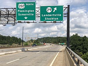
State and U.S. routes that pass through include Route 12, Route 29 and U.S. Route 202 (including part of the New Hope-Lambertville Toll Bridge).
County routes that traverse the municipality are CR 519, CR 523, CR 579 (which runs along the border between Raritan) and CR 604.
Interstate 78 is outside the township in neighboring Franklin Township.
Notable people
People who were born in, residents of, or otherwise closely associated with Delaware Township include:
- Willard H. Allen (1893–1957), poultry scientist who served as New Jersey secretary of agriculture from 1938 to 1956.
- George Newton Best (1846–1926), bryologist, expert on moss taxonomy and second president of the Sullivant Moss Society.
- William Cotton (1880–1958), artist and playwright.
- Alan B. Handler (born 1931), New Jersey Supreme Court Justice, 1977–1999.
- Chet Huntley (1911–1974), radio and television journalist and co-anchor of the Huntley-Brinkley Report on NBC who co-owned a cattle farm which he used as a weekend retreat.
- Barbara McConnell (1935-2016), former member of the New Jersey General Assembly and former New Jersey Commissioner of Commerce and Economic Development.
- John Schoenherr (1935–2010), award-winning illustrator.
- Glenway Wescott (1901–1987), novelist and essayist.
- Lloyd Wescott (1907–1990), agriculturalist, civil servant and brother of Glenway Wescott.
- Paul Whiteman (1890–1967), big band leader who resided at Walking Horse Farm in Rosemont from 1938 to 1959, before moving to New Hope, Pennsylvania for his remaining years.
- Dick Zimmer (born 1944), former member of the United States House of Representatives.
See also
 In Spanish: Municipio de Delaware (Nueva Jersey) para niños


