
Douglas County, Missouri facts for kids
Quick facts for kids
Douglas County
|
|
|---|---|

Douglas County courthouse in Ava
|
|

Location within the U.S. state of Missouri
|
|
 Missouri's location within the U.S. |
|
| Country | |
| State | |
| Founded | October 19, 1857 |
| Named for | Stephen A. Douglas |
| Seat | Ava |
| Largest city | Ava |
| Area | |
| • Total | 815 sq mi (2,110 km2) |
| • Land | 814 sq mi (2,110 km2) |
| • Water | 1.0 sq mi (3 km2) 0.1% |
| Population
(2020)
|
|
| • Total | 11,578 |
| • Estimate
(2018)
|
13,373 |
| • Density | 14.206/sq mi (5.485/km2) |
| Time zone | UTC−6 (Central) |
| • Summer (DST) | UTC−5 (CDT) |
| Congressional district | 8th |
Douglas County is a county located in the south-central portion of the U.S. state of Missouri. As of the 2020 census, the population was 11,578. The county seat and only incorporated community is Ava. The county was officially organized on October 19, 1857, and is named after U.S. Senator Stephen A. Douglas (D-Illinois) and later Democratic presidential candidate.
Contents
History
Previously, the county seat was located at Arno, west of Ava. Prior to that, Vera Cruz (formerly called Red Bud) was the county seat. Vera Cruz is located on Bryant Creek, which flows through the middle of the county. The Civil War Battle of Clark's Mill took place near Vera Cruz on November 7, 1862 and resulted in a Confederate victory. After the American Civil War, during a period of general chaos, a group from the western part of the county broke into the Arno courthouse and removed the records back to Vera Cruz. Later in 1871, a new town site was selected, present-day Ava, near the location of the former U.S. Civil War military Post Office, Militia Spring. The location of this new town seemed to satisfy most of the residents of Douglas County to be their point of county government.
Geography
According to the U.S. Census Bureau, the county has a total area of 815 square miles (2,110 km2), of which 814 square miles (2,110 km2) is land and 1.0 square mile (2.6 km2) (0.1%) is water.
Adjacent counties
- Webster County (northwest)
- Wright County (north)
- Texas County (northeast)
- Howell County (east)
- Ozark County (south)
- Taney County (southwest)
- Christian County (west)
Major highways
 Route 5
 Route 14
 Route 76
 Route 95
 Route 181
National protected area
- Mark Twain National Forest (part)
Demographics
| Historical population | |||
|---|---|---|---|
| Census | Pop. | %± | |
| 1860 | 2,414 | — | |
| 1870 | 3,915 | 62.2% | |
| 1880 | 7,753 | 98.0% | |
| 1890 | 14,111 | 82.0% | |
| 1900 | 16,802 | 19.1% | |
| 1910 | 16,664 | −0.8% | |
| 1920 | 15,436 | −7.4% | |
| 1930 | 13,959 | −9.6% | |
| 1940 | 15,600 | 11.8% | |
| 1950 | 12,638 | −19.0% | |
| 1960 | 9,653 | −23.6% | |
| 1970 | 9,268 | −4.0% | |
| 1980 | 11,594 | 25.1% | |
| 1990 | 11,876 | 2.4% | |
| 2000 | 13,084 | 10.2% | |
| 2010 | 13,684 | 4.6% | |
| 2020 | 11,578 | −15.4% | |
| U.S. Decennial Census 1790-1960 1900-1990 1990-2000 2010-2015 |
|||
As of the census of 2000, there were 13,084 people, 5,201 households, and 3,671 families residing in the county. The population density was 16 people per square mile (6/km2). There were 5,919 housing units at an average density of 7 per square mile (3/km2). The racial makeup of the county was 96.86% White, 0.11% Black or African American, 0.95% Native American, 0.21% Asian, 0.02% Pacific Islander, 0.17% from other races, and 1.69% from two or more races. Approximately 0.84% of the population were Hispanic or Latino of any race. Among the major first ancestries reported in Douglas County are 31.3% American, 13.2% English, 12.3% German, and 9.7% Irish.
There were 5,201 households, out of which 30.10% had children under the age of 18 living with them, 60.00% were married couples living together, 7.20% had a female householder with no husband present, and 29.40% were non-families. 26.10% of all households were made up of individuals, and 13.00% had someone living alone who was 65 years of age or older. The average household size was 2.49 and the average family size was 2.99.
In the county, the population was spread out, with 25.80% under the age of 18, 7.00% from 18 to 24, 24.50% from 25 to 44, 25.60% from 45 to 64, and 17.10% who were 65 years of age or older. The median age was 40 years. For every 100 females there were 96.60 males. For every 100 females age 18 and over, there were 93.30 males.
The median income for a household in the county was $31,335, and the median income for a family was $36,648. Males had a median income of $22,706 versus $17,060 for females. The per capita income for the county was $16,710. About 12.90% of families and 17.50% of the population were below the poverty line, including 19.80% of those under age 18 and 18.20% of those age 65 or over.
Religion
According to the Association of Religion Data Archives County Membership Report (2000), Douglas County is a part of the Bible Belt with evangelical Protestantism being the majority religion. The most predominant denominations among residents in Douglas County who adhere to a religion are Southern Baptists (22.95%), Church of the Nazarene (16.28%), and Mormons (13.70%).
Established in 1950, a Trappist monastery, Assumption Abbey, can be found nestled on 3,000 acres in the Ozark hills. An associated Friary, Our Lady of the Angels, is located nearby. Both facilities have overnight rooms available to be utilized by the public for a small fee in order to find a place of solace and quiet reflection.
Communities
The county has only one incorporated town: Ava, the county seat. Also, a number of current and historic communities are present:
- Ann
- Arden
- Arno
- Ava
- Basher
- Bertha
- Blanche
- Brushyknob
- Bryant
- Buckhart
- Champion
- Coldspring
- Cross Roads
- Denlow
- Dogwood
- Drury
- Evans
- Gentryville
- Girdner
- Goodhope
- Hebron
- Jackson Mill
- Merritt
- Midway
- Mount Zion
- Olathia
- Ongo
- Red Bank
- Rippee
- Rome
- Roosevelt
- Roy
- Smallett
- Squires
- Sweden
- Tigris
- Topaz
- Vanzant
- Vera Cruz
Education
Of adults 25 years of age and older in Douglas County, 69.7% possess a high school diploma or higher while 9.9% hold a bachelor's degree or higher as their highest educational attainment.
Public schools

-
- Ava Elementary School (PK-04)
- Ava Middle School (05-08)
- Ava High School (09-12)
- Plainview Elementary School (K-08) - West of Ava
- Skyline Elementary (K-08)
Private schools
Public libraries
- Douglas County Public Library
Images for kids
-
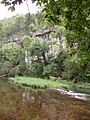
The bluff above Hunter Creek at Vera Cruz
-
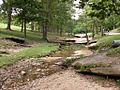
Roadside park in Mill Hollow adjacent to Route 5


See also
 In Spanish: Condado de Douglas (Misuri) para niños
