Durham, Oregon facts for kids
Quick facts for kids
Durham, Oregon
|
||
|---|---|---|

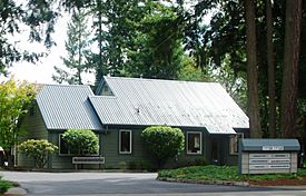
City hall
|
||
|
||

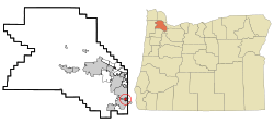
Location in Oregon
|
||
| Country | United States | |
| State | Oregon | |
| County | Washington | |
| Incorporated | 1966 | |
| Area | ||
| • Total | 0.41 sq mi (1.06 km2) | |
| • Land | 0.41 sq mi (1.06 km2) | |
| • Water | 0.00 sq mi (0.00 km2) | |
| Elevation | 197 ft (60 m) | |
| Population
(2010)
|
||
| • Total | 1,351 | |
| • Estimate
(2019)
|
1,928 | |
| • Density | 4,702.44/sq mi (1,817.28/km2) | |
| Time zone | UTC-8 (Pacific) | |
| • Summer (DST) | UTC-7 (Pacific) | |
| ZIP code |
97224
|
|
| Area code(s) | 503 and 971 | |
| FIPS code | 41-21250 | |
| GNIS feature ID | 1120224 | |
| Website | www.durham-oregon.us | |
Durham is a city in Washington County, Oregon, United States. Incorporated in 1966, the city is surrounded by Tigard and Tualatin and is adjacent to the Bridgeport Village shopping complex. The population was 1,351 at the 2010 census.
Contents
History
The city was named for Albert Alonzo Durham, founder of the nearby town of Oswego. Durham operated a sawmill and a flour mill on Fanno Creek, which flows through the city, from 1866 until his death in 1898. The site, located along the Boones Ferry Road to Portland, was originally known as Durhams Mills. In 1908, the Oregon Electric Railway established a stop called Durham at the location. Residents of the city voted for incorporation in 1966 to protect the location from industrialization of its residential areas. Today, the community is primarily residential.
Geography
According to the United States Census Bureau, the city has a total area of 0.41 square miles (1.06 km2), all land. It sits at 197 feet (60 m) above sea-level. The main road through Durham is Upper Boones Ferry Road, with Interstate 5 approximately 0.5 miles (0.8 km) east of the city. Part of the western boundary of the city is the Tualatin River, with Durham City Park also on the western edge of Durham.
Demographics
| Historical population | |||
|---|---|---|---|
| Census | Pop. | %± | |
| 1970 | 410 | — | |
| 1980 | 707 | 72.4% | |
| 1990 | 748 | 5.8% | |
| 2000 | 1,382 | 84.8% | |
| 2010 | 1,351 | −2.2% | |
| 2019 (est.) | 1,928 | 42.7% | |
| U.S. Decennial Census | |||
2010 census
As of the census of 2010, there were 1,351 people, 545 households, and 371 families living in the city. The population density was 3,295.1 inhabitants per square mile (1,272.2/km2). There were 561 housing units at an average density of 1,368.3 per square mile (528.3/km2). The racial makeup of the city was 83.8% White, 1.7% African American, 0.4% Native American, 1.3% Asian, 1.4% Pacific Islander, 8.2% from other races, and 3.2% from two or more races. Hispanic or Latino of any race were 13.8% of the population.
There were 545 households, of which 33.6% had children under the age of 18 living with them, 51.9% were married couples living together, 12.3% had a female householder with no husband present, 3.9% had a male householder with no wife present, and 31.9% were non-families. 24.2% of all households were made up of individuals, and 5.7% had someone living alone who was 65 years of age or older. The average household size was 2.48 and the average family size was 2.95.
The median age in the city was 38.1 years. 24.1% of residents were under the age of 18; 9.7% were between the ages of 18 and 24; 23.8% were from 25 to 44; 32% were from 45 to 64; and 10.3% were 65 years of age or older. The gender makeup of the city was 48.3% male and 51.7% female.
See also
 In Spanish: Durham (Oregón) para niños


