
Duval County, Texas facts for kids
Quick facts for kids
Duval County
|
|
|---|---|

The Duval County Courthouse in San Diego
|
|

Location within the U.S. state of Texas
|
|
 Texas's location within the U.S. |
|
| Country | |
| State | |
| Founded | 1876 |
| Named for | Burr H. Duval |
| Seat | San Diego |
| Largest city | San Diego |
| Area | |
| • Total | 1,796 sq mi (4,650 km2) |
| • Land | 1,793 sq mi (4,640 km2) |
| • Water | 2.1 sq mi (5 km2) 0.1% |
| Population
(2020)
|
|
| • Total | 9,831 |
| • Density | 5.4738/sq mi (2.1135/km2) |
| Time zone | UTC−6 (Central) |
| • Summer (DST) | UTC−5 (CDT) |
| Congressional district | 15th |
Duval County is a county located in the U.S. state of Texas. As of the 2020 census, its population was 9,831. The county seat is San Diego. The county was founded in 1858 and later organized in 1876. It is named for Burr H. Duval, a soldier in the Texas Revolution who died in the Goliad Massacre.
Contents
History
Even though Duval County lies in the United States, it has long been Mexican in character. A Mexican first surveyed it in 1804, Jose Contrerras, surveyor general of San Luis Potosi. Luis Muniz was born there in 1828, the county's first recorded birth. The important colonists came from Mier, Tamaulipas - and Anglos later respected their descendants as the old Mexican families.
The Texas Legislature established Duval County February 1, 1858. The Texas Almanac of 1867 reported that Duval and nearby Dimmit County had only four stock raisers and their population was unlikely to grow much absent the discovery of mineral wealth. Not long after, a wave of Anglo immigrants entered the county to raise sheep. Englishmen, Frenchmen, Germans, Irishmen, and Scots came. During this boom, the county seat enjoyed formal balls and haute cuisine. The Hotel Martinet's Sunday feast drew patrons from Corpus Christi, 50 miles (80 km) to the East. Prosperity in the 1880s eased ethnic animosities. After the Texas-Mexican Railway was built in 1881, its San Diego station was important for hides, wool, and cotton. But in 1886 the sheep began to die, and the boom died.
The corrupt Parr family political machine dominated Duval and nearby Jim Wells counties during the twentieth century, and were instrumental in the 1948 election of Lyndon Johnson to the US Senate, and to some extent the 1960 presidential election which threw Texas to John F Kennedy.
Geography
According to the U.S. Census Bureau, the county has a total area of 1,796 square miles (4,650 km2), of which 1,793 square miles (4,640 km2) is land and 2.1 square miles (5.4 km2) (0.1%) is water.
Major highways
 U.S. Highway 59
 The future route of Interstate 69W is planned to follow the current route of U.S. 59 in most places.
 State Highway 16
 State Highway 44
 State Highway 285
 State Highway 339
 State Highway 359
 Farm to Market Road 716
 Farm to Market Road 1329
 Farm to Market Road 2295
 Farm to Market Road 3196
Adjacent counties
- McMullen County (north)
- Live Oak County (northeast)
- Jim Wells County (east)
- Brooks County (southeast)
- Jim Hogg County (southwest)
- Webb County (west)
Demographics
| Historical population | |||
|---|---|---|---|
| Census | Pop. | %± | |
| 1870 | 1,083 | — | |
| 1880 | 5,732 | 429.3% | |
| 1890 | 7,598 | 32.6% | |
| 1900 | 8,483 | 11.6% | |
| 1910 | 8,964 | 5.7% | |
| 1920 | 8,251 | −8.0% | |
| 1930 | 12,191 | 47.8% | |
| 1940 | 20,565 | 68.7% | |
| 1950 | 15,643 | −23.9% | |
| 1960 | 13,398 | −14.4% | |
| 1970 | 11,722 | −12.5% | |
| 1980 | 12,517 | 6.8% | |
| 1990 | 12,918 | 3.2% | |
| 2000 | 13,120 | 1.6% | |
| 2010 | 11,782 | −10.2% | |
| 2020 | 9,831 | −16.6% | |
| U.S. Decennial Census 1850–2010 2010 2020 |
|||
2020 census
| Race / Ethnicity | Pop 2010 | Pop 2020 | % 2010 | % 2020 |
|---|---|---|---|---|
| White alone (NH) | 1,206 | 937 | 10.24% | 9.53% |
| Black or African American alone (NH) | 86 | 145 | 0.73% | 1.47% |
| Native American or Alaska Native alone (NH) | 18 | 13 | 0.15% | 0.13% |
| Asian alone (NH) | 17 | 45 | 0.14% | 0.46% |
| Pacific Islander alone (NH) | 5 | 0 | 0.04% | 0.00% |
| Some Other Race alone (NH) | 6 | 8 | 0.05% | 0.08% |
| Mixed Race/Multi-Racial (NH) | 20 | 721 | 0.17% | 7.33% |
| Hispanic or Latino (any race) | 10,424 | 7,962 | 88.47% | 80.99% |
| Total | 11,782 | 9,831 | 100.00% | 100.00% |
Note: the US Census treats Hispanic/Latino as an ethnic category. This table excludes Latinos from the racial categories and assigns them to a separate category. Hispanics/Latinos can be of any race.
Communities
Cities
- Benavides
- Freer
- San Diego (county seat) (small part in Jim Wells County)
Census-designated places
Unincorporated communities
Ghost Towns
- Duval County from the Handbook of Texas Online
 |
McMullen County | Live Oak County | |
|
| Webb County | Jim Wells County | |||
| Jim Hogg County | Brooks County |
Education
School districts for the county include:
- Benavides Independent School District
- Freer Independent School District
- Premont Independent School District
- Ramirez Common School District
- San Diego Independent School District
Coastal Bend College (formerly Bee County College) is the designated community college for the county.
Images for kids
-
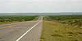
State Highway 16, Duval County, Texas, USA. (16 April 2016)
.jpg)
See also
 In Spanish: Condado de Duval (Texas) para niños
