East Fork Salmon River facts for kids
Quick facts for kids East Fork Salmon River |
|
|---|---|
|
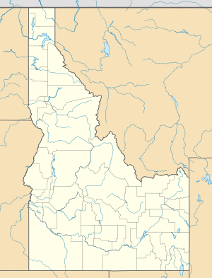
Location of the mouth of the East Fork Salmon River in Idaho
|
|
| Country | United States |
| State | Idaho |
| Region | Custer County |
| Physical characteristics | |
| Main source | Boulder Mountains 43°44′46″N 114°33′17″W / 43.74611°N 114.55472°W |
| River mouth | Salmon River 5,390 ft (1,640 m) 44°16′06″N 114°19′36″W / 44.26833°N 114.32667°W |
| Length | 34 mi (55 km) |
| Basin features | |
| Basin size | 541 sq mi (1,400 km2) |
The East Fork Salmon River is a 34-mile (55 km) tributary of the Salmon River, flowing through Custer County, Idaho in the United States. It joins the Salmon River about 3.7 miles (6.0 km) east of Clayton and 17 miles (27 km) south-southwest of Challis. The East Fork Salmon River is formed at the confluence of the West Fork East Fork Salmon River and the South Fork East Fork Salmon River between the Boulder and White Cloud mountains in Sawtooth National Recreation Area.

All content from Kiddle encyclopedia articles (including the article images and facts) can be freely used under Attribution-ShareAlike license, unless stated otherwise. Cite this article:
East Fork Salmon River Facts for Kids. Kiddle Encyclopedia.


