Easton, Kansas facts for kids
Quick facts for kids
Easton, Kansas
|
|
|---|---|

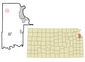
Location within Leavenworth County and Kansas
|
|

|
|
| Country | United States |
| State | Kansas |
| County | Leavenworth |
| Founded | 1850s |
| Platted | 1854 |
| Incorporated | 1903 |
| Named for | Easton, Pennsylvania |
| Area | |
| • Total | 0.16 sq mi (0.41 km2) |
| • Land | 0.16 sq mi (0.41 km2) |
| • Water | 0.00 sq mi (0.00 km2) |
| Elevation | 906 ft (276 m) |
| Population
(2010)
|
|
| • Total | 253 |
| • Estimate
(2019)
|
258 |
| • Density | 1,622.64/sq mi (627.37/km2) |
| Time zone | UTC-6 (CST) |
| • Summer (DST) | UTC-5 (CDT) |
| ZIP code |
66020
|
| Area code | 913 |
| FIPS code | 20-19600 |
| GNIS ID | 0478377 |
Easton is a city in Leavenworth County, Kansas, United States. As of the 2010 census, the city population was 253. It is part of the Kansas City metropolitan area.
History
Easton was originally known as Eastin, and under the latter name was laid out in 1854 by General Lucien J. Eastin. Later, at the insistence of Governor Andrew Horatio Reeder, the name was changed to Easton for Reeder's birthplace of Easton, Pennsylvania.
The first post office in Easton was established in December 1855.
Geography
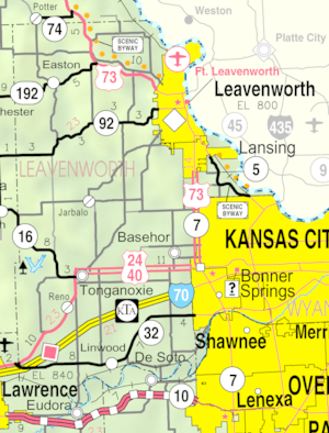
Easton is located at 39°20′40″N 95°6′59″W / 39.34444°N 95.11639°W (39.344400, −95.116524). According to the United States Census Bureau, the city has a total area of 0.14 square miles (0.36 km2), all of it land.
Climate
The climate in this area is characterized by hot, humid summers and generally mild to cool winters. According to the Köppen Climate Classification system, Easton has a humid subtropical climate, abbreviated "Cfa" on climate maps.
Demographics
| Historical population | |||
|---|---|---|---|
| Census | Pop. | %± | |
| 1910 | 310 | — | |
| 1920 | 228 | −26.5% | |
| 1930 | 277 | 21.5% | |
| 1940 | 255 | −7.9% | |
| 1950 | 255 | 0.0% | |
| 1960 | 320 | 25.5% | |
| 1970 | 435 | 35.9% | |
| 1980 | 460 | 5.7% | |
| 1990 | 405 | −12.0% | |
| 2000 | 362 | −10.6% | |
| 2010 | 253 | −30.1% | |
| 2019 (est.) | 258 | 2.0% | |
| U.S. Decennial Census | |||
2010 census
As of the census of 2010, there were 253 people, 81 households, and 55 families residing in the city. The population density was 1,807.1 inhabitants per square mile (697.7/km2). There were 100 housing units at an average density of 714.3 per square mile (275.8/km2). The racial makeup of the city was 98.8% White, 0.4% African American, and 0.8% from two or more races. Hispanic or Latino of any race were 1.2% of the population.
There were 81 households, of which 32.1% had children under the age of 18 living with them, 51.9% were married couples living together, 12.3% had a female householder with no husband present, 3.7% had a male householder with no wife present, and 32.1% were non-families. Of all households 25.9% were made up of individuals, and 11.1% had someone living alone who was 65 years of age or older. The average household size was 2.57 and the average family size was 3.09.
The median age in the city was 41.9 years. Of residents 20.6% were under the age of 18; 9% were between the ages of 18 and 24; 25.3% were from 25 to 44; 17.4% were from 45 to 64; and 27.7% were 65 years of age or older. The gender makeup of the city was 46.6% male and 53.4% female.
Education
Easton is a part of USD 449 Easton. Pleasant Ridge High School is the district high school. The Pleasant Ridge High School mascot is Rams.
Easton High School was closed due to school unification. The Easton High School mascot was Easton Dragons.
See also
 In Spanish: Easton (Kansas) para niños

