
Elizabeth, South Australia facts for kids
Quick facts for kids ElizabethAdelaide, South Australia |
|||||||||||||||
|---|---|---|---|---|---|---|---|---|---|---|---|---|---|---|---|

Clock tower at Elizabeth City Shopping Centre with the Windsor building to the left of the picture.
|
|||||||||||||||
| Population | 1,024 (2016 census) | ||||||||||||||
| Established | 1955 | ||||||||||||||
| Postcode(s) | 5112 | ||||||||||||||
| Location | 24 km (15 mi) N of Adelaide city centre | ||||||||||||||
| LGA(s) | City of Playford | ||||||||||||||
| State electorate(s) | Elizabeth | ||||||||||||||
| Federal Division(s) | Spence | ||||||||||||||
|
|||||||||||||||
Elizabeth is an outer northern suburb of the Adelaide metropolitan area, South Australia, 24 km north of the Adelaide city centre. It is located in the City of Playford. At the 2016 census, Elizabeth had a population of 1,024.
Established in 1955, it was the seat of the former local government body, the Old City of Elizabeth, which included Elizabeth as well as the immediately adjacent suburbs on all sides except the west. Although the City of Elizabeth no longer exists, having been amalgamated into the much larger City of Playford in 1997, the term 'Elizabeth', in the context of Adelaide, typically refers to the historic municipality and the distinct community therein.
Contents
History
Before the 1950s, most of the area surrounding today's suburb of Elizabeth was farming land. After the end of the Second World War with its shortage of materials, the state government decided that South Australia needed to grow and become industrialised.
A "satellite city" was planned for the Elizabeth area, and the South Australian Housing Trust initiated a housing development program in the area, with a purchase of 1,200 hectares (3,000 acres) of rural land between the older "country towns" (now Adelaide suburbs) of Salisbury and Smithfield.
The Suburb of Elizabeth was formed on 16 November 1955, being named after Queen Elizabeth II, who visited the suburb in 1963.
As well as the Town Centre, originally with open air shopping malls there was a theatre (named "The Octagon"),
Geography
Elizabeth is the seat of the Playford local government area and thus acts as a central business district for the surrounding suburbs. It lies between the Gawler Central railway line and Main North Road. DSTO Edinburgh is located to the west of Elizabeth.
Demographics
The 2016 Census by the Australian Bureau of Statistics counted 1,024 persons in the suburb of Elizabeth on census night. Of these, 543 (52.9%) were male and 483 (47.1%) were female. The majority of residents 657 (65.2%) was born in Australia. 81 (8.0%) were born in England. The median age of Elizabeth residents is 38. Children aged 0 – 14 years made up 16.7% of the population and people aged 65 years and over made up 14.8% of the population.
Community
The local newspaper is the News Review Messenger. Other regional and national newspapers such as The Advertiser and The Australian are also available. The Bunyip Newspaper also covers the Elizabeth area in its Playford Times section.
Schools
Playford International College (formerly Fremont-Elizabeth City High School) is on Philip Highway. Kaurna Plains School is on Ridley Road.
Sport
Elizabeth is the home of the Central District Bulldogs, an Australian rules football team in the South Australian National Football League (SANFL). It is currently the strongest team in South Australian football, having (in 2010) won nine of the last eleven SANFL Premierships. They play all of their home games at Elizabeth Oval (currently named "Playford Alive Oval").
Elizabeth also has an association football club (soccer), the Playford City Patriots, who play in the South Australian State League. However, their home stadium is Ramsay Park in Elizabeth West.
Facilities and attractions
The Elizabeth Shopping Centre is in the middle of the suburb. Formerly known as Elizabeth Town Centre, it has been progressively expanded since the 1960s. In its early days it featured open air malls, but today it comprises a single storey undercover mall. A major renovation and extension was completed in 2004.
Parks
Dauntsey Reserve is located between Winterslow Road and Woodford Road. Ridley Reserve is located on the suburb's southern boundary. There are other parks and reserves in the suburb.
Transportation
Roads
Elizabeth is serviced by Main North Road, connecting the suburb to Adelaide city centre, and by Philip Highway.
Public transport
Elizabeth is serviced by public transport run by the Adelaide Metro.
The Gawler railway line passes beside the suburb. The closest station is Elizabeth.
Elizabeth is serviced by buses run by the Adelaide Metro.
Images for kids
-
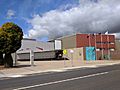
City of Playford civic centre, Elizabeth, in 2017

See also
 In Spanish: Elizabeth (Australia Meridional) para niños
