Elwood, Nebraska facts for kids
Quick facts for kids
Elwood, Nebraska
|
|
|---|---|
|
Village
|
|

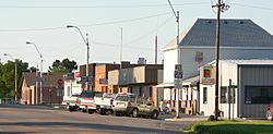
Downtown Elwood: Smith Avenue
|
|

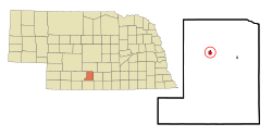
Location of Elwood, Nebraska
|
|
| Country | United States |
| State | Nebraska |
| County | Gosper |
| Area | |
| • Total | 0.52 sq mi (1.34 km2) |
| • Land | 0.52 sq mi (1.34 km2) |
| • Water | 0.00 sq mi (0.00 km2) |
| Elevation | 2,667 ft (813 m) |
| Population
(2010)
|
|
| • Total | 707 |
| • Estimate
(2019)
|
683 |
| • Density | 1,318.53/sq mi (509.51/km2) |
| Time zone | UTC-6 (Central (CST)) |
| • Summer (DST) | UTC-5 (CDT) |
| ZIP code |
68937
|
| Area code(s) | 308 |
| FIPS code | 31-15570 |
| GNIS feature ID | 0829101 |
| Website | elwoodnebraska.com |
Elwood is a village and the county seat of Gosper County, Nebraska, United States. It is part of the Lexington, Nebraska Micropolitan Statistical Area. The population was 707 at the 2010 census.
Contents
History
Elwood was platted in 1885 when the Chicago, Burlington and Quincy Railroad was extended to that point. It was named for Elwood Thomas, a homesteader.
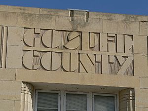
The Gosper County Courthouse in Elwood is on the National Register of Historic Places. The Art Deco building was designed by the Kearney architectural firm of McClure & Walker.
Geography
Elwood is located at 40°35′19″N 99°51′38″W / 40.58861°N 99.86056°W (40.588632, -99.860603).
According to the United States Census Bureau, the village has a total area of 0.52 square miles (1.35 km2), all of it land.
Elwood is located at the junction of Nebraska Highway 23 and U.S. Highway 283, and is south of Elwood Reservoir. In Elwood, the two highways respectively follow Ripley Street and Smith Street.
Demographics
| Historical population | |||
|---|---|---|---|
| Census | Pop. | %± | |
| 1890 | 373 | — | |
| 1900 | 377 | 1.1% | |
| 1910 | 464 | 23.1% | |
| 1920 | 473 | 1.9% | |
| 1930 | 509 | 7.6% | |
| 1940 | 633 | 24.4% | |
| 1950 | 562 | −11.2% | |
| 1960 | 581 | 3.4% | |
| 1970 | 601 | 3.4% | |
| 1980 | 716 | 19.1% | |
| 1990 | 679 | −5.2% | |
| 2000 | 761 | 12.1% | |
| 2010 | 707 | −7.1% | |
| 2019 (est.) | 683 | −3.4% | |
| U.S. Decennial Census | |||
2010 census
As of the census of 2010, there were 707 people, 282 households, and 183 families residing in the village. The population density was 1,359.6 inhabitants per square mile (524.9/km2). There were 312 housing units at an average density of 600.0 per square mile (231.7/km2). The racial makeup of the village was 95.0% White, 0.7% African American, 0.1% Native American, 2.3% from other races, and 1.8% from two or more races. Hispanic or Latino of any race were 3.7% of the population.
There were 282 households, of which 29.1% had children under the age of 18 living with them, 55.0% were married couples living together, 7.1% had a female householder with no husband present, 2.8% had a male householder with no wife present, and 35.1% were non-families. 32.3% of all households were made up of individuals, and 17.8% had someone living alone who was 65 years of age or older. The average household size was 2.37 and the average family size was 2.98.
The median age in the village was 46.4 years. 24.6% of residents were under 18; 4.2% were between 18 and 24; 19.7% were from 25 to 44; 25.7% were from 45 to 64, and 25.7% were 65 years of age or older. The gender makeup of the village was 46.7% male and 53.3% female.
See also
 In Spanish: Elwood (Nebraska) para niños


