
Ephraim, Wisconsin facts for kids
Quick facts for kids
Ephraim, Wisconsin
|
|
|---|---|
|
Village
|
|

Ephraim Village Hall
|
|

Location of Ephraim in Door County, Wisconsin.
|
|
| Country | |
| State | |
| County | Door |
| Area | |
| • Total | 8.13 sq mi (21.06 km2) |
| • Land | 3.79 sq mi (9.81 km2) |
| • Water | 4.34 sq mi (11.25 km2) |
| Elevation | 663 ft (202 m) |
| Population
(2010)
|
|
| • Total | 288 |
| • Estimate
(2019)
|
280 |
| • Density | 73.94/sq mi (28.55/km2) |
| Time zone | UTC-6 (Central (CST)) |
| • Summer (DST) | UTC-5 (CDT) |
| Area code(s) | 920 |
| FIPS code | 55-24150 |
| GNIS feature ID | 1564680 |
Ephraim is a village in Door County, Wisconsin, United States. It is located across Eagle Harbor from Peninsula State Park. The population was 288 at the 2010 census. The village is known for its views of Eagle Harbor and the bluffs of Green Bay and its white buildings.
Contents
History

The village was founded in 1853 by the Reverend Andreas Iverson as a Moravian religious community. The steeples of the Ephraim Moravian Church and the Free Evangelical Lutheran Church-Bethania Scandinavian Evangelical Lutheran Congregation are the landmarks of the village as seen from Eagle Harbor. The home of Reverend Iverson, as well as the Anderson Store, the Anderson Barn and History Center, the Pioneer Schoolhouse and the Goodletson log cabin are preserved by the Ephraim Historical Foundation and open to visitors as museums. The Ephraim Historical Foundation also offers walking tours of the village.
Since its founding, the village prohibited alcohol sales or manufacture within the village; it was, until 2016, the only dry municipality in the state of Wisconsin. There have been two referenda concerning the sale of liquor within the village, in 1934 and 1992. Both times the citizenry voted decisively to keep the village dry (with majorities of 59% and 74%, respectively). On April 5, 2016, village residents voted on two separate referenda to allow beer and/or wine sales within the village, both of which passed by 56% and 68% majorities.
Geography
To the west is Peninsula State Park; to the east and south are unincorporated parts of the town of Gibraltar. Ephraim is located at 45°9′23″N 87°10′16″W / 45.15639°N 87.17111°W (45.156509, -87.171047).
According to the United States Census Bureau, the village has a total area of 7.16 square miles (18.54 km2), of which, 3.79 square miles (9.82 km2) of it is land and 3.37 square miles (8.73 km2) is water.
The highest point in the village (at the north end of North Orchard St.) is about 788 feet (240 m) above sea level, or 210 feet (64 m) above the surface of Green Bay.
Climate
The climate in Ephraim is temperate, with warm summers and cold winters.
| Weather chart for Sturgeon Bay, WI | |||||||||||||||||||||||||||||||||||||||||||||||
|---|---|---|---|---|---|---|---|---|---|---|---|---|---|---|---|---|---|---|---|---|---|---|---|---|---|---|---|---|---|---|---|---|---|---|---|---|---|---|---|---|---|---|---|---|---|---|---|
| J | F | M | A | M | J | J | A | S | O | N | D | ||||||||||||||||||||||||||||||||||||
|
1.8
24
8
|
1.1
28
11
|
2.1
38
21
|
2.7
50
32
|
2.9
64
43
|
3.5
74
53
|
3.4
79
59
|
3.6
77
57
|
3.4
69
50
|
2.7
56
39
|
2.5
42
28
|
1.8
30
16
|
||||||||||||||||||||||||||||||||||||
| temperatures in °F precipitation totals in inches source: Climate-Charts.com |
|||||||||||||||||||||||||||||||||||||||||||||||
|
Metric conversion
|
|||||||||||||||||||||||||||||||||||||||||||||||
Demographics
2010 census
| Historical population | |||
|---|---|---|---|
| Census | Pop. | %± | |
| 1920 | 196 | — | |
| 1930 | 191 | −2.6% | |
| 1940 | 254 | 33.0% | |
| 1950 | 244 | −3.9% | |
| 1960 | 221 | −9.4% | |
| 1970 | 236 | 6.8% | |
| 1980 | 319 | 35.2% | |
| 1990 | 261 | −18.2% | |
| 2000 | 353 | 35.2% | |
| 2010 | 288 | −18.4% | |
| 2019 (est.) | 280 | −2.8% | |
| U.S. Decennial Census | |||
As of the census of 2010, there were 288 people, 138 households, and 92 families residing in the village. The population density was 76.0 inhabitants per square mile (29.3/km2). There were 654 housing units at an average density of 172.6 per square mile (66.6/km2). The racial makeup of the village was 99.0% White, 0.3% Native American, and 0.7% from other races. Hispanic or Latino of any race were 2.4% of the population.
There were 138 households, of which 17.4% had children under the age of 18 living with them, 56.5% were married couples living together, 7.2% had a female householder with no husband present, 2.9% had a male householder with no wife present, and 33.3% were non-families. 27.5% of all households were made up of individuals, and 15.9% had someone living alone who was 65 years of age or older. The average household size was 2.09 and the average family size was 2.52.
The median age in the village was 58.8 years. 14.9% of residents were under the age of 18; 2.5% were between the ages of 18 and 24; 16.7% were from 25 to 44; 33% were from 45 to 64; and 33% were 65 years of age or older. The gender makeup of the village was 46.9% male and 53.1% female.
Events
The village's main festival is Fyr Bal, a Scandinavian celebration held near the solstice in mid-June to drive out the wicked winter witch. Bonfires burn along the shoreline as residents and visitors gather to celebrate the beginning of summer.
Education
Gibraltar Area Schools serves the community. Gibraltar Elementary School and Gibraltar Secondary School are the two schools.
Notable people
- Bert D. Thorp, Wisconsin State Assembly and businessman, lived in Ephraim; he served as president of the village of Ephraim.
Images for kids
-
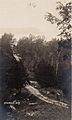
Car near the top of a dirt road near Ephraim; from a postcard postmarked in 1916

See also
 In Spanish: Ephraim (Wisconsin) para niños
