
Fairmont, West Virginia facts for kids
Quick facts for kids
Fairmont, West Virginia
|
|
|---|---|

Downtown Fairmont and the Monongahela River in 2006
|
|
| Nickname(s):
"Friendly City"
|
|
| Motto(s):
"Spend a Day... Spend a Lifetime"
|
|

Location of Fairmont in Marion County, West Virginia.
|
|
| Country | United States |
| State | West Virginia |
| County | Marion |
| Government | |
| • Type | Council-manager government |
| Area | |
| • Total | 8.99 sq mi (23.27 km2) |
| • Land | 8.60 sq mi (22.28 km2) |
| • Water | 0.38 sq mi (0.99 km2) |
| Elevation | 984 ft (300 m) |
| Population
(2010)
|
|
| • Total | 18,704 |
| • Estimate
(2019)
|
18,388 |
| • Density | 2,137.64/sq mi (825.36/km2) |
| Time zone | UTC−5 (Eastern (EST)) |
| • Summer (DST) | UTC−4 (EDT) |
| ZIP codes |
26554-26555
|
| Area code(s) | 304 |
| FIPS code | 54-26452 |
| GNIS feature ID | 1560581 |
| Website | Fairmontwv.gov |


Fairmont is a city in Marion County, West Virginia, United States. The population was 18,704 at the 2010 census. It is the county seat of Marion County.
Contents
History
Prior to the founding of Fairmont, the land that would become Marion County was part of Monongalia and Harrison County. Oral history indicates that in 1808, Boaz Fleming made his annual trek to Clarksburg to pay his brother's Harrison County taxes. While in Clarksburg, Fleming attended a social gathering that included his cousin, Dolly Madison, wife of President James Madison. Fleming complained to Mrs. Madison about having to travel over a hundred miles each year from his home to pay his Monongalia County taxes and his brother's Harrison County taxes. Mrs. Madison supposedly suggested that he create his own county to save him all that travel. In 1814, Fleming circulated a petition to do precisely that, naming the proposed county Madison County, in honor of Dolly and James Madison.
Milford (also known as Pleasantville) was the only town within the borders of Fleming's proposed county, so Fleming decided to make this town the seat of Madison County. However, Milford's citizens preferred to remain part of Monongalia County. As a result, Fleming's petition failed to gain sufficient support to be presented to the Virginia General Assembly. Fleming then focused on creating a town near his farm, which was located on the west side of the Monongahela River. In 1817, Fleming's sons—William and David—began to clear land on part of their father's farm to make way for the new town; this part of the farm would later become downtown Fairmont. In 1819, a road was built from Clarksburg to Morgantown. Fleming's new town was about halfway between the two cities, making it a good resting point. The town was incorporated as Middletown on January 19, 1820. It is unknown if the town was called Middletown because of its location midway between Clarksburg and Morgantown or because Fleming's first wife, Elizabeth Hutchinson, was originally from Middletown, Delaware.
The current borders of Marion County were established in 1842, and Middletown was named the county's seat. At that time, William Haymond, Jr. suggested that the town's name be changed to Fairmont because the town had a beautiful overlook of the Monongahela River, giving it a "fair mount." The Borough of Fairmont was incorporated in 1843 by the Virginia General Assembly.
Many of the first buildings in Fairmont were poorly constructed. By 1852—little more than 30 years after the city's founding—a large portion of Fairmont was reported to be run-down and dilapidated. Reports from 1873 indicate that these buildings had continued to fall into disrepair. On April 2, 1876, a fire destroyed a large portion of the city's business district, as well as many houses in the area. The continuing dilapidation of the city's buildings may have contributed to the fire; the large number of coal mines under Fairmont may have also played a role.
Between 1891 and 1901—in a span of only 10 years—Fairmont's population had increased from 1,000 to 7,000. The City of Fairmont was chartered in 1899; as a result of the charter, the city absorbed the surrounding towns of Palastine (also known as East Side) and West Fairmont. By 1901, Fairmont was an important commercial center. Many railroads—including the Baltimore and Ohio Railroad on its way from Cumberland, MD to Wheeling, WV—traveled through the city. By this time, Fairmont was also the leading center of the coal trade industry in northern West Virginia, employing some 10,000 workers in the coal mines around Fairmont. The city also gained many improvements, including telephone, water, and electric service.
Geography
The Tygart Valley River and the West Fork River join in Fairmont to form the Monongahela River. Buffalo Creek, a tributary of the Monongahela River, flows through the northern part of the city.
According to the US Army Corp of engineers, Fairmont, West Virginia, is the port city farthest from the ocean (2,085 miles) via an inland waterway.
According to the United States Census Bureau, the city has a total area of 9.00 square miles (23.31 km2), of which, 8.62 square miles (22.33 km2) is land and 0.38 square miles (0.98 km2) is water.
Climate
| Climate data for Fairmont, West Virginia | |||||||||||||
|---|---|---|---|---|---|---|---|---|---|---|---|---|---|
| Month | Jan | Feb | Mar | Apr | May | Jun | Jul | Aug | Sep | Oct | Nov | Dec | Year |
| Average high °F (°C) | 38 (3) |
42 (6) |
53 (12) |
64 (18) |
73 (23) |
80 (27) |
83 (28) |
82 (28) |
76 (24) |
65 (18) |
53 (12) |
42 (6) |
63 (17) |
| Average low °F (°C) | 20 (−7) |
22 (−6) |
30 (−1) |
38 (3) |
49 (9) |
57 (14) |
61 (16) |
60 (16) |
53 (12) |
41 (5) |
33 (1) |
25 (−4) |
41 (5) |
| Average precipitation inches (mm) | 3.45 (88) |
2.95 (75) |
4.07 (103) |
3.59 (91) |
4.85 (123) |
4.24 (108) |
4.92 (125) |
4.18 (106) |
3.51 (89) |
3.03 (77) |
3.68 (93) |
3.38 (86) |
45.85 (1,164) |
| Source: weather.com | |||||||||||||
Infrastructure
Highways
Fairmont is located in the North-Central region of the state, along West Virginia's I-79 High Tech Corridor. Major highways include:
 Interstate 79
 U.S. Highway 19
 U.S. Highway 250
 West Virginia Route 310
 West Virginia Route 273
Airports
Fairmont Municipal Airport (Frankman Field) is a public use airport located two nautical miles (4 km) southwest of the central business district of Fairmont. It is owned by the Fairmont-Marion County Regional Airport Authority.
Demographics
| Historical population | |||
|---|---|---|---|
| Census | Pop. | %± | |
| 1850 | 683 | — | |
| 1860 | 704 | 3.1% | |
| 1870 | 621 | −11.8% | |
| 1880 | 900 | 44.9% | |
| 1890 | 1,023 | 13.7% | |
| 1900 | 5,655 | 452.8% | |
| 1910 | 9,711 | 71.7% | |
| 1920 | 17,851 | 83.8% | |
| 1930 | 23,159 | 29.7% | |
| 1940 | 23,105 | −0.2% | |
| 1950 | 29,346 | 27.0% | |
| 1960 | 27,477 | −6.4% | |
| 1970 | 26,093 | −5.0% | |
| 1980 | 23,863 | −8.5% | |
| 1990 | 20,210 | −15.3% | |
| 2000 | 19,097 | −5.5% | |
| 2010 | 18,704 | −2.1% | |
| 2020 | 18,416 | −1.5% | |
| U.S. Decennial Census | |||
2010 census
At the 2010 census, there were 18,704 people, 8,133 households and 4,424 families living in the city. The population density was 2,169.8 inhabitants per square mile (837.8/km2). There were 9,200 housing units at an average density of 1,067.3 per square mile (412.1/km2). The racial makeup of the city was 88.9% White, 7.5% African American, 0.2% Native American, 0.6% Asian, 0.4% from other races, and 2.3% from two or more races. Hispanic or Latino of any race were 1.4% of the population.
There were 8,133 households, of which 24.1% had children under the age of 18 living with them, 37.7% were married couples living together, 12.5% had a female householder with no husband present, 4.2% had a male householder with no wife present, and 45.6% were non-families. 36.0% of all households were made up of individuals, and 14.1% had someone living alone who was 65 years of age or older. The average household size was 2.16 and the average family size was 2.83.
The median age was 36.8 years. 18% of residents were under the age of 18; 16.2% were between the ages of 18 and 24; 25% were from 25 to 44; 24.4% were from 45 to 64; and 16.5% were 65 years of age or older. The gender makeup of the city was 48.2% male and 51.8% female.
Landmarks
Fairmont Senior High School
Fairmont Senior High School (FSHS) is an historic secondary school, listed on the National Register of Historic Places on March 22, 2002. Architect William B. Ittner, who is responsible for over three dozen entries in the National Register, designed the school in the late 1920s. The school's architectural classification is Colonial Revival, with a stone foundation, brick walls, and asphalt shingle roofing.
Fairmont State University
Fairmont State University is a public university with an approximate enrollment of 7,700 students. The institution offers master's degrees in business, education, teaching, criminal justice, and nursing, in addition to 90 baccalaureate and 50 associate degrees. Originally named Fairmont Normal School, the college was located on the corner of Fairmont Avenue and Second Street and moved to its present location in 1917.
Pricketts Fort State Park
Pricketts Fort is a 22-acre (8.9 ha) West Virginia state park and site of an historic fort built to defend early European settlers from raids by hostile Native Americans. The feuds were generally over territory the settlers appropriated following the Treaty of Fort Stanwix (1768).
Other
- Valley Falls State Park is also located nearby to the east.
- The Johnnie Johnson (musician) Blues & Jazz Festival is held annually in Fairmont, WV.
- Fairmont's National White Collar Crime Center provides nationwide support to law enforcement agencies involved in prevention, investigation, and prosecution of economic and high-tech crime.
- NASA Independent Verification and Validation Facility, governed by the Goddard Space Flight Center, houses more than 150 full-time employees and more than 20 in-house partners and contractors.
- The Jacobs-Hutchinson Block building, also known as Peoples' National Bank and Friendly Furniture Store
- The Aerial Port Gymnastic Center is where the 1984 Olympic Medalist Mary Lou Retton was trained, now relocated to the former site of ABC Printing.
Education

Fairmont Senior High School
Fairmont Senior High School is a public high school that is listed on the National Register of Historic Places. The school was established in the late 1800s, and the school was relocated in 1905 and 1928. The current iteration of the school, which is located on Loop Park Dr, was designed by the architect William B. Ittner.
Fairmont State University
Fairmont State University is a public university with an approximate enrollment of 3,800 students. The institution offers master's degrees in business, education, teaching, criminal justice, and nursing, in addition to 90 baccalaureate and 50 associate degrees. Originally established as a school for teachers, the college was named Fairmont Normal School, and was located on the corner of Fairmont Avenue and Second Street and moved to its present location in 1917.
Dunbar School
.jpg)
Dunbar School is a historic building in Fairmont, West Virginia, that used to be an all-black high school. The school was designed by the architect William B Ittner. The school was built in 1928.
Notable people

- Tony Adamle, played in NFL for Cleveland Browns (1947–1951, 1954)
- Frank J. Breth, United States Marine Corps brigadier general
- David Carpenter, professional baseball player, Atlanta Braves, New York Yankees
- Joe Cerisano, singer, songwriter, musician ("Be All That You Can Be", "Hands Across America")
- Augusta Clark, librarian, politician and lawyer; second African-American woman on Philadelphia City Council (1980-2000)
- Ann K. Covington, former chief justice of Supreme Court of Missouri, first woman to hold that position
- Frank Kendall Everest Jr., U.S. Air Force officer best remembered as aeroengineer and test pilot during 1950s; once known as "Fastest Man Alive"
- Ron Everhart, assistant basketball coach West Virginia University, head coach at Duquesne, Northeastern and McNeese State
- Art Finley, North American television and radio personality, mostly in San Francisco and Vancouver, remembered by many as "Mayor Art", host of children's show aired on KRON-TV in San Francisco from 1959 to 1966
- Aretas B. Fleming, 8th Governor of West Virginia
- Carrie Watson Fleming, First Lady of West Virginia, 1890–1893
- Frank Cruise Haymond, Judge of West Virginia Supreme Court of Appeals, 1945-1972
- Thomas Haymond, 19th Century congressman and lawyer
- Philip C. Jimeno, member of Maryland State Legislature
- Johnnie Johnson, piano player and blues musician, member of Rock and Roll Hall of Fame
- Rashod Kent, NFL player
- Fuzzy Knight, film and television actor, appeared in over 180 films between 1929 and 1967, usually as a cowboy hero's sidekick
- John Knowles, author of A Separate Peace
- Alan Mollohan, U.S. Representative from West Virginia's 1st District
- Stephen Montague, classical composer, lived in Fairmont as a child from 1952 to 1957
- Michael Oliverio II, member of state senate, representing 13th District
- Francis H. Pierpont, Governor of union controlled parts of Virginia during American Civil War, known as "father of West Virginia"
- Doris Piserchia, science fiction writer
- Raphiael Putney (born 1990), basketball player for Maccabi Haifa of the Israeli National League
- Mary Lou Retton, gymnast, 1984 Olympic gold medalist, member of President's Council on Physical Fitness and Sports
- George S. Roberts, combat fighter pilot with the Tuskegee Airmen
- Nick Saban, current head coach of the Alabama Crimson Tide football team of the University of Alabama.
- Dante Stills, American football defensive lineman for the West Virginia Mountaineers
- Darius Stills, American football defensive tackle for the West Virginia Mountaineers
- Robert Tinnell, screenwriter, director, producer, author of comic books and graphic novels
- Clarence Wayland Watson, founded several companies that became Consolidation Coal and Mining Companies, was U.S. Senator from West Virginia from 1911 to 1913
- Hershel W. Williams, awarded Medal of Honor for his outstanding heroism in Battle of Iwo Jima
Images for kids
-
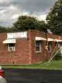
The current Country Club Bakery location in 2020

See also
 In Spanish: Fairmont (Virginia Occidental) para niños
