
Fauquier County, Virginia facts for kids
Quick facts for kids
Fauquier County
|
||
|---|---|---|
|
County
|
||
| Fauquier County | ||

Fauquier County Courthouse in Warrenton
|
||
|
||

Location within the U.S. state of Virginia
|
||
 Virginia's location within the U.S. |
||
| Country | ||
| State | ||
| Founded | 1759 | |
| Named for | Francis Fauquier | |
| Seat | Warrenton | |
| Largest town | Warrenton | |
| Area | ||
| • Total | 651 sq mi (1,690 km2) | |
| • Land | 647 sq mi (1,680 km2) | |
| • Water | 3.8 sq mi (10 km2) 0.6% | |
| Population
(2020)
|
||
| • Total | 72,972 | |
| • Density | 112.09/sq mi (43.28/km2) | |
| Time zone | UTC−5 (Eastern) | |
| • Summer (DST) | UTC−4 (EDT) | |
| Congressional districts | 1st, 5th | |
| Website | www.fauquiercounty.gov | |

Fauquier is a county in the Commonwealth of Virginia. As of the 2020 census, the population was 72,972. The county seat is Warrenton.
Fauquier County is in Northern Virginia and is a part of the Washington metropolitan area. The county is one of the fastest-growing and highest-income counties in the United States.
Contents
History

In 1608, the first European to explore in the vicinity, Captain John Smith, reported that the Whonkentia (a subgroup of the Siouan-speaking Manahoac tribe) inhabited the area. The Manahoac were forced out around 1670 by the Iroquois (Seneca), who did not resettle the area. The Conoy camped briefly near The Plains, from 1697 to 1699. The Six Nations ceded the entire region including modern Fauquier to Virginia Colony at the Treaty of Albany, in 1722.
Fauquier County was established on May 1, 1759, from Prince William County. It is named for Francis Fauquier, Lieutenant Governor of Virginia at the time, who won the land in a poker game, according to legend.
American Civil War battles in Fauquier County included (in order) the First Battle of Rappahannock Station, the Battle of Thoroughfare Gap, the Battle of Kelly's Ford, the Battle of Aldie, the Battle of Middleburg, the Battle of Upperville, the First and Second Battle of Auburn, the Battle of Buckland Mills, and the Second Battle of Rappahannock Station.
Fauquier County celebrated its 250th anniversary in 2009 with year-long events. The festivities began with the African-American Historical Association's celebration of Black History Month in February. The grand events took place on May 1 when Main Street was filled with guests and residents who enjoyed entertainment by historians, demonstrations, performances, contests, activities, lectures, Kid’s Corner, and live music. Birthday cakes were assembled and shared with the Fauquier Food Distribution Coalition. Historical site visits included some of the confederate battlefields, and many local churches hosted homecoming celebrations. Festivities concluded on December 31 with First Night Warrenton, a family-oriented event with musical performances, puppet shows and a magician.
Geography
According to the U.S. Census Bureau, the county has an area of 651 square miles (1,690 km2), of which 647 square miles (1,680 km2) is land and 3.8 square miles (9.8 km2) (0.6%) is water.
Adjacent counties
- Clarke County (north)
- Loudoun County (north)
- Prince William County (east)
- Stafford County (southeast)
- Culpeper County (southwest)
- Rappahannock County (west)
- Warren County (northwest)
Major highways
 I-66
I-66 US 15
US 15 US 17
US 17 US 29
US 29 US 50
US 50 US 211
 SR 28
SR 28 SR 55
SR 55 SR 245
Demographics
| Historical population | |||
|---|---|---|---|
| Census | Pop. | %± | |
| 1790 | 17,892 | — | |
| 1800 | 21,329 | 19.2% | |
| 1810 | 22,689 | 6.4% | |
| 1820 | 23,103 | 1.8% | |
| 1830 | 26,086 | 12.9% | |
| 1840 | 21,897 | −16.1% | |
| 1850 | 20,868 | −4.7% | |
| 1860 | 21,706 | 4.0% | |
| 1870 | 19,690 | −9.3% | |
| 1880 | 22,993 | 16.8% | |
| 1890 | 22,590 | −1.8% | |
| 1900 | 23,374 | 3.5% | |
| 1910 | 22,526 | −3.6% | |
| 1920 | 21,869 | −2.9% | |
| 1930 | 21,071 | −3.6% | |
| 1940 | 21,039 | −0.2% | |
| 1950 | 21,248 | 1.0% | |
| 1960 | 24,066 | 13.3% | |
| 1970 | 26,375 | 9.6% | |
| 1980 | 35,889 | 36.1% | |
| 1990 | 48,741 | 35.8% | |
| 2000 | 55,139 | 13.1% | |
| 2010 | 65,203 | 18.3% | |
| 2020 | 72,972 | 11.9% | |
| U.S. Decennial Census 1790–1960 1900–1990 1990–20002010 2020 |
|||
2020 census
| Race / Ethnicity | Pop 2010 | Pop 2020 | % 2010 | % 2020 |
|---|---|---|---|---|
| White alone (NH) | 53,410 | 54,969 | 81.91% | 75.33% |
| Black or African American alone (NH) | 5,232 | 4,999 | 8.02% | 6.85% |
| Native American or Alaska Native alone (NH) | 186 | 128 | 0.29% | 0.18% |
| Asian alone (NH) | 826 | 1,204 | 1.27% | 1.65% |
| Pacific Islander alone (NH) | 27 | 49 | 0.04% | 0.07% |
| Some Other Race alone (NH) | 103 | 339 | 0.16% | 0.46% |
| Mixed Race/Multi-Racial (NH) | 1,241 | 3,491 | 1.90% | 4.78% |
| Hispanic or Latino (any race) | 4,178 | 7,793 | 6.41% | 10.68% |
| Total | 65,203 | 72,972 | 100.00% | 100.00% |
Note: the US Census treats Hispanic/Latino as an ethnic category. This table excludes Latinos from the racial categories and assigns them to a separate category. Hispanics/Latinos can be of any race.
Communities
Towns
- Remington
- The Plains
- Warrenton (county seat)
Census-designated places
Other unincorporated communities
Education
Elementary schools
- C. M. Bradley Elementary School
- James G. Brumfield Elementary School
- W. G. Coleman Elementary School
- Grace Miller Elementary School
- H. M. Pearson Elementary School
- C. Hunter Ritchie Elementary School
- P. B. Smith Elementary School
- Claude Thompson Elementary School
- Mary Walter Elementary School
- Greenville Elementary School
- M. M. Pierce Elementary School
Middle schools
- Auburn Middle School
- Cedar Lee Middle School
- W. C. Taylor Middle School
- Marshall Middle School
- Warrenton Middle School
High schools
- Fauquier High School
- Liberty High School
- Southeastern Alternative School
- Kettle Run High School
- Mountain Vista Governor's School
Private schools
- Fresta Valley Christian School
- Highland School
- St. John The Evangelist Catholic School
- Wakefield School
Higher education
- Lord Fairfax Community College
- Thorpe House Adult Learning Center
Notable people
- Turner Ashby, born in Fauquier County, Confederate Army colonel in the American Civil War.
- Martin Berkofsky, classical pianist and philanthropist.
- Irv Cross, American footballer and sportscaster.
- Robert Duvall, American-born actor who maintains a farm in The Plains.
- Bertram and Diana Firestone, owners of Newstead Farm.
- George B. Fitch, American businessman, Mayor of Warrenton, founder of Jamaican Bobsled Team.
- Rear Admiral Cary Travers Grayson, owner of historic Blue Ridge Farm.
- Eppa Hunton, U.S. Representative and Senator from Virginia, born and lived in Warrenton.
- Charles Marshall, born in Warrenton, assistant adjutant general, aide de camp and military secretary to Gen. Robert E. Lee. Grandnephew of Chief Justice John Marshall.
- James K. Marshall, Colonel in the Confederate States Army, killed in action during Pickett's Charge at the Battle of Gettysburg while leading the brigade of J. Johnston Pettigrew, grandson of Chief Justice John Marshall.
- John Marshall, born in Fauquier County, Chief Justice of the United States.
- Paul Mellon, philanthropist, an Exemplar of Racing and owner of Rokeby Farm.
- John S. Mosby, lived in Warrenton, was a Confederate partisan ranger and cavalryman during the American Civil War. Buried in Warrenton cemetery.
- Albert Rust, 19th-century American politician who served as a senior officer of the Confederate States Army during the American Civil War (1861–1865).
- Michaele Salahi and Tareq Salahi, the White House Gate Crashers.
- Willard Scott, an American media personality best known for his work on NBC's The Today Show who lived in Paris, Virginia.
- Scott Shipp, born in Warrenton, Superintendent of Virginia Military Institute from 1890 to 1907.
- Isabel Dodge Sloane, owner of Brookmeade Stud.
- William "Extra Billy" Smith, died in Warrenton, was a lawyer, congressman, two time Governor of Virginia and one of the oldest Confederate generals in the American Civil War.
- Liz Whitney Tippett, owner of the Llangollen estate.
- Karen O'Connor and David O'Connor, Olympic eventing riders
Images for kids
-
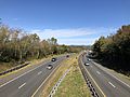
View west along I-66/SR 55 and north along US 17 in northwestern Fauquier County
_in_Ashville,_Fauquier_County,_Virginia.jpg)
See also
 In Spanish: Condado de Fauquier para niños
