
Feather Falls, California facts for kids
Quick facts for kids
Feather Falls
|
|
|---|---|

Feather Falls
Location in California

Feather Falls
Location in the United States
|
|
| Country | United States |
| State | California |
| County | Butte County |
| Elevation | 2,982 ft (909 m) |
Feather Falls (formerly Mooretown, Moresville, and Feather River) is a rural unincorporated community in Butte County, California north and east of Lake Oroville. It lies at an elevation of 2982 feet (909 m). It is home to Feather Falls Elementary School, a K-8 facility. It takes its name from the nearby 410-foot Feather Falls
The community's ZIP code is 95940, which is shared with part of Oroville.
History
The Mooretown post office operated from 1888 to 1913. The Feather River post office opened for a time in 1919, and was re-established in 1921. The name was changed to Feather Falls that same year, and moved to its present location in 1938.
In history, the community was called Mooretown and Moresville according to the US Geological Survey.
Other nearby communities to the north and east along Lumpkin Road are named Lumpkin and Rogerville.
Climate
According to the Köppen Climate Classification system, Feather Falls has a warm-summer Mediterranean climate, abbreviated "Csa" on climate maps.
- US Geological Survey, National Geographic Names Database
- Map: Forbestown, California, 7.5 minute quadrangle, 1994, US Geological Survey.
- Map: Clipper Mills, California, 7.5 minute quadrangle, 1994, US Geological Survey.
Images for kids
-
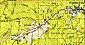
Town and railroad in 1948

