Ferry County, Washington facts for kids
Quick facts for kids
Ferry County
|
|
|---|---|

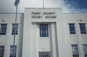
Ferry County Courthouse in Republic
|
|

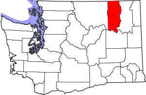
Location within the U.S. state of Washington
|
|
 Washington's location within the U.S. |
|
| Country | |
| State | |
| Founded | February 21, 1899 |
| Named for | Elisha P. Ferry |
| Seat | Republic |
| Largest city | Republic |
| Area | |
| • Total | 2,257 sq mi (5,850 km2) |
| • Land | 2,203 sq mi (5,710 km2) |
| • Water | 54 sq mi (140 km2) 2.4%% |
| Population
(2020)
|
|
| • Total | 7,178 |
| • Estimate
(2021)
|
7,273 |
| • Density | 3.5/sq mi (1.4/km2) |
| Time zone | UTC−8 (Pacific) |
| • Summer (DST) | UTC−7 (PDT) |
| Congressional district | 5th |
Ferry County is a county located on the northern border of the U.S. state of Washington. As of the 2020 census, the population was 7,178, making it the fourth-least populous county in Washington. The county seat and largest city is Republic. The county was created out of Stevens County in February 1899 and is named for Elisha P. Ferry, the state's first governor.
Contents
Geography
According to the U.S. Census Bureau, the county has a total area of 2,257 square miles (5,850 km2), of which 2,203 square miles (5,710 km2) is land and 54 square miles (140 km2) (2.4%) is water. Most of the county is covered by the rugged Kettle River Range, which extends from the Canada–US border at the north, all the way to its southernmost perimeter bounded by the Columbia River and Lake Roosevelt. Only a narrow north–south strip running the length of the county on the west between the San Poil River and the Okanogan County line is covered by the Okanogan Highland. Except for the town of Republic, the county is very sparsely populated.
Geographic features
|
|
|
Major rivers and lakes
- Columbia River
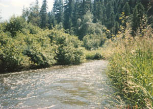
- Kettle River
- Sanpoil River
- Franklin D. Roosevelt Lake, called Lake Roosevelt
- Curlew Lake
- Swan Lake
- Ferry Lake
- Fish Lake
- Long Lake
Adjacent counties
- Stevens County, east
- Lincoln County, southwest
- Okanogan County, west
- Kootenay Boundary Regional District, British Columbia, north
National protected areas
- Pacific Northwest National Scenic Trail (part)
- Colville National Forest (part)
- Lake Roosevelt National Recreation Area (part)
Demographics
| Historical population | |||
|---|---|---|---|
| Census | Pop. | %± | |
| 1900 | 4,562 | — | |
| 1910 | 4,800 | 5.2% | |
| 1920 | 5,143 | 7.1% | |
| 1930 | 4,292 | −16.5% | |
| 1940 | 4,701 | 9.5% | |
| 1950 | 4,096 | −12.9% | |
| 1960 | 3,889 | −5.1% | |
| 1970 | 3,655 | −6.0% | |
| 1980 | 5,811 | 59.0% | |
| 1990 | 6,295 | 8.3% | |
| 2000 | 7,260 | 15.3% | |
| 2010 | 7,551 | 4.0% | |
| 2020 | 7,178 | −4.9% | |
| 2021 (est.) | 7,273 | −3.7% | |
| U.S. Decennial Census 1790–1960 1900–1990 1990–2000 2010–2020 |
|||
2010 census
As of the 2010 census, there were 7,551 people, 3,190 households, and 2,070 families living in the county. The population density was 3.4 inhabitants per square mile (1.3/km2). There were 4,403 housing units at an average density of 2.0 per square mile (0.77/km2). The racial makeup of the county was 76.3% white, 16.7% American Indian, 0.7% Asian, 0.3% black or African American, 0.1% Pacific islander, 1.2% from other races, and 4.8% from two or more races. Those of Hispanic or Latino origin made up 3.4% of the population. In terms of ancestry, 23.0% were German, 18.0% were English, 12.3% were Irish, and 3.7% were American.
Of the 3,190 households, 23.9% had children under the age of 18 living with them, 49.2% were married couples living together, 9.2% had a female householder with no husband present, 35.1% were non-families, and 28.5% of all households were made up of individuals. The average household size was 2.29 and the average family size was 2.75. The median age was 47.3 years.
The median income for a household in the county was $35,485 and the median income for a family was $43,576. Males had a median income of $41,755 versus $30,972 for females. The per capita income for the county was $18,021. About 13.6% of families and 20.8% of the population were below the poverty line, including 24.3% of those under age 18 and 12.4% of those age 65 or over.
Communities
City
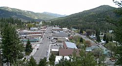
- Republic (county seat)
Census-designated places
Other unincorporated communities
Economy
Ferry County reaches to Canada on the north, and to the Columbia River on the east. Its southern portion is in the boundary of the Colville Indian Reservation, controlled by the Colville Confederated Tribes, and its northern portion is largely occupied by Colville National Forest. As a result, only eighteen percent of the total county area is taxable-use ground. The county's economy is largely based on timber-extraction, and mining.
Ferry County's topography and climate make it an ideal recreation destination, so tourism is becoming a significant portion of the county's economy. Washington State Highway 20, designated a National Scenic Highway, crosses the county east–west, and has the state's highest navigable pass (5,575 feet above sea level).
The county seat, Republic, is the site of the Stonerose Interpretive Center and Fossil Site, which exhibits and explains Eocene-era fossils from an ancient lake bed north of Republic.
Notable people
- Alex N. Dragnich (1912-2009) - political scientist
- Stella Leach (1918-2010) - nurse and activist
See also
 In Spanish: Condado de Ferry para niños


