
Forest County, Wisconsin facts for kids
Quick facts for kids
Forest County
|
|
|---|---|

Forest County Courthouse
|
|

Location within the U.S. state of Wisconsin
|
|
 Wisconsin's location within the U.S. |
|
| Country | |
| State | |
| Founded | 1885 |
| Seat | Crandon |
| Largest city | Crandon |
| Area | |
| • Total | 1,046 sq mi (2,710 km2) |
| • Land | 1,014 sq mi (2,630 km2) |
| • Water | 32 sq mi (80 km2) 3.1% |
| Population
(2010)
|
|
| • Total | 9,304 |
| • Estimate
(2020)
|
8,960 |
| • Density | 8.895/sq mi (3.4343/km2) |
| Time zone | UTC−6 (Central) |
| • Summer (DST) | UTC−5 (CDT) |
| Congressional district | 7th |
Forest County is a county in the U.S. state of Wisconsin. As of the 2010 census, the population was 9,304. Its county seat is Crandon. The Forest County Potawatomi Community and the Sokaogon Chippewa Community have reservations in Forest County.
Contents
History
Forest County was created by the Wisconsin State Legislature in 1885 from portions of neighboring Langlade and Oconto counties. The county was named for the forests contained within its limits.
Geography
According to the U.S. Census Bureau, the county has a total area of 1,046 square miles (2,710 km2), of which 1,014 square miles (2,630 km2) is land and 32 square miles (83 km2) (3.1%) is water.
Adjacent counties
- Florence County - northeast
- Marinette County - east
- Oconto County - southeast
- Langlade County - southwest
- Oneida County - west
- Vilas County - northwest
- Iron County, Michigan - north
Major highways
|
|
Airport
- Y55 - Crandon Municipal Airport
National protected area
- Nicolet National Forest (part)
Demographics
| Historical population | |||
|---|---|---|---|
| Census | Pop. | %± | |
| 1890 | 1,012 | — | |
| 1900 | 1,396 | 37.9% | |
| 1910 | 6,782 | 385.8% | |
| 1920 | 9,850 | 45.2% | |
| 1930 | 11,118 | 12.9% | |
| 1940 | 11,805 | 6.2% | |
| 1950 | 9,437 | −20.1% | |
| 1960 | 7,542 | −20.1% | |
| 1970 | 7,691 | 2.0% | |
| 1980 | 9,044 | 17.6% | |
| 1990 | 8,776 | −3.0% | |
| 2000 | 10,024 | 14.2% | |
| 2010 | 9,304 | −7.2% | |
| 2020 (est.) | 8,960 | −3.7% | |
| U.S. Decennial Census 1790–1960 1900–1990 1990–2000 2010–2020 |
|||

As of the census of 2000, there were 10,024 people, 4,043 households, and 2,769 families residing in the county. The population density was 10 people per square mile (4/km2). There were 8,322 housing units at an average density of 8 per square mile (3/km2). The racial makeup of the county was 85.86% White, 11.30% Native American, 1.18% Black or African American, 0.17% Asian, 0.04% Pacific Islander, 0.23% from other races, and 1.22% from two or more races. 1.08% of the population were Hispanic or Latino of any race. 34.3% were of German, 11.4% Polish, 7.4% Irish and 5.4% American ancestry. 95.5% spoke English, 1.4% Spanish and 1.0% Potawatomi as their first language.
Out of the 4,043 households, 29.20% had children under the age of 18, 54.00% had a married couple living together, 9.80% had a female householder with no husband present, and 31.50% were non-families. 28.20% of all households were made up of individuals living alone, and 13.20%, of individuals of 65 years of age or older living alone. The average household size was 2.39 and the average family size was 2.89.
The age distribution in the county's population was as follows: 25.30% under the age of 18, 7.80% from 18 to 24, 23.90% from 25 to 44, 23.80% from 45 to 64, and 19.30% 65 years of age or older. The median age was 40 years. For every 100 females there were 100.20 males. For every 100 females age 18 and over, there were 99.00 males.
Communities

City
- Crandon (county seat)
Towns
Census-designated places
Unincorporated communities
Ghost towns
Images for kids
-
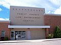
Law Enforcement Center
-
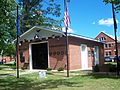
Forest County Veterans Memorial


See also
 In Spanish: Condado de Forest (Wisconsin) para niños
