
Fort Yates, North Dakota facts for kids
Quick facts for kids
Fort Yates, North Dakota
|
|
|---|---|

Fort Yates Baptist Mission in Fort Yates
|
|

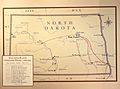
Location of Fort Yates, North Dakota
|
|
| Country | United States |
| Indian Reservation | Standing Rock Indian Reservation |
| State | North Dakota |
| County | Sioux |
| Area | |
| • Total | 0.06 sq mi (0.16 km2) |
| • Land | 0.06 sq mi (0.16 km2) |
| • Water | 0.00 sq mi (0.00 km2) |
| Elevation | 1,634 ft (498 m) |
| Population
(2010)
|
|
| • Total | 184 |
| • Estimate
(2019)
|
202 |
| • Density | 3,366.67/sq mi (1,293.09/km2) |
| Time zone | UTC−6 (Central (CST)) |
| • Summer (DST) | UTC−5 (CDT) |
| ZIP code |
58538
|
| Area code(s) | 701 |
| FIPS code | 38-27860 |
| GNIS feature ID | 1029027 |
Fort Yates is a city in Sioux County, North Dakota, United States. It is the tribal headquarters of the Standing Rock Sioux Tribe and county seat of Sioux County. Since 1970 the population has declined markedly from more than 1100 residents, as people have left for other locations for work. The population was 184 at the 2010 census.
Contents
History
A primarily Native American settlement developed here after a US Army post at this site was established in 1863 as the Standing Rock Cantonment, intended for the US Army garrison to oversee the Hunkpapa and Blackfeet bands, and the Inhunktonwan and Cuthead of the Upper Yanktonai, of the Lakota Oyate. In 1878 the US Army renamed the fort to honor Captain George Yates, who was killed by the Lakota Oyate at the Battle of Little Big Horn in 1876. The town that developed was also known as Fort Yates. The Army post and fort were decommissioned in 1903.
Fort Yates also served as the headquarters of the US Standing Rock Indian Agency, which in the late 19th century was headed by US Indian Service Agent James McLaughlin. Worried about the Hunkpapa Lakota chief Sitting Bull possibly taking part in the Ghost Dance movement, he ordered the arrest of the chief on 14 December 1890. During the bungled event the chief was shot and killed at dawn in his log cabin by agency non-Hunkpapa Dakota police.
Sitting Bull was buried at Fort Yates. In 1953, his family authorized his remains to be exhumed and transferred to a gravesite overlooking the Missouri River near his birthplace at Mobridge, South Dakota. A monument dedicated to Sitting Bull was installed at his burial site at Fort Yates. Another monument, with his bust on a pedestal, overlooks the Missouri River at the Mobridge burial site.
This city has become the tribal headquarters of the federally recognized Standing Rock Sioux Tribe, whose reservation encompasses it. They founded Sitting Bull College in Fort Yates, a tribal college now named for their noted 19th-century leader. Known also as "Long Soldier", it is the most populous electoral district of the reservation.
Geography and climate
Fort Yates is located at 46°5′6″N 100°37′49″W / 46.08500°N 100.63028°W (46.084899, -100.630144).
According to the United States Census Bureau, the city has a total area of 0.06 square miles (0.16 km2), all of it land. Fort Yates has a semiarid climate (Köppen BSk), with hot summers, cold and very dry winters (though sometimes moderated by chinook winds) and substantial diurnal temperature ranges. On February 2, 1992 the city recorded 72 °F or 22.2 °C, the highest ever recorded for any winter month in North Dakota.
| Climate data for Fort Yates, North Dakota (1981–2010) | |||||||||||||
|---|---|---|---|---|---|---|---|---|---|---|---|---|---|
| Month | Jan | Feb | Mar | Apr | May | Jun | Jul | Aug | Sep | Oct | Nov | Dec | Year |
| Record high °F (°C) | 64.0 (17.8) |
72.0 (22.2) |
85.0 (29.4) |
99.0 (37.2) |
107.0 (41.7) |
110.0 (43.3) |
119.0 (48.3) |
111.0 (43.9) |
107.0 (41.7) |
95.0 (35.0) |
80.0 (26.7) |
69.0 (20.6) |
119.0 (48.3) |
| Average high °F (°C) | 27.3 (−2.6) |
32.5 (0.3) |
43.3 (6.3) |
59.2 (15.1) |
70.4 (21.3) |
80.1 (26.7) |
87.1 (30.6) |
86.0 (30.0) |
74.2 (23.4) |
60.8 (16.0) |
42.3 (5.7) |
29.4 (−1.4) |
57.8 (14.3) |
| Daily mean °F (°C) | 14.6 (−9.7) |
19.9 (−6.7) |
30.5 (−0.8) |
41.1 (5.1) |
56.0 (13.3) |
65.6 (18.7) |
72.0 (22.2) |
70.4 (21.3) |
58.8 (14.9) |
46.1 (7.8) |
30.5 (−0.8) |
17.8 (−7.9) |
44.0 (6.7) |
| Average low °F (°C) | 2.0 (−16.7) |
7.3 (−13.7) |
17.6 (−8.0) |
28.9 (−1.7) |
41.5 (5.3) |
51.2 (10.7) |
56.9 (13.8) |
54.8 (12.7) |
43.4 (6.3) |
31.3 (−0.4) |
18.6 (−7.4) |
6.1 (−14.4) |
30.1 (−1.1) |
| Record low °F (°C) | −41.0 (−40.6) |
−50.0 (−45.6) |
−33.0 (−36.1) |
−7.0 (−21.7) |
16.0 (−8.9) |
28.0 (−2.2) |
28.0 (−2.2) |
29.0 (−1.7) |
15.0 (−9.4) |
−4.0 (−20.0) |
−23.0 (−30.6) |
−34.0 (−36.7) |
−50.0 (−45.6) |
| Average precipitation inches (mm) | 0.19 (4.8) |
0.32 (8.1) |
0.55 (14) |
1.04 (26) |
2.49 (63) |
2.83 (72) |
2.39 (61) |
1.57 (40) |
1.49 (38) |
1.30 (33) |
0.43 (11) |
0.23 (5.8) |
14.83 (376.7) |
| Average snowfall inches (cm) | 6.1 (15) |
9.6 (24) |
11.3 (29) |
2.3 (5.8) |
0.0 (0.0) |
0.0 (0.0) |
0.0 (0.0) |
0.0 (0.0) |
0.0 (0.0) |
0.3 (0.76) |
2.0 (5.1) |
4.8 (12) |
36.2 (92) |
| Source: NOAA, WRCC | |||||||||||||
Demographics
| Historical population | |||
|---|---|---|---|
| Census | Pop. | %± | |
| 1880 | 446 | — | |
| 1890 | 511 | 14.6% | |
| 1970 | 1,153 | — | |
| 1980 | 771 | −33.1% | |
| 1990 | 183 | −76.3% | |
| 2000 | 228 | 24.6% | |
| 2010 | 184 | −19.3% | |
| 2019 (est.) | 202 | 9.8% | |
| U.S. Decennial Census 2018 Estimate |
|||

2010 census
As of the census of 2010, there were 184 people, 66 households, and 43 families residing in the city. The population density was 3,066.7 inhabitants per square mile (1,184.1/km2). There were 73 housing units at an average density of 1,216.7 per square mile (469.8/km2). The racial makeup of the city was 5.4% White, 92.4% Native American, 0.5% from other races, and 1.6% from two or more races. Hispanic or Latino of any race were 2.2% of the population.
There were 66 households, of which 45.5% had children under the age of 18 living with them, 22.7% were married couples living together, 30.3% had a female householder with no husband present, 12.1% had a male householder with no wife present, and 34.8% were non-families. 28.8% of all households were made up of individuals, and 7.5% had someone living alone who was 65 years of age or older. The average household size was 2.79 and the average family size was 3.26.
The median age in the city was 33.6 years. 31% of residents were under the age of 18; 8.7% were between the ages of 18 and 24; 27.6% were from 25 to 44; 22.8% were from 45 to 64; and 9.8% were 65 years of age or older. The gender makeup of the city was 53.3% male and 46.7% female.

Fort Yates water treatment plant
The water treatment plant at Fort Yates, an integral part of the The Standing Rock Rural Water System, is the primary source of drinking water for over three thousand people which includes the residents of Porcupine, Cannonball and Fort Yates as well the Prairie Knights Casino and Lodge. The intake is on the Missouri River.
Education
It is in the Fort Yates School District, which is integrated with the Standing Rock Community School.
Images for kids
-
Northern Plains Overland Trails 1866-1877 map on display at the Fort Totten Historic Site

See also
 In Spanish: Fort Yates (Dakota del Norte) para niños
