Franklin County, Arkansas facts for kids
Quick facts for kids
Franklin County
|
||
|---|---|---|
|
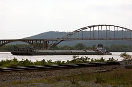
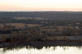
Clockwise from top: The Ozark Bridge over the Arkansas River, Franklin County Courthouse in Ozark, the Wiederkehr Wine Cellar near Altus, Sunset from Reed Mountain overlooking the Arkansas River Valley, Overlook at White Rock Mountain in the Ozark National Forest, Franklin County Courthouse in Charleston
|
||
|
||

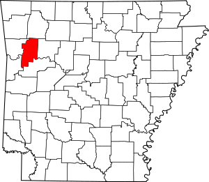
Location within the U.S. state of Arkansas
|
||
 Arkansas's location within the U.S. |
||
| Country | ||
| State | ||
| Founded | December 19, 1837 | |
| Named for | Benjamin Franklin | |
| Seat | Ozark (northern district); Charleston (southern district) |
|
| Largest city | Ozark | |
| Area | ||
| • Total | 620 sq mi (1,600 km2) | |
| • Land | 609 sq mi (1,580 km2) | |
| • Water | 11 sq mi (30 km2) 1.7%% | |
| Population
(2010)
|
||
| • Total | 18,125 | |
| • Estimate
(2019)
|
17,715 | |
| • Density | 29.23/sq mi (11.29/km2) | |
| Time zone | UTC−6 (Central) | |
| • Summer (DST) | UTC−5 (CDT) | |
| Congressional district | 4th | |
Franklin County is a county in Arkansas. As of the 2010 census, the population was 18,125. The county has two county seats, Charleston and Ozark. The county was formed on December 19, 1837, and named for Benjamin Franklin, American statesman. To the north of the Arkansas River, which bisects Franklin County, the county is wet and alcohol is sold in liquor stores, bars and local vineyards. To the south of the Arkansas River, the county is dry.
Contents
History
Franklin County was carved out of Crawford County in December 1837. At that time, Franklin was significantly larger than it is at present, encompassing part of present-day Logan County which was formed in 1871.
Initially, the county had a single courthouse at Ozark. Later, after complaints about how difficult it was to cross the river at times, a second courthouse was established at Charleston, sometime in the 1890s.
The reality television show, The Simple Life, starring Nicole Richie and Paris Hilton was filmed in Altus in 2003.
Geography
According to the U.S. Census Bureau, the county has a total area of 620 square miles (1,600 km2), of which 609 square miles (1,580 km2) is land and 11 square miles (28 km2) (1.7%) is water.
Major highways
 Interstate 40
 U.S. Highway 64
 Highway 22
 Highway 23
 Highway 41
 Highway 60
 Highway 96
Adjacent counties
- Madison County (north)
- Johnson County (east)
- Logan County (southeast)
- Sebastian County (southwest)
- Crawford County (west)
National protected area
- Ozark National Forest (part)
Demographics
| Historical population | |||
|---|---|---|---|
| Census | Pop. | %± | |
| 1840 | 2,665 | — | |
| 1850 | 3,972 | 49.0% | |
| 1860 | 7,298 | 83.7% | |
| 1870 | 9,627 | 31.9% | |
| 1880 | 14,951 | 55.3% | |
| 1890 | 19,934 | 33.3% | |
| 1900 | 17,395 | −12.7% | |
| 1910 | 20,638 | 18.6% | |
| 1920 | 19,364 | −6.2% | |
| 1930 | 15,762 | −18.6% | |
| 1940 | 15,683 | −0.5% | |
| 1950 | 12,358 | −21.2% | |
| 1960 | 10,213 | −17.4% | |
| 1970 | 11,301 | 10.7% | |
| 1980 | 14,705 | 30.1% | |
| 1990 | 14,897 | 1.3% | |
| 2000 | 17,771 | 19.3% | |
| 2010 | 18,125 | 2.0% | |
| 2019 (est.) | 17,715 | −2.3% | |
| U.S. Decennial Census 1790–1960 1900–1990 1990–2000 2010–2016 |
|||
2020 census
| Race | Number | Percentage |
|---|---|---|
| White (non-Hispanic) | 15,201 | 88.91% |
| Black or African American (non-Hispanic) | 78 | 0.46% |
| Native American | 199 | 1.16% |
| Asian | 162 | 0.95% |
| Pacific Islander | 10 | 0.06% |
| Other/Mixed | 956 | 5.59% |
| Hispanic or Latino | 491 | 2.87% |
As of the 2020 United States census, there were 17,097 people, 6,723 households, and 4,537 families residing in the county.
Communities
Cities
- Altus
- Branch
- Charleston (county seat)
- Ozark (county seat)
- Wiederkehr Village
Town
Unincorporated communities
Ghost town
Townships
Townships in Arkansas are the divisions of a county. Each township includes unincorporated areas; some may have incorporated cities or towns within part of their boundaries. Arkansas townships have limited purposes in modern times. However, the United States Census does list Arkansas population based on townships (sometimes referred to as "county subdivisions" or "minor civil divisions"). Townships are also of value for historical purposes in terms of genealogical research. Each town or city is within one or more townships in an Arkansas county based on census maps and publications. The townships of Franklin County are listed below; listed in parentheses are the cities, towns, and/or census-designated places that are fully or partially inside the township.
- Alix (part of Wiederkehr Village)
- Barham
- Black Oak
- Boston
- Cobb
- Cravens
- Donald (most of Branch)
- Grover
- Hogan (Altus, Denning, part of Wiederkehr Village)
- Hurricane
- Ivy
- Limestone
- McIlroy
- Middle
- Mill Creek
- Miller
- Morgan
- Mountain
- Mulberry
- Prairie (Charleston, small part of Branch)
- Shores
- Six Mile
- Walker
- Wallace
- Watalula
- Weaver
- White Oak (Ozark, most of Wiederkehr Village)
- White Rock
- Wittich
See also
 In Spanish: Condado de Franklin (Arkansas) para niños


