
Fukuoka Prefecture facts for kids
Quick facts for kids Fukuoka Prefecture |
|||||||||
|
|||||||||
 |
|||||||||
| Capital | Fukuoka | ||||||||
| Region | Kyūshū (Saikaidō) | ||||||||
| Island | Kyūshū | ||||||||
| Governor | Hiroshi Ogawa (since April 2011) | ||||||||
| Area (rank) | 4,971.01 km² (29th) | ||||||||
| - % water | 2.3% | ||||||||
| Population (September 1, 2010) | |||||||||
| - Population | 5,071,732 (9th) | ||||||||
| - Density | 1,020.26 /km² | ||||||||
| Districts | 12 | ||||||||
| Municipalities | 60 | ||||||||
| ISO 3166-2 | JP-40 | ||||||||
| Website | www.pref.fukuoka.lg.jp/somu/ multilingual/english/top.html |
||||||||
| Prefectural Symbols | |||||||||
| - Flower | Ume blossom (Prunus mume) | ||||||||
| - Tree | Azalea (Rhododendron tsutsusi) | ||||||||
| - Bird | Japanese Bush Warbler (Cettia diphone) | ||||||||
| - Fish | |||||||||
 Symbol of Fukuoka Prefecture |
|||||||||

Fukuoka Prefecture (福岡県, Fukuoka-ken) is a prefecture in the Kyūshū region of Japan on the island of Kyūshū. The capital city is Fukuoka.
Contents
History
The area of Fukuoka Prefecture includes the old provinces of Chikugo, Chikuzen, and Buzen.
Timeline
- November 19, 1274 (Bun'ei 11, 20th day of the 10th month): Battle of Bun'ei
- August 15, 1281 (Kōan 4, 30th day of the 7th month): Battle of Kōan
Geography
Fukuoka Prefecture faces the sea on three sides. The prefecture borders Saga, Ōita, and Kumamoto prefectures. Fukuoka is near Yamaguchi Prefecture across the Kanmon Straits.
Fukuoka includes the two largest cities on Kyūshū, Fukuoka and Kitakyūshū. Small islands are near the north coast of the prefecture.
Cities
There are 28 cities in the prefecture:
|
|
Towns and villages
These are the towns and villages in each district of the prefecture
|
|
|
|
National Parks
National Parks are established in about 18% of the total land area of the prefecture.
Shrines and Temples
Kōra taisha, Sumiyoshi-jinja, Hakosagi-gū and Usa-jinjū are the chief Shinto shrines (ichinomiya) in the prefecture.
Related pages
- Provinces of Japan
- Prefectures of Japan
- List of regions of Japan
- List of islands of Japan
- Kyushu National Museum
- Giravanz Kitakyushu
- Fukuoka Art Museum
- Kyushu National Museum
- Dazaifu
Images for kids
-
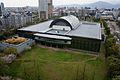
Fukuoka City Museum
-
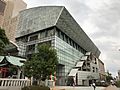
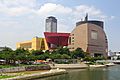
Fukuoka Asian Art Museum
-
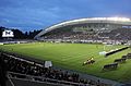
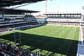
Level5 Stadium, home of Avispa Fukuoka
-
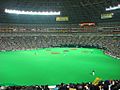
Fukuoka Yahuoku Dome, home of the Softbank Hawks
-
Mikuni World Stadium, home of Giravanz Kitakyushu
-
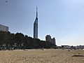
Fukuoka Tower from Seaside Momochi
-
Riverwalk Kitakyushu
-
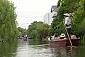
A sightseeing boat in Yanagawa Canal
-
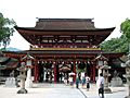
Dazaifu Tenman-gū
-
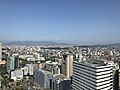
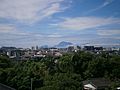
Fukuoka City
-
Tobata, Kitakyushu
-
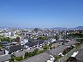
Kurume
-
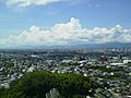
Omuta


See also
 In Spanish: Prefectura de Fukuoka para niños
