
Garwood, Texas facts for kids
Quick facts for kids
Garwood, Texas
|
|
|---|---|

Garwood, Texas
Location in Texas
|
|
| Country | United States |
| State | Texas |
| County | Colorado |
| Elevation | 154 ft (47 m) |
| Time zone | UTC-6 (Central (CST)) |
| • Summer (DST) | UTC-5 (CDT) |
| ZIP code |
77442
|
| Area code(s) | 979 |
| GNIS feature ID | 1336419 |
Garwood is an unincorporated community in Colorado County, Texas, United States. It is located on State Highway 71 at virtually the geographic midpoint between Columbus, Texas and El Campo, Texas. Nearly 1,000 people lived in Garwood in 2000.
Geography
Garwood is situated at the junction of State Highway 71 and FM 950 in southern Colorado County, approximately 13 miles (21 km) southwest of Eagle Lake and 20 miles (32 km) south of Columbus. According to the Handbook of Texas, the community had an estimated population of 975 in 2000. Although it is unincorporated, Garwood has a post office, with the ZIP code of 77442.
-
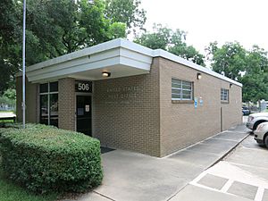
US post office is located on Arthur Street.
-
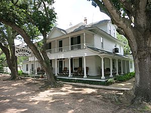
Bucksnag Hunting Club is in a grand old house.
-
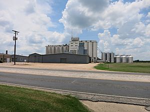
Silos can be seen on Texas 71 across from the school.


Climate
The climate in this area is characterized by hot, humid summers and generally mild to cool winters. According to the Köppen Climate Classification system, Garwood has a humid subtropical climate, abbreviated "Cfa" on climate maps.
- Garwood, Texas from the Handbook of Texas Online
Education
Public education in the community of Garwood is provided by the Rice Consolidated Independent School District. Zoned campuses include Garwood School (grades K-6; located in Garwood), Rice Junior High School (grades 7-8), and Rice High School (grades 9-12).
The designated community college for Rice CISD is Wharton County Junior College.
-
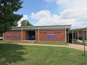
Garwood Elementary School (Rice CISD) on Texas 71

