Gaviota Coast facts for kids
Quick facts for kids Gaviota Coast |
|
|---|---|
| Location | Santa Barbara County, California |
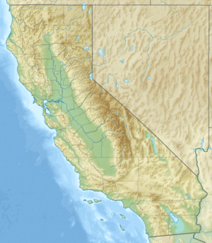
| Coordinates | 34°28′15″N 120°13′29″W / 34.47083°N 120.22472°W |
| Offshore water bodies | Pacific Ocean |
| Elevation | 23 feet (7 m) |
| Length | 76 miles (122 km) |
| Area | 200,000 hectares (490,000 acres) |
| GNIS feature ID | 1702035 |
| ZIP codes | 93117, 93436 |
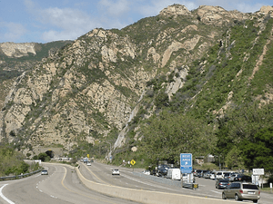
The Gaviota Coast in Santa Barbara County, California is a rural coastline along the Santa Barbara Channel roughly bounded by the city of Goleta and the north boundary of the county. This last undeveloped stretch of Southern California coastline consists of dramatic bluffs, isolated beaches and terraced grasslands.
Contents
History
Sites inhabited in the Paleoindian Period (13,000–8,500 B.P.) have been found through archeological deposits at the mouths of rivers and along the seashore where there was an abundance of food. At least fourteen Chumash villages were located along the coastline including Qasil, Tajiguas, and Shishuchi'i'.
The Spanish began colonizing Alta California with the Portolá expedition of 1769–1770. Much of the area is within the 1794 Spanish land grant, Rancho Nuestra Señora del Refugio.
Congress ordered a study in 1999 for a proposed 76-mile-long (122 km) National Seashore from Coal Oil Point at UC Santa Barbara to Point Sal at the northern boundary of Vandenberg Air Force Base. Although the National Park Service found the area suitable with nationally significant natural and cultural resources, the study found the establishment to not be feasible due to local opposition within the approximately 200,000 acres (81,000 ha) study area and the high cost of acquiring land and running a new park.
Geography
Situated on a narrow coastal terrace between a rugged coastline and the Santa Ynez Mountains of the Los Padres National Forest, the area has a Mediterranean climate. The coastal waters are considered unique for the biodiversity of ocean life. The unusual species found here are the result of the cold water from the north meeting the warm water from the south. The annual migration of about 19,000 Gray whales through the Santa Barbara Channel may come as close as 100 feet (30 m) from the shoreline. The unusual abundance and diversity of wildlife includes an estimated 1,400 plant and animal species. The Santa Ynez Mountains are a migration corridor for wildlife from the large interior region of California. Wildlife includes mountain lions, black bears, badgers, golden eagles, and the California condor.
The Gaviota Creek watershed is the largest watershed along this coast and is the most important steelhead stream in Southern Santa Barbara County. Refugio Creek is one of the larger coastal streams along the coast and descends through a mosaic of commercial orchards, ranches, and rural residential developments and crosses under Highway 101 before flowing into the Pacific Ocean.
Land use
The narrow coastal terrace is primarily used for recreation and cattle grazing. The county adopted a coastal land use plan in 1982 that was consistent with their policies and development standards to preserve the natural scenic beauty. The lightly populated area has large ranches with much of the land held in agricultural preserves under the Williamson Act and used for avocado, lemon and other fruit orchards. Some of the ranches are also luxury estates. El Rancho Tajiguas is a 3,600 acres (1,500 ha) working ranch that was developed with two luxury homes over a period of 40 years under the ownership of Mansour Ojjeh. The 1,800 acres (730 ha) Las Varas Ranch was purchased by Charlie Munger and donated to the University of California, Santa Barbara in 2018.
The Hondo and Harmony oil rigs can be easily seen offshore in front of the Channel Islands in the Santa Barbara Channel from the highway or railroad. Crude oil and natural gas are produced by these offshore platforms. Local land use agencies have kept oil processing facilities to a minimum while the oil and gas are processed at onshore receiving plants before being transported to distant refineries. The area was one of the earliest locations in California developed for offshore oil and gas production.
Protected areas along US 101 include three public beaches with campgrounds and hiking trails: Gaviota State Park, El Capitán State Beach, and Refugio State Beach. There are also several marine protected area off the coast: Point Conception State Marine Reserve, Naples State Marine Conservation Area, and Kashtayit State Marine Conservation Area. There are also several private campgrounds.
Transportation

US 101 and the main coastal railroad line both parallel the coastline atop the coastal bluff. The 21-mile-long (34 km) section of US 101 from the north boundary of Goleta to State Route 1 at Las Cruces is designated by the state as a scenic highway. The coastal bluff section of the rail line is longer at 30 miles (48 km). An Interim California Coastal Trail alignment from Guadalupe to Gaviota State Park is under study. These routes follow Chumash and Spanish Period trails.


