
Georgetown, Ohio facts for kids
Quick facts for kids
Georgetown, Ohio
|
|
|---|---|
|
Village
|
|

|
|

Location of Georgetown, Ohio
|
|

Location of Georgetown in Brown County
|
|
| Country | United States |
| State | Ohio |
| County | Brown |
| Township | Pleasant |
| Area | |
| • Total | 4.14 sq mi (10.74 km2) |
| • Land | 4.14 sq mi (10.74 km2) |
| • Water | 0.00 sq mi (0.00 km2) |
| Elevation | 919 ft (280 m) |
| Population
(2010)
|
|
| • Total | 4,331 |
| • Estimate
(2019)
|
4,243 |
| • Density | 1,023.64/sq mi (395.22/km2) |
| Time zone | UTC-5 (Eastern (EST)) |
| • Summer (DST) | UTC-4 (EDT) |
| ZIP code |
45121
|
| Area code(s) | 937, 326 |
| FIPS code | 39-29778 |
| GNIS feature ID | 1064714 |
| Website | http://www.georgetownohio.us/ |
Georgetown is a village in Brown County, Ohio, United States located about 36 miles southeast of Cincinnati. The population was 4,331 at the 2010 census. It is the county seat of Brown County. Georgetown was the childhood home of Ulysses S. Grant.
Contents
History
Georgetown was platted in 1819. The village took its name from Georgetown, Kentucky. A post office called Georgetown has been in operation since 1821.
Geography
Georgetown is located at 38°52′1″N 83°54′9″W / 38.86694°N 83.90250°W (38.866926, -83.902590).
According to the United States Census Bureau, the village has a total area of 4.04 square miles (10.46 km2), all land.
Gallery
-
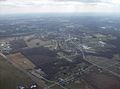
Georgetown's north side from the air.
-
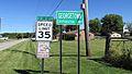
Georgetown corporation limit sign.
-
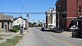
Looking north on Main Street in Georgetown.


Demographics
| Historical population | |||
|---|---|---|---|
| Census | Pop. | %± | |
| 1850 | 618 | — | |
| 1860 | 723 | 17.0% | |
| 1870 | 1,037 | 43.4% | |
| 1880 | 1,293 | 24.7% | |
| 1890 | 1,473 | 13.9% | |
| 1900 | 1,529 | 3.8% | |
| 1910 | 1,580 | 3.3% | |
| 1920 | 1,670 | 5.7% | |
| 1930 | 1,531 | −8.3% | |
| 1940 | 1,848 | 20.7% | |
| 1950 | 2,200 | 19.0% | |
| 1960 | 2,674 | 21.5% | |
| 1970 | 3,087 | 15.4% | |
| 1980 | 3,467 | 12.3% | |
| 1990 | 3,627 | 4.6% | |
| 2000 | 3,631 | 0.1% | |
| 2010 | 4,331 | 19.3% | |
| 2019 (est.) | 4,243 | −2.0% | |
| U.S. Decennial Census | |||
2010 census
As of the census of 2010, there were 4,331 people, 1,722 households, and 1,085 families living in the village. The population density was 1,072.0 inhabitants per square mile (413.9/km2). There were 1,939 housing units at an average density of 480.0 per square mile (185.3/km2). The racial makeup of the village was 95.5% White, 1.9% African American, 0.3% Native American, 0.5% Asian, 0.2% from other races, and 1.6% from two or more races. Hispanic or Latino of any race were 0.6% of the population.
There were 1,722 households, of which 34.6% had children under the age of 18 living with them, 41.6% were married couples living together, 15.7% had a female householder with no husband present, 5.7% had a male householder with no wife present, and 37.0% were non-families. 32.7% of all households were made up of individuals, and 14.8% had someone living alone who was 65 years of age or older. The average household size was 2.36 and the average family size was 2.93.
The median age in the village was 38.6 years. 24.5% of residents were under the age of 18; 7.9% were between the ages of 18 and 24; 25.5% were from 25 to 44; 23.2% were from 45 to 64; and 18.7% were 65 years of age or older. The gender makeup of the village was 48.2% male and 51.8% female.
Places of interest
President Ulysses S. Grant grew up and attended grade school in Georgetown. The school house is still in the town, where the locals refer to it as the Grant Schoolhouse. Also in Georgetown are Grant's childhood home and the tannery that his father owned across the street. All three are stops on the Land of Grant tour.
Being the county seat, Georgetown hosts the large Brown County Fair and parade which brings in thousands of patrons from other towns. The headstone of General Thomas L. Hamer is in the old cemetery located by the Brown County Fair Grounds.
Seventeen acres of the city was listed on the National Register of Historic Places in 1978 as the Georgetown Historic District.
Education
Georgetown has a public library, a branch of the Brown County Public Library.
Notable people
- Carr Van Anda, Managing Editor of the New York Times
- Electra Collins Doren, suffragette, library scientist
- Brian Grant, professional basketball player
- Ulysses S. Grant, President of the United States
- Jesse Root Grant, father of Ulysses S. Grant, settled in Georgetown, became Mayor of Georgetown in 1837
- Thomas L. Hamer, U.S. Congressman who fought in the Mexican–American War
- August V. Kautz, U.S. Army Major General
- Albert Kautz, U.S. Navy Rear Admiral
- Rodney J. McKinley, Chief Master Sergeant of the Air Force
- John Ruthven, wildlife artist
See also
 In Spanish: Georgetown (Ohio) para niños
