Glen Gardner, New Jersey facts for kids
Quick facts for kids
Glen Gardner, New Jersey
|
|
|---|---|
|
Borough
|
|
| Borough of Glen Gardner | |
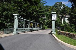
Glen Gardner Pony Pratt Truss Bridge
|
|
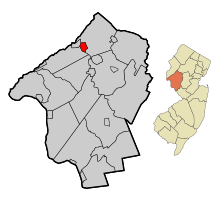
Map of Glen Gardner in Hunterdon County. Inset: Location of Hunterdon County highlighted in the State of New Jersey.
|
|
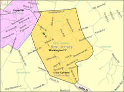
Census Bureau map of Glen Gardner, New Jersey
|
|
| Country | |
| State | |
| County | |
| Incorporated | March 26, 1919 |
| Named for | Gardner brothers |
| Government | |
| • Type | Borough |
| • Body | Borough Council |
| Area | |
| • Total | 1.55 sq mi (4.01 km2) |
| • Land | 1.55 sq mi (4.01 km2) |
| • Water | 0.00 sq mi (0.00 km2) 0.00% |
| Area rank | 448th of 565 in state 16th of 26 in county |
| Elevation | 541 ft (165 m) |
| Population | |
| • Total | 1,704 |
| • Estimate
(2019)
|
1,911 |
| • Rank | 504th of 566 in state 19th of 26 in county |
| • Density | 1,117.8/sq mi (431.6/km2) |
| • Density rank | 368th of 566 in state 7th of 26 in county |
| Time zone | UTC−05:00 (Eastern (EST)) |
| • Summer (DST) | UTC−04:00 (Eastern (EDT)) |
| ZIP Code |
08826
|
| Area code(s) | 908 exchange: 537, 638, 932 |
| FIPS code | 3401926550 |
| GNIS feature ID | 0885232 |
Glen Gardner is a borough in Hunterdon County, New Jersey, United States. At the time of the 2010 United States Census, the borough's population was 1,704, reflecting a decline of 198 (-10.4%) from the 1,902 counted in the 2000 Census, which had in turn increased by 237 (+14.2%) from the 1,665 counted in the 1990 Census.
Glen Gardner is located at the extreme western border of Lebanon Township and was incorporated as a borough by an act of the New Jersey Legislature on March 26, 1919, from portions of both Lebanon Township and Bethlehem Township based on the results of a referendum held that same day. Portions of the borough were ceded to Hampton borough in 1931.
Contents
Geography
According to the United States Census Bureau, the borough had a total area of 1.524 square miles (3.948 km2), all of which was land.
Unincorporated communities, localities and place names located partially or completely within the borough include .
Bells Crossing and Clarksville are unincorporated communities located within Glen Gardner.
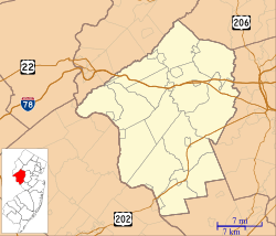
The borough borders the Hunterdon County municipalities of Bethlehem Township, Hampton Borough and Lebanon Township.
Demographics
| Historical population | |||
|---|---|---|---|
| Census | Pop. | %± | |
| 1920 | 818 | — | |
| 1930 | 554 | −32.3% | |
| 1940 | 536 | −3.2% | |
| 1950 | 654 | 22.0% | |
| 1960 | 787 | 20.3% | |
| 1970 | 874 | 11.1% | |
| 1980 | 834 | −4.6% | |
| 1990 | 1,665 | 99.6% | |
| 2000 | 1,902 | 14.2% | |
| 2010 | 1,704 | −10.4% | |
| 2019 (est.) | 1,911 | 12.1% | |
| Population sources: 1920 1920-1930 1930-1990 2000 2010 |
|||
Census 2010
As of the census of 2010, there were 1,704 people, 768 households, and 434 families residing in the borough. The population density was 1,117.8 per square mile (431.6/km2). There were 825 housing units at an average density of 541.2 per square mile (209.0/km2)*. The racial makeup of the borough was 94.54% (1,611) White, 1.76% (30) Black or African American, 0.06% (1) Native American, 1.82% (31) Asian, 0.00% (0) Pacific Islander, 0.35% (6) from other races, and 1.47% (25) from two or more races. [[Hispanic (U.S. Census)|Hispanic or Latino of any race were 5.28% (90) of the population.
There were 768 households out of which 28.4% had children under the age of 18 living with them, 45.1% were married couples living together, 8.5% had a female householder with no husband present, and 43.5% were non-families. 35.3% of all households were made up of individuals, and 7.6% had someone living alone who was 65 years of age or older. The average household size was 2.22 and the average family size was 2.97.
In the borough, the population was spread out with 21.3% under the age of 18, 6.6% from 18 to 24, 28.5% from 25 to 44, 34.8% from 45 to 64, and 8.8% who were 65 years of age or older. The median age was 41.6 years. For every 100 females there were 97.7 males. For every 100 females ages 18 and old there were 91.6 males.
The Census Bureau's 2006-2010 American Community Survey showed that (in 2010 inflation-adjusted dollars) median household income was $73,750 (with a margin of error of +/- $15,026) and the median family income was $98,693 (+/- $9,105). Males had a median income of $62,434 (+/- $12,072) versus $49,417 (+/- $13,970) for females. The per capita income for the borough was $37,184 (+/- $4,006). About 1.2% of families and 2.3% of the population were below the poverty line, including 1.4% of those under age 18 and 7.6% of those age 65 or over.
Census 2000
At the 2000 United States Census, there were 1,902 people, 805 households and 474 families residing in the borough. The population density was 1,217.6 per square mile (470.7/km2). There were 829 housing units at an average density of 530.7 per square mile (205.2/km2). The racial makeup of the borough was 95.69% White, 0.89% African American, 0.11% Native American, 1.47% Asian, 0.11% Pacific Islander, 0.58% from other races, and 1.16% from two or more races. Hispanic or Latino of any race were 3.42% of the population.
There were 805 households, of which 32.9% had children under the age of 18 living with them, 46.6% were married couples living together, 9.7% had a female householder with no husband present, and 41.1% were non-families. 34.2% of all households were made up of individuals, and 8.6% had someone living alone who was 65 years of age or older. The average household size was 2.33 and the average family size was 3.07.
Age distribution was 25.3% under the age of 18, 6.0% from 18 to 24, 41.2% from 25 to 44, 19.8% from 45 to 64, and 7.6% who were 65 years of age or older. The median age was 35 years. For every 100 females, there were 95.5 males. For every 100 females age 18 and over, there were 89.7 males.
The median household income was $59,917, and the median family income was $75,369. Males had a median income of $50,776 versus $40,179 for females. The per capita income for the borough was $28,647. About 4.2% of families and 4.5% of the population were below the poverty line, including 4.8% of those under age 18 and 1.4% of those age 65 or over.
Transportation
As of May 2010[update], the borough had a total of 10.89 miles (17.53 km) of roadways, of which 7.84 miles (12.62 km) were maintained by the municipality, 1.36 miles (2.19 km) by Hunterdon County and 1.69 miles (2.72 km) by the New Jersey Department of Transportation.
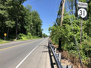
New Jersey Route 31 is the main highway through Glen Gardner.
Education
Clinton-Glen Gardner School District is school district based in the Town of Clinton, that serves students from Clinton Town and Glen Gardner Borough in pre-kindergarten through eighth grade at Clinton Public School. Before Glen Gardner, a non-operating district, was consolidated into the district, students from the borough had attend the district's school as part of a sending/receiving relationship. Other students attend the school on a tuition basis. Formerly known as the Town of Clinton School District, the district's board of education voted in November 2009 to revise the name to Clinton-Glen Gardner School District to reflect the merger. As of the 2018–19 school year, the district, comprised of one school, had an enrollment of 431 students and 44.7 classroom teachers (on an FTE basis), for a student–teacher ratio of 9.6:1.
Public school students in ninth through twelfth grades attend Voorhees High School in Lebanon Township, which also serves students from Califon, Hampton, High Bridge, Lebanon Township and Tewksbury. As of the 2018–19 school year, the high school had an enrollment of 982 students and 83.1 classroom teachers (on an FTE basis), for a student–teacher ratio of 11.8:1. The school is part of the North Hunterdon-Voorhees Regional High School District, which also serves the communities of Clinton Town, Clinton Township, Franklin Township, Lebanon Borough and Union Township.
Eighth grade students from all of Hunterdon County are eligible to apply to attend the high school programs offered by the Hunterdon County Vocational School District, a county-wide vocational school district that offers career and technical education at its campuses in Raritan Township and at programs sited at local high schools, with no tuition charged to students for attendance.
Notable people
People who were born in, residents of, or otherwise closely associated with Glen Gardner include:
- Whittaker Chambers (1901–1961), writer and editor who testified against Alger Hiss about their work for Soviet intelligence.
- Wyllis Cooper (1899–1955), radio writer.
- Wesley Lance (c. 1909-2007), member of both the New Jersey General Assembly and the New Jersey Senate.
- Anne Marie Letko (born 1969), long-distance runner who competed in the Summer Olympics in 1996 and 2000.
See also
 In Spanish: Glen Gardner (Nueva Jersey) para niños


