
Glen Lyon, Pennsylvania facts for kids
Quick facts for kids
Glen Lyon, Pennsylvania
|
|
|---|---|
.jpg)
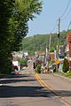
Houses in Glen Lyon
|
|

Glen Lyon, Pennsylvania
Location in Pennsylvania

Glen Lyon, Pennsylvania
Location in the United States
|
|
| Country | United States |
| State | Pennsylvania |
| County | Luzerne |
| Township | Newport |
| Area | |
| • Total | 3.4 sq mi (8.8 km2) |
| • Land | 3.4 sq mi (8.7 km2) |
| • Water | 0.08 sq mi (0.2 km2) |
| Population
(2010)
|
|
| • Total | 1,873 |
| • Density | 551/sq mi (212.8/km2) |
| Time zone | UTC-5 (Eastern (EST)) |
| • Summer (DST) | UTC-4 (EDT) |
| ZIP code |
18617
|
| Area code(s) | 570 |
Glen Lyon is a census-designated place (CDP) in Newport Township, Luzerne County, Pennsylvania, United States. The population was 1,873 at the 2010 census.
Geography
Glen Lyon is located at 41°10′32″N 76°4′28″W / 41.17556°N 76.07444°W (41.175582, -76.074556).
According to the United States Census Bureau, the CDP has a total area of 3.4 square miles (8.8 km2), of which 3.3 square miles (8.5 km2) is land and 0.1 square miles (0.26 km2), or 2.05%, is water.
Demographics
As of the census of 2000, there were 1,881 people, 828 households, and 494 families residing in the CDP. The population density was 563.5 people per square mile (217.4/km2). There were 1,089 housing units at an average density of 326.3/sq mi (125.9/km2). The racial makeup of the CDP was 97.98% White, 1.49% African American, 0.21% Asian, and 0.32% from two or more races. Hispanic or Latino of any race were 0.37% of the population.
There were 828 households, out of which 26.8% had children under the age of 18 living with them, 38.9% were married couples living together, 15.2% had a female householder with no husband present, and 40.3% were non-families. 34.7% of all households were made up of individuals, and 20.4% had someone living alone who was 65 years of age or older. The average household size was 2.27 and the average family size was 2.89.
In the CDP, the population was spread out, with 23.0% under the age of 18, 9.1% from 18 to 24, 28.6% from 25 to 44, 20.5% from 45 to 64, and 18.8% who were 65 years of age or older. The median age was 37 years. For every 100 females, there were 92.5 males. For every 100 females age 18 and over, there were 84.8 males.
The median income for a household in the CDP was $24,271, and the median income for a family was $36,250. Males had a median income of $28,576 versus $20,323 for females. The per capita income for the CDP was $13,753. About 16.9% of families and 22.2% of the population were below the poverty line, including 35.0% of those under age 18 and 16.2% of those age 65 or over.
History
The town of Glen Lyon was founded after anthracite coal mining began in that section of Newport Township ca. 1869. The colliery was operated by the Susquehannah Coal Company, a Pennsylvania Railroad property. The west side of the town was once called Morgantown; the east side, Williamstown. Later the railroad built Glen Lyon Station as its local terminus, and the town received that name. A part of the east side, separated from the rest by the railroad, became known as Canada. Roads and a streetcar line linked the town to Nanticoke and Wilkes-Barre. The streetcar line was replaced eventually by buses and automobiles as the main means of transport.
The two parts of the town were divided by a knuckle of hill on which Sixth Shaft was dug into the earth. Coal hoisted from that mine was moved across a bridge to the breaker (coal processing plant) built in 1887. Gravity moved the coal through processes of washing, removing rocks and sizing for different uses. The coal came out at north end of the breaker for loading into railroad cars and trucks. The Seventh Shaft colliery operated for some years west of town, linked to the breaker by a narrow gauge railroad. The town originally was developed by Welsh miners who were Protestants, usually members of the Methodist Church. There was a small Methodist church on Market Street. Later, immigrants from Central Europe (Poland, 35.1%) and Southern Europe became predominant. Two Polish Roman Catholic parishes, Saint Adalbert's and Saint Michael's, were founded in the late nineteenth century. Their churches were built on the west side of the breaker. Other European miners and their families belonged to Ukrainian or "Byzantine Rite" parishes on the east side of the town. A company-operated store existed for a time, but it closed in the 1920s. Commercial structures grew up on Nanticoke Street, later Main Street, providing food and supplies. Several neighborhood taverns existed throughout the town. Glen Lyon's miners were involved in unionization activities, culminating in their representation by the United Mine Workers.
Mining declined after the Second World War. The M. A. Hanna Company closed Seventh Shaft but retained Sixth Shaft and the breaker into the 1960s. The breaker stood idle for three years after closing finally in 1971. It burned overnight in October 1974. The death of the deep mines after the Knox Mine Disaster of 1959 also diminished the town. Some strip mining continued for years thereafter. Small dress factories provided employment, mostly for women, in the period when mining was in decline; but they too closed. Retirees formed a large portion of the population. The town was linked to markets for coal by truck even after rail shipments ceased. Many business closed as deep mining declined, and increasing numbers of houses stood vacant. The Roman Catholic churches were gradually consolidated, and St. Michael's was demolished (ca. 2004). St. Dennis, the "Irish" church, became a possession of the Knights of Columbus.
The 1948 film The Miracle of the Bells is nominally set in Glen Lyon, and some scenes were shot there.
 |
Hunlock Township, Union Township | Hunlock Creek | Newport Township, West Nanticoke | |
| Union Township, Shickshinny | Wanamie | |||
| Lee, Mocanaqua | Slocum Township | Slocum Corners |
Notable people
- Bob Duliba, baseball player
- Tess Gardella Broadway Entertainer
Images for kids
-
Glen Lyon from the east
-
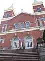
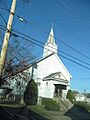
Church in Glen Lyon
-
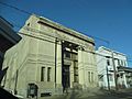
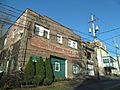
Bank in Glen Lyon
-
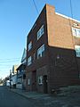
Glen Lyon
-
Church in Glen Lyon
-
Glen Lyon

.jpg)
.jpg)
.jpg)
.jpg)
.jpg)
See also
 In Spanish: Glen Lyon para niños
