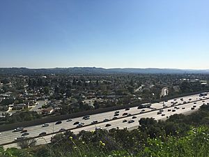
Glendora, California facts for kids
Quick facts for kids
Glendora, California
|
||
|---|---|---|
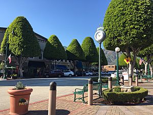
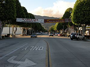
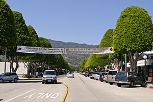
Glendora Village with its famous Ficus trees
|
||
|
||
| Motto(s):
Pride of the Foothills
|
||
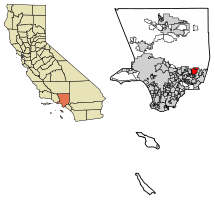
Location of Glendora in Los Angeles County, California.
|
||
| Country | ||
| State | ||
| County | ||
| Incorporated | November 13, 1911 | |
| Named for | Leadora Bennett Whitcomb | |
| Area | ||
| • Total | 19.66 sq mi (50.92 km2) | |
| • Land | 19.51 sq mi (50.52 km2) | |
| • Water | 0.15 sq mi (0.40 km2) 0.84% | |
| Elevation | 774 ft (236 m) | |
| Population
(2020)
|
||
| • Total | 52,558 | |
| • Density | 2,582/sq mi (996.9/km2) | |
| Time zone | UTC−8 (PST) | |
| • Summer (DST) | UTC−7 (PDT) | |
| ZIP Codes |
91740 and 91741
|
|
| Area codes | 626, 909 | |
| FIPS code | 06-30014 | |
| GNIS feature ID | 1652713 | |
Glendora is a city in the San Gabriel Valley in Los Angeles County, California, 26 miles (42 km) east of Los Angeles. As of the 2020 census, the population of Glendora was 52,558.
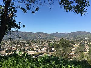
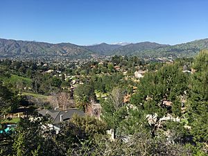
Known as the "Pride of the Foothills", Glendora is nestled in the foothills of the San Gabriel Mountains. Its downtown area, locally known as the Glendora Village, hosts dozens of restaurants, cafes, shops, and boutiques along Glendora Avenue with many community events scheduled throughout the year. It has been voted as one of the best and friendliest downtowns in the San Gabriel Valley for the last eight years. A suburban feel, low crime rates, and a consistently high-ranking school district has made the city an attractive choice for families in the region. Glendora was incorporated on November 13, 1911, the 25th city to achieve incorporation in Los Angeles County.
Neighborhoods and residences in Glendora reflect the city's history and range from Queen Annes, to Folk Victorians, early 20th-century bungalows, to ranch style homes, to mid-rise multi-family residential complexes, to modern mansions. Glendora's most expensive neighborhoods contain many very large, secluded, estate homes with views across the San Gabriel Valley to Downtown Los Angeles. Glendora is also home to the Glendora Country Club, which includes a Robert Trent Jones Sr. 18-hole golf course that has been played by many professional golfers.
Glendora is bordered by Azusa and the unincorporated community of Citrus to the west, San Dimas to the east and south, Covina and the unincorporated community of Charter Oak to the south, and the San Gabriel Mountains range to the north.
Contents
History
Ygnacio Palomares received the 22,000-acre (89 km2) land grant Rancho San Jose from Governor Juan Bautista Alvarado in 1837. The land included the present day cities of Pomona, Claremont, La Verne, San Dimas, and Glendora.
Located at the foot of the San Gabriel Mountains, modern Glendora was founded on April 1, 1887 by George D. Whitcomb who moved to California from Illinois in the early 1880s. Whitcomb was the founder of the Whitcomb Locomotive Works in Chicago and Rochelle, Illinois. He devised the name Glendora by combining the name of his wife, Leadora Bennett Whitcomb, with the location of his home in a glen of the San Gabriel Mountains. Prior to its 1911 incorporation, Glendora's administrator officially occupied the office of President of Glendora.
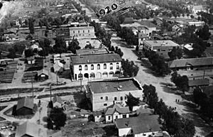
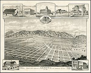
The downtown area as it appears now is the product of years of renovation and maintenance by the city. There once stood a movie theatre, various banks, and playhouses downtown but all were converted into more modern commercial buildings. The original layout can be read about on the Downtown Glendora Historical Walk, by reading placards placed along Glendora Avenue (previously called Michigan Avenue). The original townsite was bounded by Sierra Madre Avenue on the north, Minnesota Avenue on the east, Ada Avenue, & the railroad on the south, & Pennsylvania Avenue on the west.
Glendora used to be home to many military academies, which have since been converted into either churches or private school facilities. These academies included Brown Military Academy, now St. Lucy's Priory High School and Church of the Open Door on Sierra Madre, and Harding Military Academy, whose property is now home to North Glendora Private, a prestigious private community adjacent to Easley Canyon atop Glendora Avenue.
From 1960 to 1978, Glendora was home to Clokey Productions which produced 85 episodes of Gumby and 65 episodes of Davey and Goliath in town. In celebration of this history, Glendora hosted the first Gumby Fest in 2014 which brought thousands of people from around the country and Canada. In 2015 the 2nd GumbyFest was held at Citrus College over an entire weekend.
Several wildfires have affected the city in recent years, the most notable being the Colby Fire, which displaced hundreds of Glendora residents. A relief concert titled "Glendora Band Aid" was held shortly after the fire to help raise funds to assist the homeowners who lost their homes in the fire.
Glendora has an active Chamber of Commerce, established in 1903. The mission of the Glendora Chamber is to provide tools and resources to assist the business community in prospering and adapting to the economic climate, while growing membership and promoting local purchasing.
Geography
Glendora is located at 34°7′51″N 117°51′15″W / 34.13083°N 117.85417°W (34.130957, -117.854127). The city lies in the eastern end of the San Gabriel Valley between the San Gabriel Mountains range to the north and the South Hills to the south.
According to the United States Census Bureau, the city has a total area of 19.6 square miles (51 km2), of which 19.4 square miles (50 km2) is land and 0.2 square miles (0.52 km2), or 0.84%, is water.
Climate
| Climate data for Glendora, California (1981–2010 normals) | |||||||||||||
|---|---|---|---|---|---|---|---|---|---|---|---|---|---|
| Month | Jan | Feb | Mar | Apr | May | Jun | Jul | Aug | Sep | Oct | Nov | Dec | Year |
| Average high °F (°C) | 68 (20) |
69 (21) |
71 (22) |
76 (24) |
79 (26) |
84 (29) |
90 (32) |
92 (33) |
89 (32) |
80 (27) |
74 (23) |
68 (20) |
78 (26) |
| Average low °F (°C) | 43 (6) |
45 (7) |
47 (8) |
49 (9) |
54 (12) |
58 (14) |
62 (17) |
62 (17) |
60 (16) |
55 (13) |
47 (8) |
42 (6) |
52 (11) |
| Average precipitation inches (mm) | 3.78 (96) |
4.76 (121) |
2.66 (68) |
1.20 (30) |
.33 (8.4) |
.09 (2.3) |
.01 (0.25) |
.03 (0.76) |
.18 (4.6) |
1.05 (27) |
1.62 (41) |
2.45 (62) |
18.16 (461) |
Demographics
| Historical population | |||
|---|---|---|---|
| Census | Pop. | %± | |
| 1930 | 2,761 | — | |
| 1940 | 2,822 | 2.2% | |
| 1950 | 3,988 | 41.3% | |
| 1960 | 20,752 | 420.4% | |
| 1970 | 31,380 | 51.2% | |
| 1980 | 38,500 | 22.7% | |
| 1990 | 47,828 | 24.2% | |
| 2000 | 49,415 | 3.3% | |
| 2010 | 50,073 | 1.3% | |
| 2020 | 52,558 | 5.0% | |
| U.S. Decennial Census | |||
2020
As of the census of 2020, there were 52,558 people, 16,887 households, and 3.01 persons per household residing in the city. The population density was 2,582 inhabitants per square mile (996.9/km2). The racial makeup of the city was 70.4% White (47.9% Non-Hispanic White), 1.9% Black or African American, 0.6% Native American, 11.6% Asian, 0.3% Pacific Islander, and 7.2% from two or more races. 34.4% of the population were Hispanic or Latino of any race.
According to the 2020 United States Census, Glendora had a median household income of $96,132, with 8.3% of the population living below the federal poverty line.
2010
As of the census of 2010, there were 50,073 people, 16,819 households, and 12,866 families residing in the city. The population density was 2,581.5 inhabitants per square mile (996.8/km2). There were 17,145 housing units at an average density of 895.7 per square mile (345.9/km2). The racial makeup of the city was 75.1% White (57.0% Non-Hispanic White), 1.9% Black or African American, 0.7% Native American, 8.0% Asian, 0.1% Pacific Islander, 5.2% from other races, and 4.8% from two or more races. 30.7% of the population were Hispanic or Latino of any race.
There were 16,819 households, out of which 38.6% had children under the age of 18 living with them, 60.1% were married couples living together, 12.1% had a female householder with no husband present, and 23.5% were non-families. 19.1% of all households were made up of individuals, and 7.9% had someone living alone who was 65 years of age or older. The average household size was 2.88 and the average family size was 3.30.
In the city, the age of the population was diverse, with 27.6% under the age of 18, 7.6% from 18 to 24, 29.1% from 25 to 44, 23.2% from 45 to 64, and 12.5% who were 65 years of age or older. The median age was 37 years. For every 100 females, there were 93.2 males. For every 100 females age 18 and over, there were 89.6 males.
According to the 2010 United States Census, Glendora had a median household income of $74,615, with 7.8% of the population living below the federal poverty line. More recently, the L.A. Times estimated the median household income at $81,336 based on updated figures from the U.S. Census and SCAG.
Culture and Recreation
Cultural Facilities
- Haugh Performing Arts Center
- Glendora Historical Society Museum
- Rubel Castle, constructed by Michael Rubel.
- Glendora Public Library
Festivals
- Summer Concerts in the Park
- Glendora Annual Chalk Fest
- Earth Festival
- Heritage Festival
- Halloween Carnival
- Glendora Christmas Parade
- Gumby Annual Fest
Parks and Trails
Glendora is an active community and it has an extensive system of parks, trails, and recreational programs for the community.
- Big Dalton Canyon Wilderness Park and campground
- Centennial Heritage Park - The site was constructed to depict a late 19th-century to early 20th-century citrus ranch and features the Hamilton House, the Orton Englehart workshop, a working print shop, and numerous antique farm implements.
- Finkbiner Park
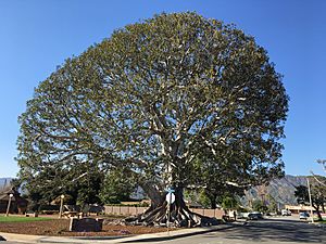
- Big Tree Park - Small park with a majestic 140 years old Moreton Bay Fig tree.
- Louie Pompei Memorial Sports Park
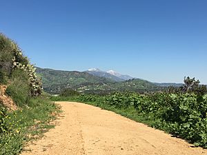
- South Hills Park and wilderness trail
- Colby Trail
- Lower Monroe Truck Trail - Hiking and mountain biking trail.
- Punk Out Trail
- Mystic Canyon Trail
- Glen Oaks Golf and Learning Center - Offers a driving range, instructional services, practice area, and the 9-hole Par 3 course itself.
- Camp Cahuilla Summer Camp ("Dirt Camp") - One of the most popular of the Parks and Recreation programs offering activities to more than 500 children every summer.
The Glendora Mountain Road is also a popular road for cyclists and sightseers offering spectacular views through the San Gabriel Mountains.
Transportation
Public transit
Glendora is served by Foothill Transit which provides connections through the city and express service to downtown Los Angeles. The Metro L Line termini station at APU/Citrus College in the adjacent city of Azusa also provides a transit link to the Metro system of trains and buses. A future extension of the L Line, from its current termini in Azusa to the City of Montclair in San Bernardino County, will include a station in Glendora to be located in the southeast corner of the intersection of Ada Avenue and Vermont Avenue. The station is not expected to be in service until 2026. When it opens, the rail line will be renamed the A Line per Metro's new naming convention and will connect to the former Blue Line via the new Regional Connector in downtown Los Angeles. It will provide a "one-seat ride" (no transfers) to the Financial District of Los Angeles and downtown Long Beach.
Glendora also runs its own weekday transportation shuttle service, the Glendora Mini Bus, with shuttles serving the Metrolink Commuter Rail Station in nearby Covina, the APU/Citrus College Metro station, and an inter-school service connecting some of the city's schools. The Mini Bus also provides curb-to-curb transportation services for senior and disabled residents of Glendora.
Freeways and highways
Glendora lies at the intersection of two major freeways, the 210 and the 57, in what was formerly known as the Glendora Curve. These two freeways conveniently connect the city with the rest of the Southern California region. Historic U.S. Route 66 also traverses the city from east to west and it is an important corridor for businesses. Other major roads and highways include Foothill Boulevard, Grand Avenue, Arrow Highway, and Lone Hill Avenue.
Airports
There are no airports within the city limits. Glendora is within forty-five miles from all major area airports including Los Angeles International Airport (LAX), Hollywood Burbank Airport (BUR), Ontario International Airport (ONT), Long Beach Airport (LGB), and John Wayne Airport (SNA) in Orange County.
Sister cities
 Moka, Japan
 Mérida, Yucatán, Mexico
Economy
Top employers
According to the city's 2018 Comprehensive Annual Financial Report, the top employers in the city are:
| Rank | Employer | # of Employees |
|---|---|---|
| 1 | Citrus College | 807 |
| 2 | Glendora Unified School District | 798 |
| 3 | LA County Department of Children and Family Services | 600 |
| 4 | Foothill Presbyterian Hospital | 653 |
| 5 | Glendora Grand | 350 |
| 6 | Ormco Corporation | 350 |
| 7 | Walmart | 416 |
| 8 | Glendora Community Hospital | 334 |
| 9 | City of Glendora | 245 |
| 10 | Sam's Club | 196 |
Education
The city has two public school districts: Glendora Unified and Charter Oak Unified School Districts. These school districts are considered two of the best in the state and the country, consistently ranking in the top performing brackets. Both districts have schools designated as California Distinguished Schools and Gold Ribbon Schools.
Elementary schools
- Cullen Elementary School
- La Fetra Elementary School
- Sellers Elementary School
- Stanton Elementary School
- Sutherland Elementary School
- Washington Elementary School (COUSD)
- Willow Elementary School (COUSD)
Middle schools
- Goddard Middle School
- Sandburg Middle School
High schools
- Glendora High School
Continuation high schools
- Arrow Continuation High School (COUSD)
- Whitcomb Continuation High School
Private schools
- Hope Lutheran Church and School – Preschool through 8th-grade boys and girls school
- Foothill Christian School – Preschool through 8th-grade boys and girls school
- St. Lucy's Priory High School – All girls college-prep high school
- St. Dorothy School – Kindergarten through 8th grade boys and girls school
Universities and colleges
- Citrus College
Notable people
Notable people who live or have lived in Glendora, California include:
- Steven Barnes, science fiction and mystery author, and writer
- Chris Casamassa – martial artist
- Bryan Clay – Olympic gold medalist
- Rocky Dennis – subject of the biographical film Mask
- Soleil Moon Frye – Punky Brewster actress
- Ron Gallemore – neurosurgeon
- Casey Jacobsen – basketball player
- David Klein – inventor of Jelly Belly candy
- D. Wayne Lukas – racehorse trainer
- Gabrial McNair – No Doubt keyboardist
- José Mota – Spanish radio announcer for the Anaheim Angels and son of Manny Mota
- Tracy Murray – former basketball player
- Anna Nalick – singer
- Vince Neil – singer
- Adam Plutko - baseball player
- Sally Rand – actress and dancer
- Tony Robbins – motivational speaker
- Aaron Rowand – baseball player
- Misty Rowe – actress on Hee Haw
- Julie Smith – Olympic gold medalist
- Lynsi Snyder – owner of In-N-Out Burger
- Alex Solis – jockey
- Woody Strode – actor, American football player
- The Surfaris – surf music band
- Douglas F. Tessitor – mayor 2006-7
- Deontay Wilder - World Heavy Weight Champion 2015-2020
- George Dexter Whitcomb – founder of Glendora
- Shawn Wooten – baseball player
- DJ Peters – baseball player
Images for kids
See also
 In Spanish: Glendora (California) para niños


