Google Maps facts for kids
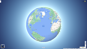
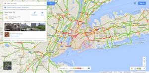
Screenshot of Google Maps in a web browser
|
|
|
Type of site
|
Web mapping |
|---|---|
| Available in | Afrikaans, Azerbaijani, Indonesian, Malay, Bosnian, Catalan, Czech, Danish, German (Germany), Estonian, English (United States), Spanish (Spain), Spanish (Latin America), Basque, Filipino, French (France), Galician, Croatian, Zulu, Icelandic, Italian, Swahili, Latvian, Lithuanian, Hungarian, Dutch, Norwegian, Uzbek, Polish, Portuguese (Brazil), Portuguese (Portugal), Romanian, Albanian, Slovak, Slovenian, Finnish, Swedish, Vietnamese, Turkish, Greek, Bulgarian, Kyrgyz, Kazakh, Macedonian, Mongolian, Russian, Serbian, Ukrainian, Georgian, Armenian, Hebrew, Urdu, Arabic, Persian, Amharic, Nepali, Hindi, Marathi, Bengali, Punjabi, Gujarati, Tamil, Telugu, Kannada, Malayalam, Sinhala, Thai, Lao, Burmese, Khmer, Korean, Japanese, Simplified Chinese, Traditional Chinese |
| Owner | |
| Commercial | Yes |
| Registration | Optional, included with a Google Account |
| Launched | February 8, 2005 |
| Current status | Active |
| Written in | C++ (back-end), JavaScript, XML, Ajax (UI) |
Google Maps is a web mapping platform and consumer application offered by Google. It offers satellite imagery, aerial photography, street maps, 360° interactive panoramic views of streets (Street View), real-time traffic conditions, and route planning for traveling by foot, car, bike, air (in beta) and public transportation. As of 2020[update], Google Maps was being used by over one billion people every month around the world.
Google Maps began as a C++ desktop program developed by brothers Lars and Jens Rasmussen at Where 2 Technologies. In October 2004, the company was acquired by Google, which converted it into a web application. After additional acquisitions of a geospatial data visualization company and a real-time traffic analyzer, Google Maps was launched in February 2005. The service's front end utilizes JavaScript, XML, and Ajax. Google Maps offers an API that allows maps to be embedded on third-party websites, and offers a locator for businesses and other organizations in numerous countries around the world. Google Map Maker allowed users to collaboratively expand and update the service's mapping worldwide but was discontinued from March 2017. However, crowdsourced contributions to Google Maps were not discontinued as the company announced those features would be transferred to the Google Local Guides program.
Google Maps' satellite view is a "top-down" or bird's-eye view; most of the high-resolution imagery of cities is aerial photography taken from aircraft flying at 800 to 1,500 feet (240 to 460 m), while most other imagery is from satellites. Much of the available satellite imagery is no more than three years old and is updated on a regular basis, according to a 2011 report. Google Maps previously used a variant of the Mercator projection, and therefore could not accurately show areas around the poles. In August 2018, the desktop version of Google Maps was updated to show a 3D globe. It is still possible to switch back to the 2D map in the settings.
Google Maps for Android and iOS devices was released in September 2008 and features GPS turn-by-turn navigation along with dedicated parking assistance features. By 2013, it was found to be the world's most popular smartphone app, with over 54% of global smartphone owners using it. In 2017, the app was reported to have two billion users on Android, along with several other Google services including YouTube, Chrome, Gmail, Search, and Google Play.
Functionality
Directions and transit
Google Maps provides a route planner, allowing users to find available directions through driving, public transportation, walking, or biking. Google has partnered globally with over 800 public transportation providers to adopt GTFS (General Transit Feed Specification), making the data available to third parties. The app can indicate users' transit route, thanks to an October 2019 update. The incognito mode, eyes-free walking navigation features were released earlier. A July 2020 update provided bike share routes.
Traffic conditions
In 2007, Google began offering traffic data as a colored overlay on top of roads and motorways to represent the speed of vehicles on particular roads. Crowdsourcing is used to obtain the GPS-determined locations of a large number of cellphone users, from which live traffic maps are produced.
Google has stated that the speed and location information it collects to calculate traffic conditions is anonymous. Options available in each phone's settings allow users not to share information about their location with Google Maps. Google stated, "Once you disable or opt out of My Location, Maps will not continue to send radio information back to Google servers to determine your handset's approximate location".
Street View
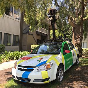
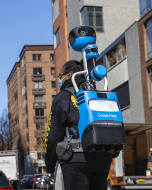
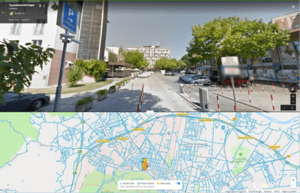
On May 25, 2007, Google released Google Street View, a feature of Google Maps providing 360° panoramic street-level views of various locations. On the date of release, the feature only included five cities in the U.S. It has since expanded to thousands of locations around the world. In July 2009, Google began mapping college campuses and surrounding paths and trails.
Street View garnered much controversy after its release because of privacy concerns about the uncensored nature of the panoramic photographs, although the views are only taken on public streets. Since then, Google has blurred faces and license plates through automated facial recognition.
In late 2014, Google launched Google Underwater Street View, including 2,300 kilometres (1,400 mi) of the Australian Great Barrier Reef in 3D. The images are taken by special cameras which turn 360 degrees and take shots every 3 seconds.
In 2017, in both Google Maps and Google Earth, Street View navigation of the International Space Station interior spaces became available.
Immersive View
It was announced at the Google I/O 2022 event that 3D images would be created using Street View. It was to be initially in five cities worldwide, with plans to add it to other cities later on.
Immersive View was to be available initially in the following locations:
| Country | Locations |
|---|---|
| Tokyo | |
| London | |
| Los Angeles, New York City, San Francisco |
Landmark Icons
Google added icons of city attractions like on Apple Maps on October 3, 2019. In the first stage, such icons were added to 9 cities.
Landmark Icons was to be available initially in the following locations:
| Locations | Country | City attractions |
|---|---|---|
| Amsterdam | Anne Frank House, Het Scheepvaartmuseum, Magna Plaza, NEMO, Oude Kerk, Rembrandt House Museum, Rijksmuseum, Royal Palace of Amsterdam, Stedelijk Museum Amsterdam, Van Gogh Museum | |
| Bangkok | Asiatique, Jim Thompson House, Yaowarat Chinatown Heritage Center, Wat Arun, Wat Benchamabophit, Wat Pho, Wat Phra Kaew, Wat Saket | |
| Barcelona | Camp Nou, Casa Milà, Plaça de Catalunya, Sagrada Família | |
| Berlin | Berlin Cathedral, Brandenburg Gate, Fernsehturm Berlin, Kaiser Wilhelm Memorial Church, Memorial to the Murdered Jews of Europe, Pergamon Museum, Reichstag building, The Wall Museum, Victory Column | |
| Budapest | Buda Castle, Great Market Hall, Heroes' Square, Hungarian Parliament, Hungarian State Opera House, Matthias Church, St. Stephen's Basilica | |
| Dubai | Burj Khalifa, Dubai Frame, Dubai Museum, Jumeirah Mosque, The Dubai Fountain | |
| Florence | Florence Cathedral, Palazzo Pitti, Santa Croce | |
| Istanbul | Sultan Abdul Samad Building, Blue Mosque, Chora Church, Dolmabahçe Palace, Galata Tower, Hagia Sophia, Maiden's Tower, Topkapı Palace | |
| Kuala Lumpur | Batu Caves, Independence Square, Islamic Arts Museum Malaysia, Jamek Mosque, Kuala Lumpur Tower, National Mosque of Malaysia, Petronas Towers, Thean Hou Temple | |
| Kyoto | Heian Shrine, Ginkaku-ji, Kinkaku-ji, Kiyomizu-dera, Kyoto Imperial Palace, Kyoto Tower, Nanzen-ji, Nijō Castle, Tenryū-ji, Tō-ji, Yasaka Shrine | |
| London | Big Ben, British Museum, Buckingham Palace, Kensington Palace, London Eye, St Paul's Cathedral, Tower of London, Westminster Abbey | |
| Los Angeles | Getty Center, Getty Villa, Grauman's Chinese Theatre, Griffith Observatory, Los Angeles County Museum of Art, Santa Monica Pier, Walt Disney Concert Hall | |
| Madrid | Almudena Cathedral, Madrid Royal Conservatory, Museo del Prado, Palacio de Cristal del Retiro, Plaza de España, Plaza Mayor, Puerta de Alcalá, Santiago Bernabéu Stadium | |
| Milan | Basilica of San Lorenzo, Basilica of Sant'Ambrogio, Castello Sforzesco, Galleria Vittorio Emanuele II, La Scala, Milan Cathedral, Pinacoteca di Brera, Royal Palace of Milan, Santa Maria delle Grazie | |
| Mumbai | Basilica of Our Lady of the Mount, Gateway of India, Global Vipassana Pagoda, Haji Ali Dargah, Siddhivinayak Temple | |
| Munich | Alte Pinakothek, BMW Welt, Frauenkirche, Hofbräuhaus am Platzl, Munich Residenz, New Town Hall, Nymphenburg Palace, Olympiapark, St. Peter's Church | |
| New York City | Empire State Building, Flatiron Building, One World Trade Center, Rockefeller Center, Solomon R. Guggenheim Museum, St. Patrick's Cathedral, Statue of Liberty | |
| Osaka | Osaka Aquarium Kaiyukan, Osaka Castle, Osaka Science Museum, Osaka Tenmangū, Sumiyoshi Taisha, Tower of the Sun, Tsūtenkaku, Umeda Sky Building | |
| Paris | Arc de Triomphe, Eiffel Tower, Les Invalides, Louvre, Notre-Dame de Paris, Palais Garnier, Panthéon, Place de la Concorde, Sacré-Cœur, Sainte-Chapelle | |
| Prague | Church of Our Lady before Týn, Dancing House, National Museum, Petřín Lookout Tower, Powder Tower, Prague Astronomical Clock, Prague Castle, Vyšehrad | |
| Rome | Campitelli, Castel Sant'Angelo, Colosseum, Pantheon, Piazza Navona, Piazza Venezia, Roman Forum, Santa Maria Maggiore, Trevi Fountain | |
| San Francisco | Alcatraz Island, Coit Tower, Painted ladies, Palace of Fine Arts, San Francisco Ferry Building, Transamerica Pyramid | |
| Sydney | Museum of Contemporary Art Australia, Sea Life Sydney Aquarium, St Mary's Cathedral, Sydney Observatory, Sydney Opera House, Sydney Town Hall | |
| Tokyo | Meiji Shrine, Roppongi Hills Mori Tower, Sensō-ji, Tokyo Imperial Palace, Tokyo National Museum, Tokyo Skytree, Tokyo Tower | |
| Vatican | St. Peter's Basilica | |
| Vienna | Albertina, Belvedere, Hofburg Place, Karlskirche, Kunsthistorisches Museum, Schönbrunn Palace, Vienna City Hall, Vienna State Opera, Wiener Riesenrad |
45° imagery
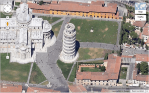
In December 2009, Google introduced a new view consisting of 45° angle aerial imagery, offering a "bird's-eye view" of cities. The first cities available were San Jose and San Diego. This feature was initially available only to developers via the Google Maps API. In February 2010, it was introduced as an experimental feature in Google Maps Labs. In July 2010, 45° imagery was made available in Google Maps in select cities in South Africa, the United States, Germany and Italy.
Business listings
Google collates business listings from multiple on-line and off-line sources. Owners are encouraged to provide Google with Business information including; address, phone number, business category and photos. Google has staff in India who check and correct listings remotely as well as support businesses with issues. Google also has teams on the ground in most countries that validate physical addresses in person. After the business listing has been verified, business owners can further optimize their profile by logging into their Google account and GMB dashboard. In mid-August 2020 Google made it more convenient for business owners to edit their business profile directly from search, simply by typing the word My business or their company name. Google Business Profile, formerly Google My Business allows businesses to create a website for free.
Genuine business owners can also optimize their business listings to gain greater visibility in Google Maps, through a type of search engine marketing called local search engine optimization.
Indoor maps
In March 2011, indoor maps were added to Google Maps, giving users the ability to navigate themselves within buildings such as airports, museums, shopping malls, big-box stores, universities, transit stations, and other public spaces (including underground facilities). Google encourages owners of public facilities to submit floor plans of their buildings in order to add them to the service. Map users can view different floors of a building or subway station by clicking on a level selector that is displayed near any structures which are mapped on multiple levels.
My Maps
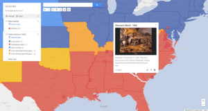
My Maps is a feature in Google Maps launched in April 2007 that enables users to create custom maps for personal use or sharing. Users can add points, lines, shapes, notes and images on top of Google Maps using a WYSIWYG editor. An Android app for My Maps, initially released in March 2013 under the name Google Maps Engine Lite, was available until its removal from the Play Store in October 2021.
Google Local Guides
Google Local Guides is a volunteer program launched by Google Maps to enable users to contribute to Google Maps when registered. It sometimes provides them additional perks and benefits for their collaboration. Users can achieve Level 1 to 10, and be awarded with badges. The program is partially a successor to Google Map Maker as features from the former program became integrated into the website and app.
The program consists of adding reviews, photos, basic information, and videos; and correcting information such as wheelchair accessibility. Adding reviews, photos, videos, new places, new roads or providing useful information gives points to the users. The level of users is upgraded when they get a certain amount of points. Starting with Level 4, a star is shown near the avatar of the user.
Timelapse
Earth Timelapse, released in April 2021, is a program in which users can see how the earth has been changed in the last 37 years. They combined the 15 million satellite images (roughly ten quadrillion pixels) to create the 35 global cloud-free Images for this program.
Implementation
As the user drags the map, the grid squares are downloaded from the server and inserted into the page. When a user searches for a business, the results are downloaded in the background for insertion into the side panel and map; the page is not reloaded. A hidden iframe with form submission is used because it preserves browser history. Like many other Google web applications, Google Maps uses JavaScript extensively. The site also uses protocol buffers for data transfer rather than JSON, for performance reasons.
The version of Google Street View for classic Google Maps required Adobe Flash. In October 2011, Google announced MapsGL, a WebGL version of Maps with better renderings and smoother transitions. Indoor maps use JPG, .PNG, .PDF, .BMP, or .GIF, for floor plans.
Users who are logged into a Google Account can save locations so that they are overlaid on the map with various colored "pins" whenever they browse the application. These "Saved places" can be organized into default groups or user named groups and shared with other users. "Starred places" is one default group example. It previously automatically created a record within the now-discontinued product Google Bookmarks.
Map data and imagery
The Google Maps terms and conditions state that usage of material from Google Maps is regulated by Google Terms of Service and some additional restrictions. Google has either purchased local map data from established companies, or has entered into lease agreements to use copyrighted map data. The owner of the copyright is listed at the bottom of zoomed maps. For example, street maps in Japan are leased from Zenrin. Street maps in China are leased from AutoNavi. Russian street maps are leased from Geocentre Consulting and Tele Atlas. Data for North Korea is sourced from the companion project Google Map Maker.
Street map overlays, in some areas, may not match up precisely with the corresponding satellite images. The street data may be entirely erroneous, or simply out of date: "The biggest challenge is the currency of data, the authenticity of data," said Google Earth representative Brian McClendon. As a result, in March 2008 Google added a feature to edit the locations of houses and businesses.
Restrictions have been placed on Google Maps through the apparent censoring of locations deemed potential security threats. In some cases the area of redaction is for specific buildings, but in other cases, such as Washington, D.C., the restriction is to use outdated imagery.
Google Maps API
Google Maps API, now called Google Maps Platform, hosts about 17 different APIs, which are themed under the following categories: Maps, Places and Routes.
After the success of reverse-engineered mashups such as chicagocrime.org and housingmaps.com, Google launched the Google Maps API in June 2005 to allow developers to integrate Google Maps into their websites. It was a free service that didn't require an API key until June 2018 (changes went into effect on July 16), when it was announced that an API key linked to a Google Cloud account with billing enabled would be required to access the API. The API currently[update] does not contain ads, but Google states in their terms of use that they reserve the right to display ads in the future.
By using the Google Maps API, it is possible to embed Google Maps into an external website, onto which site-specific data can be overlaid. Although initially only a JavaScript API, the Maps API was expanded to include an API for Adobe Flash applications (but this has been deprecated), a service for retrieving static map images, and web services for performing geocoding, generating driving directions, and obtaining elevation profiles. Over 1,000,000 web sites use the Google Maps API, making it the most heavily used web application development API. In September 2011, Google announced it would deprecate the Google Maps API for Flash.
The Google Maps API was free for commercial use, provided that the site on which it is being used is publicly accessible and did not charge for access, and was not generating more than 25,000 map accesses a day. Sites that did not meet these requirements could purchase the Google Maps API for Business.
As of June 21, 2018, Google increased the prices of the Maps API and requires a billing profile.
Google Maps in China
Due to restrictions on geographic data in China, Google Maps must partner with a Chinese digital map provider in order to legally show Chinese map data. Since 2006, this partner has been AutoNavi.
Mobile app
| Original author(s) | |
|---|---|
| Initial release | September 23, 2008 |
| Operating system | |
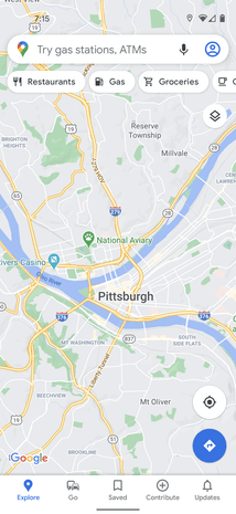
Google Maps is available as a mobile app for the Android and iOS mobile operating systems. The Android app was first released in September 2008, though the GPS-localization feature had been in testing on cellphones since 2007. Up until iOS 6, the built-in maps application on the iOS operating system was powered by Google Maps. However, with the announcement of iOS 6 in June 2012, Apple announced that they had created their own Apple Maps mapping service, which officially replaced Google Maps when iOS 6 was released on September 19, 2012. However, at launch, Apple Maps received significant criticism from users due to inaccuracies, errors and bugs. One day later, The Guardian reported that Google was preparing its own Google Maps app, which was released on December 12, 2012. Within two days, the application had been downloaded over ten million times.
Features
The Google Maps apps for iOS and Android have many of the same features, including turn-by-turn navigation, street view, and public transit information. Turn-by-turn navigation was originally announced by Google as a separate beta testing app exclusive to Android 2.0 devices in October 2009. The original standalone iOS version did not support the iPad, but tablet support was added with version 2.0 in July 2013. An update in June 2012 for Android devices added support for offline access to downloaded maps of certain regions, a feature that was eventually released for iOS devices, and made more robust on Android, in May 2014.
At the end of 2015 Google Maps announced its new offline functionality, but with various limitations – downloaded area cannot exceed 120,000 square kilometers and require a considerable amount of storage space. In January 2017, Google added a feature exclusively to Android that will, in some U.S. cities, indicate the level of difficulty in finding available parking spots, and on both Android and iOS, the app can, as of an April 2017 update, remember where users parked. In August 2017, Google Maps for Android was updated with new functionality to actively help the user in finding parking lots and garages close to a destination. In December 2017, Google added a new two-wheeler mode to its Android app, designed for users in India, allowing for more accessibility in traffic conditions. In 2019 the Android version introduced the new feature called live view that allows to view directions directly on the road thanks to augmented reality Google Maps won the 2020 Webby Award for Best User Interface in the category Apps, Mobile & Voice. In March 2021, Google added a feature in which users can draw missing roads. In June 2022, Google implemented support for toll calculation. Both iOS and Android apps report how much the user has to pay in tolls when a route that includes toll roads is input. The feature is available for roads in the USA, India, Japan and Indonesia with further expansion planned. As per reports the total number of toll roads covered in this phase is around 2000.
Go version
Google Maps Go, a version of the app designed for lower-end devices, was released in beta in January 2018. By September 2018, the app had over 10 million installations.
Artistic and literary uses
The German "geo-novel" Senghor on the Rocks (2008) told the story as a series of spreads showing a Google map location on the left and text telling the story on the right. Annika Richterich explains that the "satellite pictures in Senghor on the Rocks illustrate the main character’s travel through the West-African state of Senegal".
Artists have used Google StreetView in a range of ways. Emilio Vavarella's The Google Trilogy includes glitchy images and unintended portraits of the drivers of the Street View cars. The Japanese band group inou used Google StreetView backgrounds to make a music video for their song EYE. The US band Arcade Fire made a customized music video that used StreetView to show the viewer their own childhood home.
See also
 In Spanish: Terremoto de Taiwán de 2024 para niños
- OpenStreetMap
- Wikimapia, a mashup combining Google Maps and a wiki aimed at "describing the whole planet earth"


