Goose Gap facts for kids
Quick facts for kids Goose Gap |
|
|---|---|

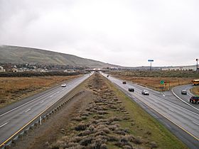
Interstate 182 approaching Goose Gap.
|
|
| Elevation | 860 ft (262 m) |
| Traversed by | |
| Location | Benton County, Washington |
| Range | Yakima Fold Belt |
| Coordinates | 46°14′42″N 119°21′26″W / 46.24500°N 119.35722°W |
Goose Gap is a small pass connecting Badger Mountain to Candy Mountain to the west of Richland, Washington. It lies significantly higher than most of the Tri-Cities and is crossed by Interstate 182 just after its western terminus. An average of 18,000 people cross Goose Gap daily.
There are residential areas on both sides of I-182 to the east of the gap, but to the west is mostly agriculture. The non-profit organization Friends of Badger Mountain is planning a new hiking trail to connect Badger Mountain to Candy Mountain, which will cross Goose Gap in a north-to-south direction, perpendicular to the Interstate.

All content from Kiddle encyclopedia articles (including the article images and facts) can be freely used under Attribution-ShareAlike license, unless stated otherwise. Cite this article:
Goose Gap Facts for Kids. Kiddle Encyclopedia.