
Goovigen facts for kids
Quick facts for kids GoovigenQueensland |
|||||||||||||||
|---|---|---|---|---|---|---|---|---|---|---|---|---|---|---|---|

Slab hut in Goovigen, 1930 From Wikimedia Commons, the free media repository
|
|||||||||||||||

Goovigen
Location in Queensland
|
|||||||||||||||
| Population | 215 (2016 census locality) | ||||||||||||||
| • Density | 0.3811/km2 (0.987/sq mi) | ||||||||||||||
| Postcode(s) | 4702 | ||||||||||||||
| Area | 564.2 km2 (217.8 sq mi) | ||||||||||||||
| Time zone | AEST (UTC+10:00) | ||||||||||||||
| Location |
|
||||||||||||||
| LGA(s) | Shire of Banana | ||||||||||||||
| State electorate(s) | Callide | ||||||||||||||
| Federal Division(s) | Flynn | ||||||||||||||
|
|||||||||||||||
Goovigen is a rural town and locality in the Shire of Banana, Queensland, Australia. In the 2016 census the locality of Goovigen had a population of 215 people.
A second town, Rannes (24°05′55″S 150°07′12″E / 24.0986°S 150.12°E), is also within the locality of Goovigen, near its western boundary.
Koorngoo is a neighbourhood (24°10′00″S 150°19′00″E / 24.1666°S 150.3166°E) within the locality, just west of centre, based around a former railway station.
Contents
History
Goovigen was originally established as a supply depot for the railways and was named for the local Aboriginal word for box tree, a species of Eucalyptus.
Goovigen Post Office opened on 1 July 1927 (a receiving office had been open from 1925).
Economy
The town supports the surrounding agricultural district which produces cotton, cattle and grain.
There are a number of homesteads in the locality, including:
- Netley (24°08′10″S 150°19′30″E / 24.1360°S 150.3250°E)
- Smoky Creek (24°07′54″S 150°22′12″E / 24.1316°S 150.3699°E)
- Tomlin (24°03′37″S 150°21′50″E / 24.0604°S 150.3639°E)
- Wyalga Downs (24°05′17″S 150°13′57″E / 24.0880°S 150.2325°E)
Education
Goovigen State School is a government primary (Prep-6) school for boys and girls at Rannes Road (24°08′36″S 150°17′11″E / 24.1432°S 150.2864°E). In 2016 had an enrolment of 8 students. In 2018, the school had an enrolment of 6 students with 2 teachers (1 full-time equivalent) and 5 non-teaching staff (2 full-time equivalent).
There is no secondary school in Goovigen. The nearest secondary schools are Biloela State High School in Biloela to the south-east and Mount Morgan State High School in Mount Morgan to the north.
Images for kids
-
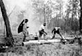
Firefighting in the Goovigen district, 1952

