
Grand Marais, Minnesota facts for kids
Quick facts for kids
Grand Marais
|
|
|---|---|

Lake Superior harbor in downtown Grand Marais
|
|

Location of the city of Grand Marais
within Cook County, Minnesota |
|
| Country | United States |
| State | Minnesota |
| County | Cook |
| Area | |
| • Total | 2.91 sq mi (7.53 km2) |
| • Land | 2.91 sq mi (7.53 km2) |
| • Water | 0.00 sq mi (0.00 km2) |
| Elevation | 617 ft (188 m) |
| Population
(2010)
|
|
| • Total | 1,351 |
| • Estimate
(2019)
|
1,357 |
| • Density | 466.48/sq mi (180.12/km2) |
| Time zone | UTC-6 (Central (CST)) |
| • Summer (DST) | UTC-5 (CDT) |
| ZIP code |
55604
|
| Area code(s) | 218 |
| FIPS code | 27-24992 |
| GNIS feature ID | 0656425 |
| Website | www.ci.grand-marais.mn.us |
Grand Marais is a city in Cook County, Minnesota, United States, on the North Shore of Lake Superior. It had a population of 1,351 at the 2010 census.[6] It is the county seat and sole municipality of Cook County.[7] Before it was settled by French Canadians and before Minnesota's statehood, Grand Marais was inhabited by the Anishinaabe indigenous people, also known as the Ojibwe. The Ojibwe name for the area is Gichi-biitoobiig,[8] which means "great duplicate water," "parallel body of water" or "double body of water" (like a bayou), a reference to the two bays that form this large harbor of Lake Superior.[9]
The area was a bustling fur trading station in the 1700s, and the French Canadian Voyageurs termed the settled village "Grand Marais" ("Great Marsh"), referring to a marsh that, in early fur-trading times, was 20 acres (8.1 ha) or less in area, nearly at the level of Lake Superior, and at the head of the little bay and harbor that led to the settlement of the village there. Another small bay on the east, less protected from storms, is separated from the harbor by a slight projecting point and a short beach. "Grand Marais" also may mean "sheltered water area", as the harbor has natural breakwall rock outcroppings, providing a natural safe harbor for early Lake Superior explorers.
To the east of Grand Marais is Chippewa City. Chippewa City thrived in the 1890s, with about 100 families living in the village. Francis Xavier church still stands slightly north of town, just off Highway 61. The church began as a Jesuit mission from Fort William, Ontario, in 1855 to minister to the Ojibwe in the area. The permanent structure was built in 1895 and was used until declining attendance forced it to close in 1936. The Cook County Historical Society restored the site between 1970 and 1974 and it was added to the National Register in 1986.
Grand Marais is a gateway to the Boundary Waters Canoe Area Wilderness (BWCAW), via the Gunflint Trail, historically a footpath for travelers and fur traders from inland lakes to Lake Superior. It is now County Road 12, a paved National Scenic Byway that begins in Grand Marais and ends at Saganaga Lake in the BWCAW, near the U.S. border with Ontario. It provides access to many of BWCAW's entry points.
The area is home to several nonprofit educational institutions, such as the Grand Marais Art Colony and the North House Folk School, and art galleries featuring the work of local and regional artists.[10]
On April 13, 2020, a large fire swept through downtown Grand Marais, destroying three buildings: The Crooked Spoon Cafe, White Pine North, and Picnic and Pine. The fire burned for over three hours in intense winds.
Contents
Geography
According to the United States Census Bureau, the city has a total area of 2.90 square miles (7.51 km2), all of it land. Grand Marais is located on the northwestern shore of Lake Superior in northeastern Minnesota. It is an entry point for the Boundary Waters Canoe Area Wilderness, situated at the beginning of the Gunflint Trail. The Superior Hiking Trail passes near Grand Marais, and Judge C. R. Magney State Park is nearby, with its unusual Devil's Kettle waterfalls.
The land surrounding Grand Marais slopes up to form the Sawtooth Bluff, a dramatic rock face visible from nearly any vantage point in the city. Adjacent to the bluff is Pincushion Mountain, a large bald monolith with dramatic views of Lake Superior and the inland wilderness.
Grand Marais Harbor is protected by Artist's Point, a barrier island formed by lava that was connected to the mainland by gravel deposited by lake currents, forming a tombolo. An Arctic–alpine disjunct community survives there.
Road access to Grand Marais is by Minnesota Highway 61, which heads northeast, following the shore of Lake Superior, and is known as the North Shore Scenic Drive. The Gunflint Trail (Cook County Road 12) begins in Grand Marais and heads northwest, away from the lake and into the Boundary Waters region.
Grand Marais is located 110 miles northeast of Duluth and 40 miles southwest of the Canada–US border.
Climate
Grand Marais has a warm-summer humid continental climate (Köppen Dfb), like the rest of northern Minnesota. Because of the moderating influence of Lake Superior, summer temperatures are cooler, winter temperatures warmer, and the seasonal temperature difference is smaller than locations farther inland. With average highs of a little over 70 °F (21 °C) in July and August, Grand Marais has the coolest summer temperatures of any weather station in Minnesota. The difference between the temperature of the warmest and coldest months is only 47.6 °F (26.4 °C), significantly smaller than 58.9 °F (32.7 °C), the seasonal temperature difference in Tower, Minnesota, about 90 miles (140 km) to the west. Despite being significantly farther north, Grand Marais lies in USDA hardiness zone 4b like Duluth and Minneapolis, with an average yearly minimum temperature of −23 °F (−31 °C).
| Climate data for Grand Marais, Minnesota (1981–2010 normals, extremes 1897-present) | |||||||||||||
|---|---|---|---|---|---|---|---|---|---|---|---|---|---|
| Month | Jan | Feb | Mar | Apr | May | Jun | Jul | Aug | Sep | Oct | Nov | Dec | Year |
| Record high °F (°C) | 52 (11) |
58 (14) |
67 (19) |
83 (28) |
88 (31) |
93 (34) |
99 (37) |
100 (38) |
90 (32) |
77 (25) |
67 (19) |
55 (13) |
100 (38) |
| Average high °F (°C) | 24.7 (−4.1) |
28.4 (−2.0) |
36.3 (2.4) |
47.4 (8.6) |
56 (13) |
63.6 (17.6) |
71.2 (21.8) |
72.1 (22.3) |
64.3 (17.9) |
52.1 (11.2) |
39.3 (4.1) |
28 (−2) |
48.7 (9.3) |
| Daily mean °F (°C) | 15.6 (−9.1) |
19.1 (−7.2) |
27.7 (−2.4) |
38.8 (3.8) |
47.0 (8.3) |
53.8 (12.1) |
61.5 (16.4) |
63.2 (17.3) |
55.8 (13.2) |
44.2 (6.8) |
32.3 (0.2) |
20.0 (−6.7) |
40.0 (4.4) |
| Average low °F (°C) | 6.5 (−14.2) |
9.9 (−12.3) |
19 (−7) |
30.1 (−1.1) |
37.9 (3.3) |
44 (7) |
51.7 (10.9) |
54.3 (12.4) |
47.4 (8.6) |
36.4 (2.4) |
25.2 (−3.8) |
12 (−11) |
31.3 (−0.4) |
| Record low °F (°C) | −34 (−37) |
−34 (−37) |
−24 (−31) |
−8 (−22) |
17 (−8) |
25 (−4) |
28 (−2) |
33 (1) |
23 (−5) |
6 (−14) |
−14 (−26) |
−27 (−33) |
−34 (−37) |
| Average precipitation inches (mm) | 0.81 (21) |
0.5 (13) |
0.87 (22) |
1.67 (42) |
2.53 (64) |
3.61 (92) |
3.12 (79) |
2.71 (69) |
3 (76) |
3.1 (79) |
1.7 (43) |
0.98 (25) |
24.6 (620) |
| Average snowfall inches (cm) | 14.2 (36) |
6.2 (16) |
6.4 (16) |
1.8 (4.6) |
0 (0) |
0 (0) |
0 (0) |
0 (0) |
0 (0) |
0.1 (0.25) |
3.1 (7.9) |
13.2 (34) |
45.7 (116) |
| Source: NOAA | |||||||||||||
Demographics
| Historical population | |||
|---|---|---|---|
| Census | Pop. | %± | |
| 1910 | 355 | — | |
| 1920 | 443 | 24.8% | |
| 1930 | 618 | 39.5% | |
| 1940 | 855 | 38.3% | |
| 1950 | 1,078 | 26.1% | |
| 1960 | 1,301 | 20.7% | |
| 1970 | 1,301 | 0.0% | |
| 1980 | 1,289 | −0.9% | |
| 1990 | 1,171 | −9.2% | |
| 2000 | 1,353 | 15.5% | |
| 2010 | 1,351 | −0.1% | |
| 2019 (est.) | 1,357 | 0.4% | |
| U.S. Decennial Census | |||
2010 census
As of the 2010 census, there were 1,351 people, 673 households, and 331 families in the city. The population density was 465.9 inhabitants per square mile (179.9/km2). There were 863 housing units, with an average density of 297.6 per square mile (114.9/km2). The racial makeup of the city was 93.4% white, 0.4% African American, 2.4% Native American, 0.5% Asian, 0.1% Pacific Islander, 0.6% from other races, and 2.5% from two or more races. Hispanic and Latino residents of any race were 1.6% of the population.
There were 673 households, of which 21.5% had children under the age of 18 living with them, 37.1% were married couples living together, 9.4% had a female householder with no husband present, 2.7% had a male householder with no wife present, and 50.8% were non-families; 43.7% of all households were made up of individuals, and 18.6% had someone living alone who was 65 years of age or older. The average household size was 1.94 persons, and the average family size was 2.67.
The median age in the city was 48.4 years; 18.1% of residents were under the age of 18; 5.1% were between the ages of 18 and 24; 23.2% were from 25 to 44; 30.8% were from 45 to 64; and 23% were 65 years of age or older. The gender makeup of the city was 45.9% male and 54.1% female.
Festivals
Grand Marais is host to numerous festivals throughout the year. These festivals celebrate the unique history and culture of the North Shore and of the city itself.
- The Dragon Boat Festival was held during the last weekend in July. Each boat is shaped like a dragon, with 20 oarsmen, a drummer, and a steersman. The proceeds raised went to three North Shore nonprofit organizations: WTIP Radio, the North Shore Health Care Foundation and the North House Folk School. The festival was retired in 2015.
- Fisherman's Picnic is held in Grand Marais during the first weekend in August. It originated in the days when the area's economy was based on logging and commercial fishing, and the community would gather for a shoreline potluck picnic featuring a fish fry of fresh Lake Superior herring. The tradition continues with the Lions Club's Famous Fishburger Stand. Herring, still provided by local commercial fisherman, is dipped in coating, fried golden brown and served piping hot on a hot dog bun.
Historic lodges and resorts
Outdoor recreation
- Boundary Waters Canoe Area
- Isle Royale National Park
- Superior Hiking Trail Association
- Cascade River State Park
- Eagle Mountain
- Judge C. R. Magney State Park
- Border Route Trail
- Gunflint Trail
- Kekekabic Hiking Trail
- Pincushion Mountain Cross Country Ski Trail
- Grand Marais Recreation Area
- Devil's Kettle
- Lutsen Mountains
Culture
Education
All of the county is zoned to Cook County ISD 166.
Images for kids
-
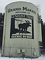
The start of the Gunflint Trail in Grand Marais
-
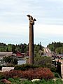
Grand Marais waterfront sculpture depicting bear cubs


See also
 In Spanish: Grand Marais (Minnesota) para niños
