
Grandview Heights, Ohio facts for kids
Quick facts for kids
Grandview Heights, Ohio
|
|
|---|---|

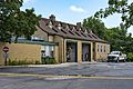
Grandview Heights Municipal Building
|
|
| Country | United States |
| State | Ohio |
| County | Franklin |
| Area | |
| • Total | 1.32 sq mi (3.42 km2) |
| • Land | 1.32 sq mi (3.41 km2) |
| • Water | 0.00 sq mi (0.01 km2) |
| Elevation | 774 ft (236 m) |
| Population
(2020)
|
|
| • Total | 8,085 |
| • Density | 6,322.46/sq mi (2,440.53/km2) |
| Time zone | UTC-5 (Eastern (EST)) |
| • Summer (DST) | UTC-4 (EDT) |
| ZIP code |
43212
|
| Area code(s) | 614 and 380 |
| FIPS code | 39-31304 |
| GNIS feature ID | 1048799 |
Grandview Heights, or simply Grandview, is a city in Franklin County, Ohio, United States. The population was 8,085 at the 2020 census.
The city was originally part of Marble Cliff, one of the first suburbs of Columbus, which settled as a community in 1890 and incorporated as the "Hamlet of Marble Cliff" in 1901. Grandview Heights became a separate village in 1906, and a city in 1931.
Grandview Heights maintains its own police and fire departments and an independent school district. Its neighbor, Marble Cliff, contracts with the city to provide these to its own residents.
Gallery
-
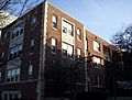
Apartments on 3rd Ave
-
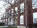
Grandview Heights High School
-

Grandview Ave.


Geography
Grandview Heights is located at 39°58′50″N 83°2′28″W / 39.98056°N 83.04111°W (39.980564, -83.041027).
According to the United States Census Bureau, the city has a total area of 1.33 square miles (3.44 km2), all land.
Demographics
| Historical population | |||
|---|---|---|---|
| Census | Pop. | %± | |
| 1910 | 489 | — | |
| 1920 | 1,185 | 142.3% | |
| 1930 | 6,358 | 436.5% | |
| 1940 | 6,960 | 9.5% | |
| 1950 | 7,659 | 10.0% | |
| 1960 | 8,270 | 8.0% | |
| 1970 | 8,460 | 2.3% | |
| 1980 | 7,420 | −12.3% | |
| 1990 | 7,010 | −5.5% | |
| 2000 | 6,695 | −4.5% | |
| 2010 | 6,536 | −2.4% | |
| 2020 | 8,085 | 23.7% | |
| Sources: | |||
2010 census
As of the census of 2010, there were 6,536 people, 2,927 households, and 1,680 families living in the city. The population density was 4,914.3 inhabitants per square mile (1,897.4/km2). There were 3,087 housing units at an average density of 2,321.1 per square mile (896.2/km2). The racial makeup of the city was 94.6% White, 1.4% African American, 0.2% Native American, 1.2% Asian, 0.8% from other races, and 1.9% from two or more races. Hispanic or Latino of any race were 2.4% of the population.
There were 2,927 households, of which 28.8% had children under the age of 18 living with them, 43.6% were married couples living together, 9.7% had a female householder with no husband present, 4.1% had a male householder with no wife present, and 42.6% were non-families. 31.5% of all households were made up of individuals, and 8.1% had someone living alone who was 65 years of age or older. The average household size was 2.23 and the average family size was 2.86.
The median age in the city was 35.7 years. 21.5% of residents were under the age of 18; 7.7% were between the ages of 18 and 24; 33.7% were from 25 to 44; 27.6% were from 45 to 64; and 9.5% were 65 years of age or older. The gender makeup of the city was 48.5% male and 51.5% female.
Bank Block
The Bank Block is a historic strip mall along Grandview Avenue, the main commercial road. One of the first to include a parking lot, the Bank Block was built in 1927. It first included a grocery store, a pharmacy, and a bank among a total of 12 storefronts.
Images for kids
-
Police Department Headquarters
-
Fire Department Headquarters
-
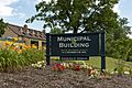
Grandview Heights Municipal Building Sign


See also
 In Spanish: Grandview Heights (Ohio) para niños
