Greenwich Township, Cumberland County, New Jersey facts for kids
Quick facts for kids
Greenwich Township, New Jersey
|
|
|---|---|
|
Township
|
|
| Township of Greenwich | |
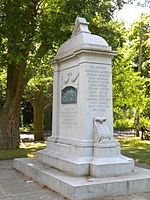
Teaburners' Monument
|
|
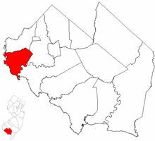
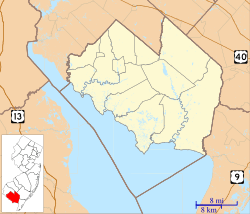
Greenwich Township highlighted in Cumberland County. Inset map: Cumberland County highlighted in the State of New Jersey.
|
|
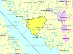
Census Bureau map of Greenwich Township, Cumberland County, New Jersey
|
|
| Country | |
| State | |
| County | |
| Established | January 19, 1748 |
| Incorporated | February 21, 1798 |
| Named for | Greenwich, England |
| Government | |
| • Type | Township |
| • Body | Township Committee |
| Area | |
| • Total | 18.75 sq mi (48.55 km2) |
| • Land | 17.77 sq mi (46.03 km2) |
| • Water | 0.97 sq mi (2.52 km2) 5.19% |
| Area rank | 152nd of 565 in state 11th of 14 in county |
| Elevation | 20 ft (6 m) |
| Population | |
| • Total | 804 |
| • Estimate
(2019)
|
758 |
| • Rank | 544th of 566 in state 13th of 14 in county |
| • Density | 45.1/sq mi (17.4/km2) |
| • Density rank | 557th of 566 in state 13th of 14 in county |
| Time zone | UTC−05:00 (Eastern (EST)) |
| • Summer (DST) | UTC−04:00 (Eastern (EDT)) |
| ZIP Code |
08323
|
| Area code(s) | 856 exchanges: 451, 453, 455 |
| FIPS code | 3401128170 |
| GNIS feature ID | 0882058 |
| Website | |
Greenwich Township is the westernmost township in Cumberland County, New Jersey, United States. As of the 2010 United States Census, the township's population was 804, reflecting a decline of 43 (-5.1%) from the 847 counted in the 2000 Census, which had in turn declined by 64 (-7.0%) from the 911 counted in the 1990 Census. It is part of the Vineland-Millville- Bridgeton Primary Metropolitan Statistical Area for statistical purposes.
Contents
History
Greenwich Township was first formed as a precinct on January 19, 1748, and was incorporated by an act of the New Jersey Legislature on February 21, 1798, as one of New Jersey's initial group of 104 townships. Portions of Hopewell Township and Stow Creek Township were annexed in 1845. The township was named for Greenwich, England.
In 1774, during the run-up to the American Revolutionary War, the small community on the Cohansey River was the site of the Greenwich Tea Party, in which a load of tea meant to be sent overland into Philadelphia, Pennsylvania was torched in the night. After the Revolutionary War, the pronunciation of the town was changed to Green-witch to differentiate itself from its English namesake.
Geography
According to the United States Census Bureau, the township had a total area of 18.834 square miles (48.780 km2), including 17.839 square miles (46.202 km2) of land and 0.995 square miles (2.578 km2) of water (5.29%).
The township borders Fairfield Township, Hopewell Township, Stow Creek Township, Salem County and the Delaware Bay.
Unincorporated communities, localities and place names located partially or completely within the township include Bacons Neck, Bayside, Caviar, Davis Mills, Othello, Sheppards Mill, Springtown and Stathams Neck.
Demographics
| Historical population | |||
|---|---|---|---|
| Census | Pop. | %± | |
| 1810 | 858 | — | |
| 1820 | 890 | 3.7% | |
| 1830 | 912 | 2.5% | |
| 1840 | 918 | 0.7% | |
| 1850 | 1,158 | 26.1% | |
| 1860 | 1,265 | 9.2% | |
| 1870 | 1,262 | −0.2% | |
| 1880 | 1,245 | −1.3% | |
| 1890 | 1,173 | −5.8% | |
| 1900 | 1,283 | 9.4% | |
| 1910 | 1,145 | −10.8% | |
| 1920 | 966 | −15.6% | |
| 1930 | 979 | 1.3% | |
| 1940 | 929 | −5.1% | |
| 1950 | 966 | 4.0% | |
| 1960 | 1,086 | 12.4% | |
| 1970 | 963 | −11.3% | |
| 1980 | 973 | 1.0% | |
| 1990 | 911 | −6.4% | |
| 2000 | 847 | −7.0% | |
| 2010 | 804 | −5.1% | |
| 2019 (est.) | 758 | −5.7% | |
| Population sources: 1810-2010 1810-1920 1840 1850-1870 1850 1870 1880-1890 1890-1910 1910-1930 1930-1990 2000 2010 |
|||
Census 2010
As of the census of 2010, there were 804 people, 336 households, and 229 families residing in the township. The population density was 45.1 per square mile (17.4/km2). There were 369 housing units at an average density of 20.7 per square mile (8.0/km2)*. The racial makeup of the township was 91.42% (735) White, 3.73% (30) Black or African American, 1.24% (10) Native American, 0.50% (4) Asian, 0.00% (0) Pacific Islander, 0.62% (5) from other races, and 2.49% (20) from two or more races. [[Hispanic (U.S. Census)|Hispanic or Latino of any race were 2.61% (21) of the population.
There were 336 households out of which 21.7% had children under the age of 18 living with them, 57.1% were married couples living together, 6.8% had a female householder with no husband present, and 31.8% were non-families. 26.5% of all households were made up of individuals, and 10.7% had someone living alone who was 65 years of age or older. The average household size was 2.39 and the average family size was 2.89.
In the township, the population was spread out with 19.8% under the age of 18, 5.3% from 18 to 24, 21.3% from 25 to 44, 35.6% from 45 to 64, and 18.0% who were 65 years of age or older. The median age was 47.7 years. For every 100 females there were 101.0 males. For every 100 females ages 18 and old there were 104.1 males.
The Census Bureau's 2006-2010 American Community Survey showed that (in 2010 inflation-adjusted dollars) median household income was $55,833 (with a margin of error of +/- $17,252) and the median family income was $80,000 (+/- $16,466). Males had a median income of $55,938 (+/- $11,759) versus $55,833 (+/- $25,039) for females. The per capita income for the borough was $31,044 (+/- $4,936). About 5.3% of families and 9.7% of the population were below the poverty line, including 12.5% of those under age 18 and 6.5% of those age 65 or over.
Census 2000
As of the 2000 United States Census there were 847 people, 326 households, and 245 families residing in the township. The population density was 46.6 people per square mile (18.0/km2). There were 361 housing units at an average density of 19.9 per square mile (7.7/km2). The racial makeup of the township was 89.96% White, 5.08% African American, 2.60% Native American, 0.24% Asian, 0.12% from other races, and 2.01% from two or more races. Hispanic or Latino of any race were 1.53% of the population.
There were 326 households, out of which 27.3% had children under the age of 18 living with them, 62.0% were married couples living together, 8.0% had a female householder with no husband present, and 24.8% were non-families. 21.8% of all households were made up of individuals, and 10.1% had someone living alone who was 65 years of age or older. The average household size was 2.60 and the average family size was 3.05.
In the township the population was spread out, with 22.0% under the age of 18, 7.0% from 18 to 24, 23.0% from 25 to 44, 33.2% from 45 to 64, and 14.9% who were 65 years of age or older. The median age was 43 years. For every 100 females, there were 98.4 males. For every 100 females age 18 and over, there were 99.1 males.
The median income for a household in the township was $52,188, and the median income for a family was $56,111. Males had a median income of $43,214 versus $30,208 for females. The per capita income for the township was $22,233. About 6.1% of families and 8.0% of the population were below the poverty line, including 8.7% of those under age 18 and 17.1% of those age 65 or over.
Transportation
As of May 2010[update], the township had a total of 33.15 miles (53.35 km) of roadways, of which 8.37 miles (13.47 km) were maintained by the municipality and 24.78 miles (39.88 km) by Cumberland County.
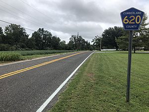
No Interstate, U.S., state or significant county highways serve Greenwich Township. The only numbered routes are minor county roads such as County Route 620.
Education
The Greenwich Township School District serves public school students in kindergarten through eighth grade at Morris Goodwin School. As of the 2018–19 school year, the district, comprised of one school, had an enrollment of 61 students and 14.6 classroom teachers (on an FTE basis), for a student–teacher ratio of 4.2:1. In the 2016–17 school year, it had 62 students, the second-smallest enrollment of any school district in the state. Under the terms of the Greenwich - Stow Creek Partnership established in 2009 with the Stow Creek School District in Stow Creek Township, New Jersey, students from both townships attend Morris Goodwin School for grades K-4 and Stow Creek School for grades 5–8.
Public school students in ninth through twelfth grades attend Cumberland Regional High School, which also serves students from Deerfield Township, Fairfield Township, Hopewell Township, Shiloh Borough, Stow Creek Township and Upper Deerfield Township. As of the 2018–19 school year, the high school had an enrollment of 1,043 students and 78.5 classroom teachers (on an FTE basis), for a student–teacher ratio of 13.3:1. Seats on the high school district's nine-member board of education are allocated to the constituent municipalities based on population, with each municipality assigned a minimum of one seat; Greenwich Township has one seat on the board.
Students are also eligible to attend Cumberland County Technology Education Center in Vineland, serving students from the entire county in its full-time technical training programs, which are offered without charge to students who are county residents.
Notable people
People who were born in, residents of, or otherwise closely associated with Greenwich Township include:
- Philip Vickers Fithian (1747–1776), peripatetic tutor, best known for his journals and letters of 1773 to 1774 when he tutored at a Virginia plantation.
- Robert Patterson (1743-1824), educator and director of the United States Mint.
- Roland Renne (1905-1989), professor of agricultural economics who served as President of Montana State College from 1943 to 1964.
See also
 In Spanish: Municipio de Greenwich (condado de Cumberland, Nueva Jersey) para niños


