
Grevenmacher facts for kids
Quick facts for kids
Grevenmacher
Gréiwemaacher
|
||
|---|---|---|

The old town hall.
|
||
|
||

Map showing, in orange, the Grevenmacher commune
|
||
| Country | ||
| Canton | Grevenmacher | |
| Commune | Grevenmacher | |
| City | 1252 | |
| Area | ||
| • Total | 16.48 km2 (6.36 sq mi) | |
| Highest elevation | 315 m (1,033 ft) | |
| Lowest elevation | 133 m (436 ft) | |
| Population
(2017)
|
||
| • Total | 4,923 | |
| • Density | 298.73/km2 (773.70/sq mi) | |
| Time zone | UTC+1 (CET) | |
| • Summer (DST) | UTC+2 (CEST) | |
| LAU2 | LU00007004 | |
| Website | Official website: http://www.grevenmacher.lu/ | |

Grevenmacher (Luxembourgish: Gréiwemaacher) is a commune with city status in eastern Luxembourg, near the border with Germany.
Grevenmacher is the capital city of the Grevenmacher canton and of the district of Grevenmacher. The city is on the left bank of the Moselle river.
Contents
Name
The name Grevenmacher is formed by two words: "Greven" and "Macher". "Macher" comes from the Latin word maceria ("very old walls"); "Greven" comes from the old German word Grafen (modern German: Graf) that means "count, earl". The town "Macher of the Count" was, since 1346, different from other "Machern" found in the region: Königsmacher, Kleinmacher, Rodemacher, Mecher, Mézières etc. The present name of Grevenmacher has been in use since 1769.
History
The valley of the Moselle, which owes its wealth to the fact that it is close to the water and it has fertile land, was settled long before the Roman era. As for Grevenmacher, the first town was behind the Holy Cross Chapel at the place called "Buerggruef", not far from the Roman road to the city of Luxembourg.
A few centuries later, the Counts of Luxembourg chose a safe place to protect their land against the powerful archbishops of Trier. They found it in Grevenmacher, that was the place where the road going from the city of Luxembourg to Trier meet with the one going from Trier to Thionville. Here a strong fortress was built, probably on the orders of Count Henry V. In 1252, this same count made Grevenmacher a city.
Geography

The commune of Grevenmacher, which is in the eastern part of the canton on the left bank of the Moselle river, has an area of 16.48 km2 (6.4 sq mi), with 650 ha (1,606 acres) of forests and 57 ha (141 acres) of vineyards.
The altitude of the commune is 133–315 m (436–1,033 ft) high. At the church, the altitude is 140 m (460 ft) high.
The most important river is the Moselle (French: Moselle; German: Mosel; Luxembourgish: Musel).
Population
There were 4,923 persons living in the commune in 2017, for a population density of 298.7 inhabitants/km².
Evolution of the population in Grevenmacher

Sights
Famous sights in Grevenmacher are, for exampleː
- "Huelen Zant", remains from an old castle;
- Chapel "Saint-Croix" (this is French and means "holy cross");
- The "Kelsbach", a beautiful piece of nature;
- The "Jardin des papillons" (this is French again and means "garden of butterflies"), a building which contains a lot of butterflies and other insects;
- The "Kulturhuef" which is a museum and a cinema.
Sport
The city has three soccer places, two in "Op Floor" (there is also the stadium from the CSG, the soccer club from Grevenmacher) and one on the bank from the Mousel. The city has also six tennis fields, three in a hall and the other three on the bank of the Mousel. Next to the tennis fields is an outdoor swimming pool. Grevenmacher has also two sports halls.
Twinned and partner towns
Grevenmacher is twinned withː
 Aubière, France
Gallery
-
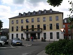
The new Town Hall
-
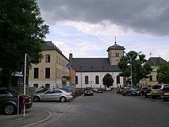
Market square
-
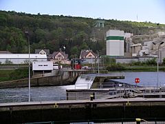
Moselle barrage at Grevenmacher
-
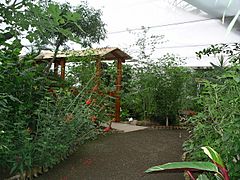
Butterfly Garden
-
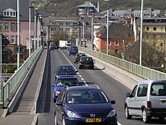
Bridge over the Moselle.


Related pages
- Cantons of Luxembourg
- Communes of Luxembourg
- List of cities in Luxembourg
Images for kids
-
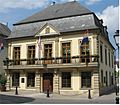
The old Town Hall
