
Gridley, California facts for kids
Quick facts for kids
City of Gridley
|
||
|---|---|---|

Annual Red Suspenders Parade honoring public safety in downtown Gridley
|
||
|
||
| Nickname(s):
A Distinguished California City
|
||
| Motto(s):
The Small Town that Loves Company
|
||

Location of Gridley in Butte County, California.
|
||

Gridley, California
Location in the United States
|
||
| Country | ||
| State | ||
| County | Butte | |
| Incorporated | November 23, 1905 | |
| Named for | George W. Gridley | |
| Area | ||
| • Total | 2.08 sq mi (5.40 km2) | |
| • Land | 2.08 sq mi (5.40 km2) | |
| • Water | 0.00 sq mi (0.00 km2) 0% | |
| Elevation | 95 ft (29 m) | |
| Population
(2010)
|
||
| • Total | 16,330 | |
| • Estimate
(2019)
|
7,246 | |
| • Density | 3,476.97/sq mi (1,342.59/km2) | |
| Time zone | UTC-8 (Pacific) | |
| • Summer (DST) | UTC-7 (PDT) | |
| ZIP code |
95948
|
|
| Area code | 530 | |
| FIPS code | 06-31260 | |
| GNIS feature IDs | 277526, 2410665 | |

Gridley is a city in Butte County, California, United States, 29 miles (47 kilometers) south of Chico, California and 56 miles (90 kilometers) north of Sacramento, California. The 2019 State of California population estimate was 7,224. California State Route 99 runs through Gridley and Interstate 5 and California State Route 70 are both nearby. The highway CA 99 goes through Gridley and the current population is 9,082 [found in a recent census].
Contents
History
The town of Gridley was named after its founder and earliest landowner, George W. Gridley. He was born in the state of New York and later moved with his parents to Galena, Illinois. In 1850 (1850 census shows him living in Sacramento without his family), he attempted to drive sheep and cattle across the plains to California. He lost the animals, but arrived safely himself and settled in this area.

As early as 1852, he was prospering in the stock business, and with ten thousand dollars profit, he returned to Illinois. Again he started back to California with a large herd of sheep. This time, six hundred survived. That was enough to give George Gridley his start in the sheep raising business. He prospered in this venture, and his home ranch consisted of some 960 acres (3.9 km2) located West of Gridley. He married Helen Orcutt in 1846 in Illinois, and she joined him in California in 1855. The Gridleys had ten children. Mr. Gridley died at the home ranch on 9 March 1881, Mrs. Gridley twenty years later, 1 August 1901. Descendants of the Gridley family are still living in the area today.
With the decline of mining, agriculture became a more stable and attractive business in the 1860s. The Central Pacific Railroad laid tracks from Oregon to Chico in 1865. The railroad completed its path to Gridley in 1870, and that is when the community of Gridley began to form. The principal products from the Gridley area were wool and sheep. Orchards, field crops, and cattle would soon follow. In 1896, the Libby, McNeil & Libby Cannery was established and became one of the largest peach canning operations in the world. However it stopped operation in 2001 and is still out of operation.
The first home and store in Gridley were built by L.C. Stone in 1874. Stone served as postmaster, the train depot and express agent, as well as a merchant. Wells Fargo & Co. opened its office in 1871 and soon other businesses followed suit.
Two large fires, one in 1884 and one in 1891, destroyed much of the original business district. The district rallied and rebuilt around 1900.
Much of the historic downtown district remains. "Silk Stocking Row" the many well-preserved turn-of-the-century homes on Hazel Street, was so named because during the Depression the only women who could afford silk stockings lived in these large Hazel Street homes.
The post office at Martinsburgh was moved to Gridley in 1870.
Geography
According to the United States Census Bureau, the city has a total area of 2.1 square miles (5.4 km2), all land.
Butte County geographer, Steve Herman, released the locally-popular "My Baby's Gone to Gridley," as a B-side to the 45rpm "This Is Oroville" in 1987. The tune can be downloaded:[1]
Climate
According to the Köppen Climate Classification system, Gridley has a warm-summer Mediterranean climate, abbreviated "Csa" on climate maps.
| Climate data for Gridley | |||||||||||||
|---|---|---|---|---|---|---|---|---|---|---|---|---|---|
| Month | Jan | Feb | Mar | Apr | May | Jun | Jul | Aug | Sep | Oct | Nov | Dec | Year |
| Record high °F (°C) | 70 (21) |
78 (26) |
84 (29) |
95 (35) |
106 (41) |
108 (42) |
113 (45) |
113 (45) |
112 (44) |
101 (38) |
84 (29) |
72 (22) |
113 (45) |
| Average high °F (°C) | 52 (11) |
59 (15) |
63.2 (17.3) |
73.4 (23.0) |
80.6 (27.0) |
88 (31) |
96 (36) |
93.5 (34.2) |
89.8 (32.1) |
77.5 (25.3) |
63.4 (17.4) |
54.1 (12.3) |
74.2 (23.4) |
| Average low °F (°C) | 34.8 (1.6) |
37.9 (3.3) |
41.6 (5.3) |
46.3 (7.9) |
52.4 (11.3) |
57.1 (13.9) |
60.9 (16.1) |
58.4 (14.7) |
55.7 (13.2) |
48.3 (9.1) |
40.1 (4.5) |
37.5 (3.1) |
47.6 (8.7) |
| Record low °F (°C) | 19 (−7) |
24 (−4) |
26 (−3) |
28 (−2) |
36 (2) |
42 (6) |
48 (9) |
48 (9) |
42 (6) |
28 (−2) |
20 (−7) |
22 (−6) |
19 (−7) |
| Average precipitation inches (mm) | 5.07 (129) |
3.05 (77) |
2.62 (67) |
1.04 (26) |
0.86 (22) |
0.26 (6.6) |
0.03 (0.76) |
0.02 (0.51) |
0.36 (9.1) |
0.89 (23) |
2.25 (57) |
3.72 (94) |
20.19 (513) |
| Average snowfall inches (cm) | 0.4 (1.0) |
0.1 (0.25) |
0 (0) |
0 (0) |
0 (0) |
0 (0) |
0 (0) |
0 (0) |
0 (0) |
0 (0) |
0 (0) |
0 (0) |
0.5 (1.3) |
| Average precipitation days (≥ 0.01 inch) | 12 | 9 | 9 | 4 | 4 | 2 | 0 | 0 | 1 | 4 | 6 | 10 | 61 |
Demographics
| Historical population | |||
|---|---|---|---|
| Census | Pop. | %± | |
| 1880 | 352 | — | |
| 1890 | 686 | 94.9% | |
| 1910 | 987 | — | |
| 1920 | 1,636 | 65.8% | |
| 1930 | 1,941 | 18.6% | |
| 1940 | 2,338 | 20.5% | |
| 1950 | 3,054 | 30.6% | |
| 1960 | 3,343 | 9.5% | |
| 1970 | 3,534 | 5.7% | |
| 1980 | 3,982 | 12.7% | |
| 1990 | 4,631 | 16.3% | |
| 2000 | 5,382 | 16.2% | |
| 2010 | 6,584 | 22.3% | |
| 2019 (est.) | 7,246 | 10.1% | |
|
|
|||
2010
The 2010 United States Census reported that Gridley had a population of 6,584. The population density was 3,179.1 people per square mile (1,227.4/km2). The racial makeup of Gridley was 4,283 (65.1%) White, 55 (0.8%) African American, 98 (1.5%) Native American, 249 (3.8%) Asian, 3 (0.0%) Pacific Islander, 1,552 (23.6%) from other races, and 344 (5.2%) from two or more races. Hispanic or Latino of any race were 3,000 persons (45.6%).
The Census reported that 6,472 people (98.3% of the population) lived in households, 16 (0.2%) lived in non-institutionalized group quarters, and 96 (1.5%) were institutionalized. There were 2,183 households, out of which 910 (41.7%) had children under the age of 18 living in them, 1,087 (49.8%) were opposite-sex married couples living together, 338 (15.5%) had a female householder with no husband present, 134 (6.1%) had a male householder with no wife present. There were 149 (6.8%) unmarried opposite-sex partnerships, and 8 (0.4%) same-sex married couples or partnerships. 520 households (23.8%) were made up of individuals, and 297 (13.6%) had someone living alone who was 65 years of age or older. The average household size was 2.96. There were 1,559 families (71.4% of all households); the average family size was 3.54.
The population was spread out, with 1,892 people (28.7%) under the age of 18, 668 people (10.1%) aged 18 to 24, 1,681 people (25.5%) aged 25 to 44, 1,415 people (21.5%) aged 45 to 64, and 928 people (14.1%) who were 65 years of age or older. The median age was 33.1 years. For every 100 females, there were 94.3 males. For every 100 females age 18 and over, there were 91.6 males.
There were 2,406 housing units at an average density of 1,161.7 per square mile (448.5/km2), of which 2,183 were occupied, of which 1,262 (57.8%) were owner-occupied, and 921 (42.2%) were occupied by renters. The homeowner vacancy rate was 2.6%; the rental vacancy rate was 6.5%. 3,829 people (58.2% of the population) lived in owner-occupied housing units and 2,643 people (40.1%) lived in rental housing units.
Economy
Gridley is adjacent to the Sacramento metropolitan area, the fifth largest metropolitan area in California.
Tourism

- The Gridley area is a sportsman's haven. Excellent hunting, fishing and naturalist opportunities are available on private and public lands. The Gray Lodge Wildlife Waterfowl Management Area, part of the Refuge Water Supply Program is located 10 miles (16 kilometers) southwest of Gridley. Its 8,400 acres form some of the most intensively used and developed wetlands in the entire Pacific Flyway.
- Gridley is 24 miles (39 kilometers) away from the recreational facilities available at Lake Oroville. Lake Oroville and the Oroville Afterbay feed into the clear rolling waters of the Feather River, which provides some of the best salmon fishing in the state. The Oroville Dam is one of the 20 largest dams in the world, the largest earth filled dam in the US, and the tallest dam in the US. Lake Oroville has 15,500 surface acres for recreation and 167 miles of shoreline. Lake Oroville features an abundance of camping, picnicking, horseback riding, hiking, sail and power boating, water-skiing, fishing, swimming, boat-in camping, floating campsites and horse camping. At the base of the Dam, the Feather River Fish Hatchery raise Chinook salmon and steelhead along the Feather River.
- Lake Oroville Visitor Center is located in Kelly Ridge and overlooks the Oroville Dam and Lake Oroville. The visitor center is home to a museum with interpretive displays, the history of the dam and the State Water Project. A 47-foot viewing tower also allows the visitor the opportunity to have a panoramic view of the lake and surrounding areas.
Education
The Gridley Community is served by the Gridley Unified School District. Schools in the Gridley Unified School District include:
- Gridley High School
- Esperanza High School
- Sycamore Middle School
- McKinley Elementary School
- Wilson Elementary School
- Manzanita Elementary School
Higher education
- California State University, Chico (Chico State)
- Butte College
- Yuba Community College
- Cal Northern School of Law
Infrastructure
Healthcare
Orchard Hospital is a general acute care facility in Gridley with a Level IV trauma center and standby emergency care.
Highways
Gridley is located in the Central Valley, along California State Route 99, 56 miles (90 kilometers) north of Sacramento. It is close to larger metropolitan areas. California State Route 70 and Interstate 5 are both within 20 miles (32 kilometers).
Public transport
B-Line Butte Regional Transit is Butte County's regional public transit system. Area residents use B-Line to travel locally in Gridley, Chico, Oroville, and Paradise, or to travel between communities throughout Butte County.
Airport
Sacramento International Airport (IATA: SMF, ICAO: KSMF, FAA LID: SMF) is a public airport 52 miles (84 kilometers) south of Gridley, in Sacramento County, California. Southwest Airlines currently accounts for half the airline passengers. The Airport served more than 10 million passengers in 2016.
The Oroville Municipal Airport is located 11 miles (18 kilometers) to the northeast of Gridley on State Route 162 and west of State Route 70.
Notable people
- G. Vernon Bennett, Los Angeles City Council member, 1935–49
- Isaac Austin, retired NBA basketball player, 1991–2004
- Wally Westlake, MLB All-Star baseball player
- Leslie Deniz, Olympic silver medal, 1984 Los Angeles, Women's discus

Images for kids
-
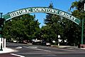
Gridley Arch welcomes visitors
-
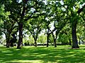
Vierra Park


See also
 In Spanish: Gridley (California) para niños
