Commercial Township, New Jersey facts for kids
Quick facts for kids
Commercial Township, New Jersey
|
|
|---|---|
|
Township
|
|
| Township of Commercial | |
|
|
| Motto(s):
Small Town Charm, Along the Scenic Maurice River
|
|
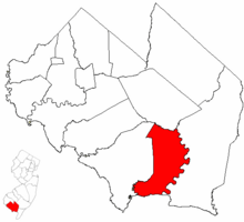
Commercial Township highlighted in Cumberland County. Inset map: Cumberland County highlighted in the State of New Jersey.
|
|
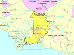
Census Bureau map of Commercial Township, New Jersey
|
|
| Country | |
| State | |
| County | |
| Incorporated | February 27, 1874 |
| Government | |
| • Type | Township |
| • Body | Township Committee |
| Area | |
| • Total | 34.41 sq mi (89.13 km2) |
| • Land | 31.91 sq mi (82.66 km2) |
| • Water | 2.50 sq mi (6.47 km2) 7.26% |
| Area rank | 70th of 565 in state 7th of 14 in county |
| Elevation | 13 ft (4 m) |
| Population | |
| • Total | 5,178 |
| • Estimate
(2019)
|
4,916 |
| • Rank | 371st of 566 in state 7th of 14 in county |
| • Density | 161.2/sq mi (62.2/km2) |
| • Density rank | 520th of 566 in state 7th of 14 in county |
| Time zone | UTC−05:00 (Eastern (EST)) |
| • Summer (DST) | UTC−04:00 (Eastern (EDT)) |
| ZIP Code |
08349 - Port Norris
|
| Area code(s) | 856 |
| FIPS code | 3401114710 |
| GNIS feature ID | 0882062 |
| Website | |
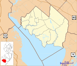
Commercial Township is a township in Cumberland County, New Jersey, United States. It is part of the Vineland-Millville-Bridgeton Primary Metropolitan Statistical Area for statistical purposes. As of the 2010 United States Census, the township's population was 5,178, reflecting a decline of 81 (-1.5%) from the 5,259 counted in the 2000 Census, which had in turn increased by 233 (+4.6%) from the 5,026 counted in the 1990 Census.
Commercial Township was incorporated as a township by an act of the New Jersey Legislature on February 27, 1874, from portions of Downe Township. The township was named for its shellfish industry.
Contents
Geography
According to the United States Census Bureau, the township had a total area of 34.438 square miles (89.194 km2), including 32.129 square miles (83.214 km2) of land and 2.309 square miles (5.980 km2) of water (6.70%).
Laurel Lake (2010 Census population of 2,989) and Port Norris (population of 1,377 as of 2010) are unincorporated communities and census-designated places (CDPs) located within Commercial Township.
Other unincorporated communities, localities and place names located partially or completely within the township include Baileytown, Bivalve, Buckshutem, Haleyville, Lores Mill, Mauricetown, North Port Norris and Shell Pile.
The township borders Maurice River Township, Millville, Downe Township and Delaware Bay.
Demographics
| Historical population | |||
|---|---|---|---|
| Census | Pop. | %± | |
| 1880 | 2,265 | — | |
| 1890 | 2,344 | 3.5% | |
| 1900 | 2,982 | 27.2% | |
| 1910 | 2,604 | −12.7% | |
| 1920 | 2,292 | −12.0% | |
| 1930 | 2,873 | 25.3% | |
| 1940 | 2,822 | −1.8% | |
| 1950 | 3,238 | 14.7% | |
| 1960 | 3,244 | 0.2% | |
| 1970 | 3,667 | 13.0% | |
| 1980 | 4,674 | 27.5% | |
| 1990 | 5,026 | 7.5% | |
| 2000 | 5,259 | 4.6% | |
| 2010 | 5,178 | −1.5% | |
| 2019 (est.) | 4,916 | −5.1% | |
| Population sources: 1880-2000 1880-1920 1880-1890 1890-1910 1910-1930 1930-1990 2000 2010 |
|||
Census 2010
As of the census of 2010, there were 5,178 people, 1,880 households, and 1,337 families residing in the township. The population density was 161.2 per square mile (62.2/km2). There were 2,115 housing units at an average density of 65.8 per square mile (25.4/km2)*. The racial makeup of the township was 83.72% (4,335) White, 10.24% (530) Black or African American, 0.35% (18) Native American, 0.52% (27) Asian, 0.00% (0) Pacific Islander, 1.53% (79) from other races, and 3.65% (189) from two or more races. [[Hispanic (U.S. Census)|Hispanic or Latino of any race were 6.10% (316) of the population.
There were 1,880 households out of which 30.6% had children under the age of 18 living with them, 42.9% were married couples living together, 18.5% had a female householder with no husband present, and 28.9% were non-families. 22.4% of all households were made up of individuals, and 9.3% had someone living alone who was 65 years of age or older. The average household size was 2.74 and the average family size was 3.14.
In the township, the population was spread out with 25.3% under the age of 18, 9.2% from 18 to 24, 25.8% from 25 to 44, 28.0% from 45 to 64, and 11.7% who were 65 years of age or older. The median age was 37.3 years. For every 100 females there were 98.2 males. For every 100 females ages 18 and old there were 98.0 males.
The Census Bureau's 2006-2010 American Community Survey showed that (in 2010 inflation-adjusted dollars) median household income was $45,323 (with a margin of error of +/- $7,873) and the median family income was $46,790 (+/- $10,373). Males had a median income of $42,297 (+/- $6,069) versus $31,391 (+/- $5,851) for females. The per capita income for the borough was $19,242 (+/- $2,315). About 18.0% of families and 18.8% of the population were below the poverty line, including 20.9% of those under age 18 and 21.2% of those age 65 or over.
Census 2000
As of the 2000 United States Census there were 5,259 people, 1,873 households, and 1,367 families residing in the township. The population density was 162.0 people per square mile (62.6/km2). There were 2,171 housing units at an average density of 66.9/sq mi (25.8/km2). The racial makeup of the township was 82.98% White, 13.42% African American, 0.42% Native American, 0.23% Asian, 0.02% Pacific Islander, 1.01% from other races, and 1.92% from two or more races. Hispanic or Latino of any race were 3.86% of the population.
There were 1,873 households, out of which 35.3% had children under the age of 18 living with them, 49.1% were married couples living together, 16.0% had a female householder with no husband present, and 21.0% were non-families. 21.4% of all households were made up of individuals, and 9.1% had someone living alone who was 65 years of age or older. The average household size was 2.80 and the average family size was 3.22.
In the township the population was spread out, with 28.3% under the age of 18, 9.3% from 18 to 24, 29.3% from 25 to 44, 20.8% from 45 to 64, and 12.3% who were 65 years of age or older. The median age was 34 years. For every 100 females, there were 97.0 males. For every 100 females age 18 and over, there were 95.0 males.
The median income for a household in the township was $34,960, and the median income for a family was $37,500. Males had a median income of $35,030 versus $21,610 for females. The per capita income for the township was $14,663. About 13.0% of families and 15.8% of the population were below the poverty line, including 21.3% of those under age 18 and 11.9% of those age 65 or over.
Transportation
As of May 2010[update], the township had a total of 77.15 miles (124.16 km) of roadways, of which 44.08 miles (70.94 km) were maintained by the municipality and 33.07 miles (53.22 km) by Cumberland County.
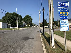
County Route 553 is the most significant road serving Commercial Township.
Points of interest
- Commercial Township School District's 2014–15 School Report Card from the New Jersey Department of Education
Education
The Commercial Township School District serves public school students in pre-kindergarten through eighth grade. As of the 2018–19 school year, the district, comprised of two schools, had an enrollment of 529 students and 42.0 classroom teachers (on an FTE basis), for a student–teacher ratio of 12.6:1. Schools in the district (with 2018–19 enrollment data from the National Center for Education Statistics) are Haleyville-Mauricetown Elementary School with 368 students in grades PreK-5 and Port Norris Middle School with 166 students in grades 6–8.
Students in ninth through twelfth grades for public school attend high school in Millville together with students from Lawrence Township and Maurice River Township, as part of a sending/receiving relationship with the Millville Public Schools under which students attend Memorial High School for ninth grade and half of the tenth grade and Millville Senior High School for half of the tenth grade through the twelfth grade.
Students are also eligible to attend Cumberland County Technology Education Center in Vineland, serving students from the entire county in its full-time technical training programs, which are offered without charge to students who are county residents.
Notable people
People who were born in, residents of, or otherwise closely associated with Commercial Township include:
- Helen Gandy (1897-1988), secretary to J. Edgar Hoover, Director of the Federal Bureau of Investigation, for 54 years.
- Elden H. Johnson (1921-1944), United States Army soldier who was awarded the Medal of Honor for his actions in World War II.
- Henry C. Loudenslager (1852–1911), represented New Jersey's 1st congressional district from 1893 to 1911.
- Larry Milbourne (born 1951), second baseman who played for 11 seasons in Major League Baseball.
- Dallas Lore Sharp (1870–1929), author and university professor.
See also
 In Spanish: Municipio de Commercial (Nueva Jersey) para niños


