Hanging Rock, Ohio facts for kids
Quick facts for kids
Hanging Rock, Ohio
|
|
|---|---|
|
Village
|
|

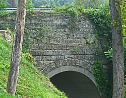
Stone arch bridge over Osborne Run
|
|

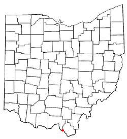
Location of Hanging Rock, Ohio
|
|

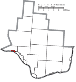
Location of Hanging Rock in Lawrence County
|
|
| Country | United States |
| State | Ohio |
| County | Lawrence |
| Township | Hamilton |
| Area | |
| • Total | 0.64 sq mi (1.66 km2) |
| • Land | 0.56 sq mi (1.44 km2) |
| • Water | 0.09 sq mi (0.22 km2) |
| Elevation | 541 ft (165 m) |
| Population
(2010)
|
|
| • Total | 221 |
| • Estimate
(2019)
|
209 |
| • Density | 375.90/sq mi (145.04/km2) |
| Time zone | UTC-5 (Eastern (EST)) |
| • Summer (DST) | UTC-4 (EDT) |
| ZIP code |
45638
|
| Area code(s) | 740 |
| FIPS code | 39-33194 |
| GNIS feature ID | 1075994 |
Hanging Rock is a village in Lawrence County, Ohio, United States, along the Ohio River. The population was 221 at the 2010 census. It is regularly labeled a speed trap; the village earned revenues of $109,186 in mayor's court receipts in 2000, compared with $3,106 in property taxes.
Hanging Rock is a part of the Huntington-Ashland, WV-KY-OH, Metropolitan Statistical Area (MSA); it had a population of 288,649 at the 2000 census.
Contents
Etymology
Hanging Rock had its start in 1820 when a blast furnace was built at the site. The village takes its name from a nearby cliff.
Geography
Hanging Rock is located at 38°33′32″N 82°43′34″W / 38.55889°N 82.72611°W (38.559021, -82.726070).
According to the United States Census Bureau, the village has a total area of 0.65 square miles (1.68 km2), of which 0.56 square miles (1.45 km2) is land and 0.09 square miles (0.23 km2) is water.
The Hanging Rock Recreational Area and the Hanging Rock Ponds are located near the village.
Demographics
| Historical population | |||
|---|---|---|---|
| Census | Pop. | %± | |
| 1880 | 624 | — | |
| 1890 | 846 | 35.6% | |
| 1900 | 665 | −21.4% | |
| 1910 | 662 | −0.5% | |
| 1920 | 591 | −10.7% | |
| 1930 | 550 | −6.9% | |
| 1940 | 481 | −12.5% | |
| 1950 | 465 | −3.3% | |
| 1960 | 352 | −24.3% | |
| 1970 | 278 | −21.0% | |
| 1980 | 353 | 27.0% | |
| 1990 | 306 | −13.3% | |
| 2000 | 279 | −8.8% | |
| 2010 | 221 | −20.8% | |
| 2019 (est.) | 209 | −5.4% | |
| U.S. Decennial Census | |||
2010 census
As of the census of 2010, there were 221 people, 95 households, and 68 families living in the village. The population density was 394.6 inhabitants per square mile (152.4/km2). There were 102 housing units at an average density of 182.1 per square mile (70.3/km2). The racial makeup of the village was 98.6% White and 1.4% from two or more races. Hispanic or Latino of any race were 1.4% of the population.
There were 95 households, of which 23.2% had children under the age of 18 living with them, 52.6% were married couples living together, 13.7% had a female householder with no husband present, 5.3% had a male householder with no wife present, and 28.4% were non-families. 20.0% of all households were made up of individuals, and 11.6% had someone living alone who was 65 years of age or older. The average household size was 2.33 and the average family size was 2.60.
The median age in the village was 47.4 years. 14.9% of residents were under the age of 18; 4.1% were between the ages of 18 and 24; 28.5% were from 25 to 44; 32.6% were from 45 to 64; and 19.9% were 65 years of age or older. The gender makeup of the village was 47.5% male and 52.5% female.
See also
 In Spanish: Hanging Rock (Ohio) para niños

