
Hanover, Massachusetts facts for kids
Quick facts for kids
Hanover, Massachusetts
|
||
|---|---|---|

Hanover Town Hall
|
||
|
||

Location in Plymouth County in Massachusetts
|
||
| Country | United States | |
| State | Massachusetts | |
| County | Plymouth | |
| Settled | 1649 | |
| Incorporated | 1727 | |
| Government | ||
| • Type | Open town meeting | |
| Area | ||
| • Total | 15.7 sq mi (40.7 km2) | |
| • Land | 15.6 sq mi (40.4 km2) | |
| • Water | 0.1 sq mi (0.3 km2) | |
| Elevation | 60 ft (18 m) | |
| Population
(2020)
|
||
| • Total | 14,833 | |
| • Density | 950.8/sq mi (367.2/km2) | |
| Time zone | UTC-5 (Eastern) | |
| • Summer (DST) | UTC-4 (Eastern) | |
| ZIP code |
02339
|
|
| Area code(s) | 339 / 781 | |
| FIPS code | 25-28285 | |
| GNIS feature ID | 0618341 | |
| Website | www.hanover-ma.gov | |

Hanover is a historic town in Plymouth County, Massachusetts, United States. The population was 14,833 at the 2020 census.
Contents
History
The area of Hanover was first settled by English settlers in 1649 when William Barstow, a farmer, built a bridge along the North River at what is now Washington Street. The land was the westernmost portion of the town of Scituate, and it would officially separate and be incorporated as a town June 14, 1727. The name "Hanover" is probably a tribute to King George I, the first Hanoverian King of Great Britain. (While George I died on June 11, 1727, the reports would not have reached the colonies until after the town's incorporation.) Hanover's early industry revolved around farming, small mills and a shipbuilding area along the North River. Later industries would include tack factories and shoe factories along the smaller waterways in the town. The town was the site of the invention of the first tack-making machine, and making tacks and fireworks were among the industries of the later 19th century for Hanover. Today, Hanover is mostly residential. The Hanover Mall and other shops are located near the intersection of Routes 3 and 53. In 2007 Hanover American Legion Post 149 baseball team won the state title. In the Summer of 2012 - Hanover became home to the New England Football League (NEFL)'s newest expansion, Semi-Professional Football Team - The South Shore Chiefs. Home games are played at Hanover High School.
Geography
According to the United States Census Bureau, the town has a total area of 15.7 square miles (41 km2), of which 15.6 square miles (40 km2) is land and 0.1 square miles (0.26 km2), or 0.70%, is water. Hanover is the 240th town in terms of size in Massachusetts. Hanover is considered to be a part of the South Shore of Massachusetts. It is bordered by Norwell to the north and east, Pembroke and Hanson to the south, and Rockland to the west and northwest. Hanover is approximately 10 miles (16 km) east of Brockton and 20 miles (32 km) southeast of Boston.
Much of Hanover's eastern and southern borders consist of three waterways, the North and Indian Head rivers along the south and southeast, and the Third Herring Brook along the east. (The latter two are both tributaries, and the town border is marked by their confluences.) There are also several small ponds and brooks throughout the town, the largest pond being Factory Pond, a tributary of the Indian Head River in the south of town. The town has several small parks, sanctuaries and conservation areas spread throughout the town.
Demographics
| Historical population | ||
|---|---|---|
| Year | Pop. | ±% |
| 1850 | 1,592 | — |
| 1860 | 1,565 | −1.7% |
| 1870 | 1,628 | +4.0% |
| 1880 | 1,897 | +16.5% |
| 1890 | 2,093 | +10.3% |
| 1900 | 2,152 | +2.8% |
| 1910 | 2,326 | +8.1% |
| 1920 | 2,575 | +10.7% |
| 1930 | 2,808 | +9.0% |
| 1940 | 2,875 | +2.4% |
| 1950 | 3,389 | +17.9% |
| 1960 | 5,923 | +74.8% |
| 1970 | 10,107 | +70.6% |
| 1980 | 11,358 | +12.4% |
| 1990 | 11,912 | +4.9% |
| 2000 | 13,164 | +10.5% |
| 2010 | 13,879 | +5.4% |
| 2020 | 14,833 | +6.9% |
| * = population estimate. Source: United States Census records and Population Estimates Program data. |
||


As of July 1, 2017, there were 14,814 people, 4,349 households, and 3,566 families residing in the town. The population density was 843.4 people per square mile (325.6/km2). There were 4,445 housing units at an average density of 284.8 per square mile (109.9/km2). The racial makeup of the town was 97.68% White, 0.55% African American, 0.08% Native American, 0.77% Asian, 0.01% Pacific Islander, 0.27% from other races, and 0.65% from two or more races. Hispanic or Latino of any race were 0.68% of the population.
There were 4,350 households, out of which 43.8% had children under the age of 18 living with them, 70.8% were married couples living together, 8.0% had a female householder with no husband present, and 18.0% were non-families. 15.2% of all households were made up of individuals, and 8.8% had someone living alone who was 65 years of age or older. The average household size was 3.02 and the average family size was 3.39.
In the town, the population was spread out, with 29.8% under the age of 18, 5.6% from 18 to 24, 28.8% from 25 to 44, 25.3% from 45 to 64, and 10.5% who were 65 years of age or older. The median age was 38 years. For every 100 females, there were 95.9 males. For every 100 females age 18 and over, there were 91.3 males.
The median income for a household in the town was $73,838, and the median income for a family was $86,835. Males had a median income of $57,321 versus $35,214 for females. The per capita income for the town was $30,268. About 1.4% of families and 2.3% of the population were below the poverty line, including 1.6% of those under age 18 and 7.8% of those age 65 or over.
Transportation
A short, three-mile portion of Massachusetts Route 3, a four-lane freeway, passes through the town, providing access via an exit at Route 53 in the northeast corner of town. The town's other major routes include Route 123 and Route 139, the latter passing through the town center. Routes 139 and 53 are coextensive for a stretch of one mile in the southeast corner of town.
The town has no rail or air service, though the town used to have rail service on the Hanover branch. The nearest rail service is the Kingston-Route 3 line of the MBTA's commuter rail service, which passes west of town, the closest stations being in Abington, Whitman, and the Greenbush station in Scituate. The nearest regional airport is Marshfield Municipal Airport, and the nearest national and international service can be reached at Logan International Airport in Boston. Seaplanes occasionally land in neighboring Hanson, on Lake Monponsett.
Education
| Hanover Public Schools | |
|---|---|
| Location | |
| 188 Broadway Street, Hanover, MA 02339 United States |
|
| District information | |
| Type | Public |
| Grades | K–12 |
| Superintendent | Matthew A. Ferron |
| Schools | 5 |
| Budget | $30,896,679 total $11,261 per pupil |
| Students and staff | |
| Students | 2,638 |
| Teachers | 188 |
| Student-teacher ratio | 14.0 to 1 |
| Other information | |
| Website | Hanover Public Schools |
Hanover operates its own school system for the town's approximately 2,700 students. There are three elementary schools, the Cedar, Center and Sylvester Elementary Schools. The Center School, and Cedar School serves students from pre-kindergarten through second grade, the Sylvester School (located around the corner from the Center School, both at Hanover Center) serves third and fourth grade students. The Hanover Middle School serves students from fifth through eighth grade, and Hanover High School serves students from ninth through twelfth grade. Hanover High's teams are nicknamed the Hawks (previously the Indians) and their colors are blue and gold. Hanover competes in the Patriot League, and their chief rival is Norwell. Hanover finished building its new high school in 2012; the graduating class of 2012 will be the first to graduate from the school and the second class to graduate on the new turf field. Hanover High School has also been known to have an outstanding graduation rate and expertise in preparing students for further academic fields.
Hanover is also the home of the South Shore Vocational Technical High School, which is located near the Hanover/Norwell shared village of Assinippi and serves the vocational needs of the surrounding communities. There are no private schools in the town; there are, however, schools in the surrounding communities. The nearest colleges are Massasoit Community College in Brockton, and Bridgewater State University. The Cardinal Cushing Centers, a Catholic facility for intellectually and developmentally challenged individuals located on Washington Street, also has educational facilities.
Notable people
- John W. Beal, architect
- George Washington Carver lived in a small cabin on the North River in Hanover for several months while he worked on his autobiography
- Richard Cushing, Archbishop of Boston for the Catholic Church from 1944-1970. He is buried in the Portiuncula Chapel at the Cardinal Cushing Centers
- R. C. Gamble, played running back for the Boston Patriots from 1968 to 1969. Resided in Hanover on Dillingham Way during the time
- Marvelous Marvin Hagler, former world middleweight boxing champion, resided in Hanover for several years at the peak of his career
- Elijah Hayward, politician from Bridgewater who learned shipbuilding in Hanover
- Nichole Hiltz, actress and was engaged to Canadian actor Mike Smith of "Trailer Park Boys" fame
- Jim Lonborg, Red Sox pitcher who worked as a dentist in Hanover
- Robert Nyman, politician who represented the Fifth Plymouth District
- Faith Salie, the actress lived in town for a few years after her birth
- Albert Smith (Maine politician), was born in Hanover in 1793
- Doug Smith, Author and minor-league hockey player. Wrote a biography that was later adapted into the 2011 film Goon
- Joseph Smith (admiral), son of sea captain and shipbuilder Albert Smith. The Smith family resided on what is today Washington Street, and operated a shipyard that was in Hanover
- Samuel Whitcomb Jr., politician
- Colin White, Forward for the NHL's Ottawa Senators
Images for kids
-
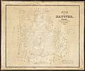
Map of Hanover, Massachusetts from 1849
.jpg)
See also
 In Spanish: Hanover (Massachusetts) para niños
