
Harrisburg, Ohio facts for kids
Quick facts for kids
Harrisburg, Ohio
|
|
|---|---|
|
Village
|
|

Looking north on High Street in Harrisburg
|
|

Location of Harrisburg, Ohio
|
|

Location of Harrisburg in Franklin County
|
|
| Country | United States |
| State | Ohio |
| Counties | Franklin, Pickaway |
| Area | |
| • Total | 0.15 sq mi (0.40 km2) |
| • Land | 0.15 sq mi (0.40 km2) |
| • Water | 0.00 sq mi (0.00 km2) |
| Elevation | 794 ft (242 m) |
| Population
(2020)
|
|
| • Total | 315 |
| • Density | 2,200.00/sq mi (849.37/km2) |
| Time zone | UTC-5 (Eastern (EST)) |
| • Summer (DST) | UTC-4 (EDT) |
| ZIP code |
43126
|
| Area code(s) | 614 and 380 |
| FIPS code | 39-33740 |
| GNIS feature ID | 1064801 |
Harrisburg is a village in Franklin and Pickaway counties in the U.S. state of Ohio. The population was 315 at the 2020 census.
Contents
Gallery
-
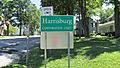
Harrisburg corporation limit sign.
-
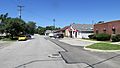
Looking north on High Street in Harrisburg.

History
Harrisburg was founded in 1836 by Joseph Chenowith and surveyed and platted by Frederick Cole. Prior to the laying out of the village, the area was known as Darby Cross Roads. The present name is after Harrisburg, Pennsylvania.
Prior to the establishment of the village of Harrisburg a post office named Big Darby Post Office had been established on March 13, 1834, and the name was changed to Harrisburgh Post Office on February 18, 1835. The post office was for some reason, unknown at this time, discontinued or decommissioned on August 26, 1836, but quickly re-established on October 21, 1836. The spelling was officially changed to "Harrisburg" on March 30, 1893.
From the outset in 1836 Harrisburg was known as a lively village. In 1836 it held about thirty families, by 1858 the population had grown to one hundred and fifteen, by 1900 to around two hundred, and in 1908 the population was estimated at three hundred.
Geography
Harrisburg is located at 39°48′39″N 83°10′15″W / 39.81083°N 83.17083°W (39.810729, -83.170728).
According to the United States Census Bureau, the village has a total area of 0.15 square miles (0.39 km2), all land.
Demographics
| Historical population | |||
|---|---|---|---|
| Census | Pop. | %± | |
| 1850 | 109 | — | |
| 1860 | 140 | 28.4% | |
| 1870 | 153 | 9.3% | |
| 1880 | 186 | 21.6% | |
| 1890 | 211 | 13.4% | |
| 1900 | 247 | 17.1% | |
| 1910 | 286 | 15.8% | |
| 1920 | 258 | −9.8% | |
| 1930 | 276 | 7.0% | |
| 1940 | 294 | 6.5% | |
| 1950 | 344 | 17.0% | |
| 1960 | 359 | 4.4% | |
| 1970 | 556 | 54.9% | |
| 1980 | 363 | −34.7% | |
| 1990 | 340 | −6.3% | |
| 2000 | 332 | −2.4% | |
| 2010 | 320 | −3.6% | |
| 2020 | 315 | −1.6% | |
| U.S. Decennial Census2020 | |||
2010 census
As of the census of 2010, there were 320 people, 138 households, and 86 families living in the village. The population density was 2,133.3 inhabitants per square mile (823.7/km2). There were 147 housing units at an average density of 980.0 per square mile (378.4/km2). The racial makeup of the village was 96.9% White, 0.6% African American, 0.9% Native American, 0.6% Asian, and 0.9% from two or more races. Hispanic or Latino people of any race were 0.3% of the population.
There were 138 households, of which 24.6% had children under the age of 18 living with them, 50.0% were married couples living together, 8.7% had a female householder with no husband present, 3.6% had a male householder with no wife present, and 37.7% were non-families. 30.4% of all households were made up of individuals, and 10.8% had someone living alone who was 65 years of age or older. The average household size was 2.32 and the average family size was 2.91.
The median age in the village was 44.7 years. 19.1% of residents were under the age of 18; 7% were between the ages of 18 and 24; 24.8% were from 25 to 44; 35% were from 45 to 64; and 14.4% were 65 years of age or older. The gender makeup of the village was 50.9% male and 49.1% female.
See also
 In Spanish: Harrisburg (Ohio) para niños
