Harrison County, Mississippi facts for kids
Quick facts for kids
Harrison County
|
||
|---|---|---|

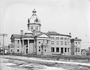
Harrison County Courthouse (constructed in 1903, destroyed by fire in 1970s)
|
||
|
||

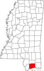
Location within the U.S. state of Mississippi
|
||
 Mississippi's location within the U.S. |
||
| Country | ||
| State | ||
| Founded | 1841 | |
| Named for | William Henry Harrison | |
| Seat | Biloxi and Gulfport | |
| Largest city | Gulfport | |
| Area | ||
| • Total | 976 sq mi (2,530 km2) | |
| • Land | 574 sq mi (1,490 km2) | |
| • Water | 402 sq mi (1,040 km2) 41% | |
| Population
(2010)
|
||
| • Total | 187,105 | |
| • Estimate
(2019)
|
208,080 | |
| • Density | 362/sq mi (140/km2) | |
| Time zone | UTC−6 (Central) | |
| • Summer (DST) | UTC−5 (CDT) | |
| Congressional district | 4th | |
Harrison County is a county located in the U.S. state of Mississippi. As of the 2010 census, the population was 187,105, making it the second-most populous county in Mississippi. Its county seats are Biloxi and Gulfport. The county is named after U.S. President William Henry Harrison.
Harrison County is part of the Gulfport-Biloxi, MS Metropolitan Statistical Area.
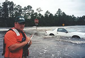
The county was severely damaged from both Hurricane Camille on August 17, 1969, and Hurricane Katrina on August 29, 2005, causing catastrophic effects.
Contents
Geography
According to the U.S. Census Bureau, the county has a total area of 976 square miles (2,530 km2), of which 574 square miles (1,490 km2) is land and 402 square miles (1,040 km2) (41%) is water. It is the second-largest county in Mississippi by total area.
Wildlife
A single pond in the county contains the critically endangered dusky gopher frog.
Major highways
 Interstate 10
 Interstate 110
 U.S. Highway 49
 U.S. Highway 90
 Mississippi Highway 15
 Mississippi Highway 53
 Mississippi Highway 67
 Mississippi Highway 605
Adjacent counties
- Stone County (north)
- Jackson County (east)
- Hancock County (west)
National protected areas
- De Soto National Forest (part)
- Gulf Islands National Seashore (part)
Demographics
| Historical population | |||
|---|---|---|---|
| Census | Pop. | %± | |
| 1850 | 4,875 | — | |
| 1860 | 4,819 | −1.1% | |
| 1870 | 5,795 | 20.3% | |
| 1880 | 7,895 | 36.2% | |
| 1890 | 12,481 | 58.1% | |
| 1900 | 21,002 | 68.3% | |
| 1910 | 34,658 | 65.0% | |
| 1920 | 32,855 | −5.2% | |
| 1930 | 44,143 | 34.4% | |
| 1940 | 50,799 | 15.1% | |
| 1950 | 84,073 | 65.5% | |
| 1960 | 119,489 | 42.1% | |
| 1970 | 134,582 | 12.6% | |
| 1980 | 157,665 | 17.2% | |
| 1990 | 165,365 | 4.9% | |
| 2000 | 189,601 | 14.7% | |
| 2010 | 187,105 | −1.3% | |
| 2020 | 208,621 | 11.5% | |
| U.S. Decennial Census 1790-1960 1900-1990 1990-2000 2010-2017 2019 |
|||
2020 census
| Race | Num. | Perc. |
|---|---|---|
| White (non-Hispanic) | 125,092 | 59.96% |
| Black or African American (non-Hispanic) | 51,143 | 24.51% |
| Native American | 786 | 0.38% |
| Asian | 5,913 | 2.83% |
| Pacific Islander | 257 | 0.12% |
| Other/Mixed | 11,454 | 5.49% |
| Hispanic or Latino | 13,976 | 6.7% |
As of the 2020 United States census, there were 208,621 people, 74,628 households, and 50,074 families residing in the county.
Communities

Cities
- Biloxi (county seat)
- D'Iberville
- Gulfport (county seat)
- Long Beach
- Pass Christian
Census-designated places
Unincorporated communities
See also
 In Spanish: Condado de Harrison (Misisipi) para niños


